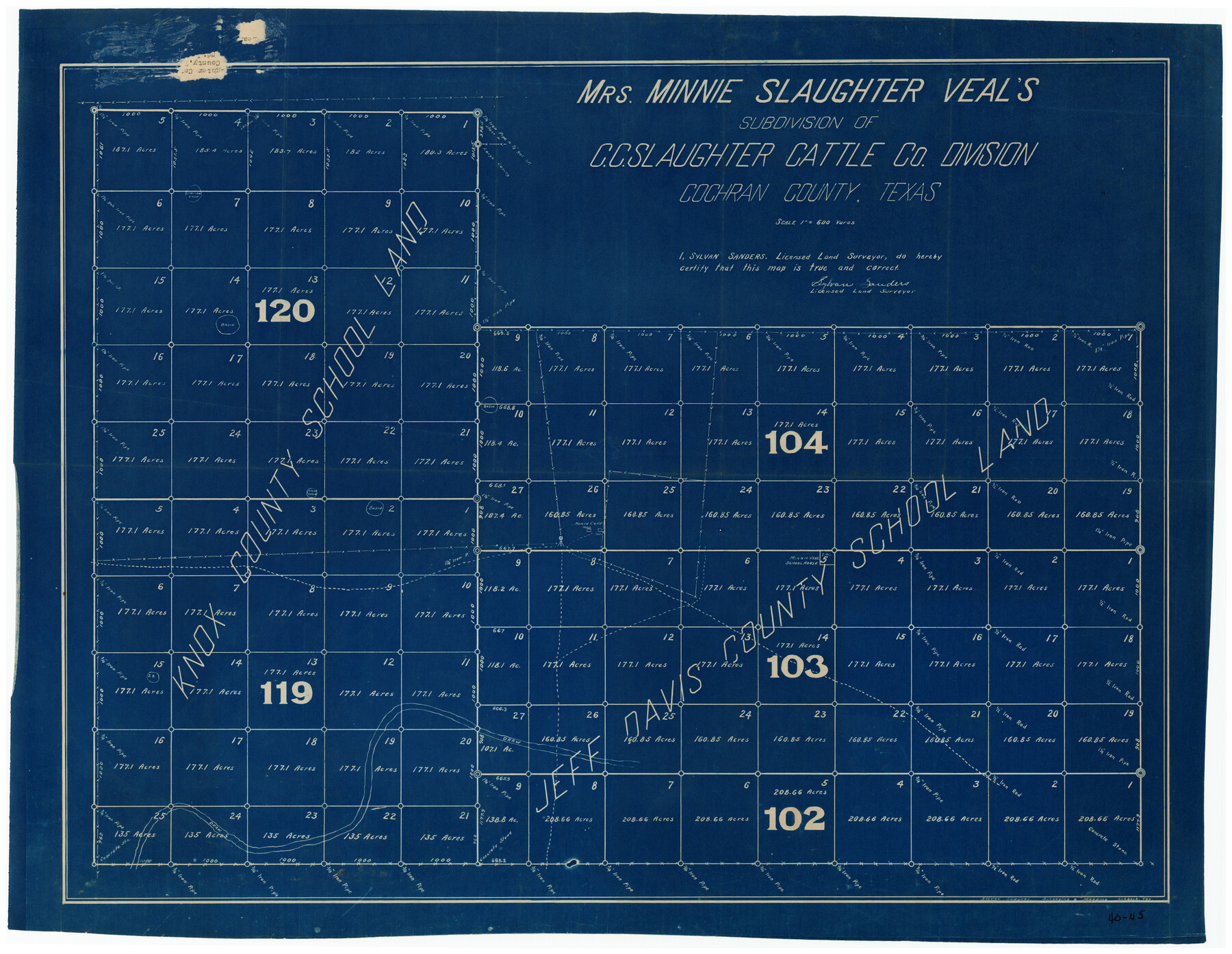
Mrs. Minnie Slaughter Veal's Subdivision of C. C. Slaughter Cattle Co. Division, Cochran County, Texas
40-45
-
Map/Doc
90296
-
Collection
Twichell Survey Records
-
People and Organizations
Sylvan Sanders (Surveyor/Engineer)
-
Counties
Cochran
-
Height x Width
26.6 x 20.5 inches
67.6 x 52.1 cm
Part of: Twichell Survey Records
The California Case

Print $3.00
- Digital $50.00
The California Case
Size 15.8 x 9.5 inches
Map/Doc 91695
[S51-58, 27, 30, 303-306, 221-224, 562, 564]
![92185, [S51-58, 27, 30, 303-306, 221-224, 562, 564], Twichell Survey Records](https://historictexasmaps.com/wmedia_w700/maps/92185-1.tif.jpg)
Print $20.00
- Digital $50.00
[S51-58, 27, 30, 303-306, 221-224, 562, 564]
Size 31.1 x 15.6 inches
Map/Doc 92185
[H. & T. C. RR. Company, Block 47]
![91150, [H. & T. C. RR. Company, Block 47], Twichell Survey Records](https://historictexasmaps.com/wmedia_w700/maps/91150-1.tif.jpg)
Print $20.00
- Digital $50.00
[H. & T. C. RR. Company, Block 47]
1874
Size 20.4 x 12.5 inches
Map/Doc 91150
[Blocks D and P]
![92490, [Blocks D and P], Twichell Survey Records](https://historictexasmaps.com/wmedia_w700/maps/92490-1.tif.jpg)
Print $20.00
- Digital $50.00
[Blocks D and P]
Size 41.8 x 29.1 inches
Map/Doc 92490
City of Littlefield Lamb County Texas Located on Texas State Capitol League 664

Print $20.00
- Digital $50.00
City of Littlefield Lamb County Texas Located on Texas State Capitol League 664
Size 41.0 x 37.1 inches
Map/Doc 89911
[Leagues 633-737]
![91107, [Leagues 633-737], Twichell Survey Records](https://historictexasmaps.com/wmedia_w700/maps/91107-1.tif.jpg)
Print $20.00
- Digital $50.00
[Leagues 633-737]
Size 23.9 x 19.6 inches
Map/Doc 91107
[Floyd County Schoo Land Lgs. 180-183, Fisher County School Land Lgs. 105-108, and part of Blk. V]
![90189, [Floyd County Schoo Land Lgs. 180-183, Fisher County School Land Lgs. 105-108, and part of Blk. V], Twichell Survey Records](https://historictexasmaps.com/wmedia_w700/maps/90189-1.tif.jpg)
Print $2.00
- Digital $50.00
[Floyd County Schoo Land Lgs. 180-183, Fisher County School Land Lgs. 105-108, and part of Blk. V]
Size 8.8 x 10.2 inches
Map/Doc 90189
[A. Dubois Survey and vicinity]
![91524, [A. Dubois Survey and vicinity], Twichell Survey Records](https://historictexasmaps.com/wmedia_w700/maps/91524-1.tif.jpg)
Print $3.00
- Digital $50.00
[A. Dubois Survey and vicinity]
Size 11.4 x 14.6 inches
Map/Doc 91524
[Sketch showing subdivisions of Leagues 7-10]
![89850, [Sketch showing subdivisions of Leagues 7-10], Twichell Survey Records](https://historictexasmaps.com/wmedia_w700/maps/89850-2.tif.jpg)
Print $20.00
- Digital $50.00
[Sketch showing subdivisions of Leagues 7-10]
1956
Size 36.6 x 39.4 inches
Map/Doc 89850
N. C. Payne Land in Lamb and Hale Counties]
![91060, N. C. Payne Land in Lamb and Hale Counties], Twichell Survey Records](https://historictexasmaps.com/wmedia_w700/maps/91060-1.tif.jpg)
Print $20.00
- Digital $50.00
N. C. Payne Land in Lamb and Hale Counties]
Size 18.6 x 23.9 inches
Map/Doc 91060
Sketch No. 2 [showing Block 46, Block M21, Block B4 and Block Y south of Canadian River]
![89929, Sketch No. 2 [showing Block 46, Block M21, Block B4 and Block Y south of Canadian River], Twichell Survey Records](https://historictexasmaps.com/wmedia_w700/maps/89929-1.tif.jpg)
Print $20.00
- Digital $50.00
Sketch No. 2 [showing Block 46, Block M21, Block B4 and Block Y south of Canadian River]
1927
Size 36.8 x 43.7 inches
Map/Doc 89929
Grimes Estate Lands, Cochran County, Texas

Print $20.00
- Digital $50.00
Grimes Estate Lands, Cochran County, Texas
Size 25.6 x 21.6 inches
Map/Doc 92520
You may also like
Haskell County Sketch File 6

Print $22.00
- Digital $50.00
Haskell County Sketch File 6
1858
Size 7.7 x 12.2 inches
Map/Doc 26126
Runnels County Sketch File 5a

Print $40.00
Runnels County Sketch File 5a
1883
Size 8.9 x 22.0 inches
Map/Doc 35438
Matagorda Bay and Approaches

Print $20.00
- Digital $50.00
Matagorda Bay and Approaches
1961
Size 35.0 x 45.0 inches
Map/Doc 73382
Roberts County Sketch File 7

Print $16.00
- Digital $50.00
Roberts County Sketch File 7
1992
Size 14.3 x 8.8 inches
Map/Doc 35316
Fayette County Working Sketch 7

Print $20.00
- Digital $50.00
Fayette County Working Sketch 7
1981
Size 24.1 x 15.6 inches
Map/Doc 69171
[Southwest part of County around B. Barrow survey]
![90919, [Southwest part of County around B. Barrow survey], Twichell Survey Records](https://historictexasmaps.com/wmedia_w700/maps/90919-1.tif.jpg)
Print $20.00
- Digital $50.00
[Southwest part of County around B. Barrow survey]
Size 19.6 x 21.1 inches
Map/Doc 90919
![88951, Haskell Co[unty], Library of Congress](https://historictexasmaps.com/wmedia_w700/maps/88951.tif.jpg)

Anderson County Sketch File 32

Print $4.00
- Digital $50.00
Anderson County Sketch File 32
2002
Size 11.3 x 8.8 inches
Map/Doc 78312
Denton County Sketch File 22

Print $4.00
- Digital $50.00
Denton County Sketch File 22
1872
Size 8.5 x 16.0 inches
Map/Doc 20746
Map of Maverick County, Texas

Print $20.00
- Digital $50.00
Map of Maverick County, Texas
1879
Size 33.0 x 23.0 inches
Map/Doc 718
Maps of Gulf Intracoastal Waterway, Texas - Sabine River to the Rio Grande and connecting waterways including ship channels

Print $20.00
- Digital $50.00
Maps of Gulf Intracoastal Waterway, Texas - Sabine River to the Rio Grande and connecting waterways including ship channels
1966
Size 14.6 x 21.7 inches
Map/Doc 61981