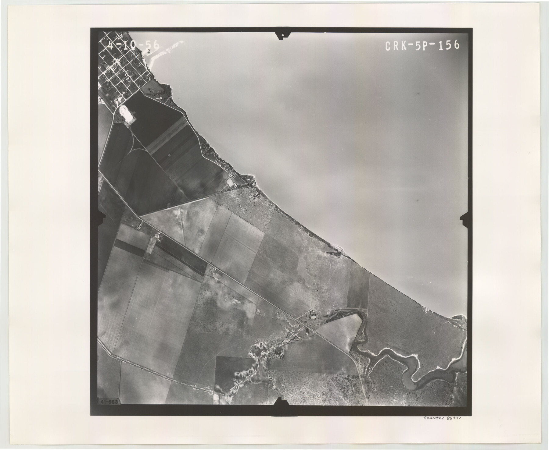
Flight Mission No. CRK-5P, Frame 156, Refugio County
CRK-5P-156
-
Map/Doc
86937
-
Collection
General Map Collection
-
Object Dates
1956/4/10 (Creation Date)
-
People and Organizations
U. S. Department of Agriculture (Publisher)
-
Counties
Refugio
-
Subjects
Aerial Photograph
-
Height x Width
18.5 x 22.5 inches
47.0 x 57.2 cm
-
Comments
Flown by V. L. Beavers and Associates of San Antonio, Texas.
Part of: General Map Collection
Map of Hamilton County

Print $20.00
- Digital $50.00
Map of Hamilton County
1872
Size 14.9 x 21.9 inches
Map/Doc 4556
Travis County Sketch File 40

Print $20.00
- Digital $50.00
Travis County Sketch File 40
1928
Size 17.7 x 22.8 inches
Map/Doc 12464
[Bastrop County line]
![65, [Bastrop County line], General Map Collection](https://historictexasmaps.com/wmedia_w700/maps/65.tif.jpg)
Print $2.00
- Digital $50.00
[Bastrop County line]
1841
Size 7.8 x 6.3 inches
Map/Doc 65
Northwest Part of Webb County

Print $40.00
- Digital $50.00
Northwest Part of Webb County
1984
Size 42.6 x 52.2 inches
Map/Doc 73319
Castro County Boundary File 1b

Print $32.00
- Digital $50.00
Castro County Boundary File 1b
Size 14.1 x 8.6 inches
Map/Doc 51208
Comal County Sketch File 8 1/2

Print $22.00
- Digital $50.00
Comal County Sketch File 8 1/2
1858
Size 9.2 x 7.4 inches
Map/Doc 19015
San Jacinto County Boundary File 2

Print $5.00
- Digital $50.00
San Jacinto County Boundary File 2
Size 15.8 x 11.0 inches
Map/Doc 58561
Collin County Boundary File 18d

Print $20.00
- Digital $50.00
Collin County Boundary File 18d
Size 12.8 x 8.2 inches
Map/Doc 51739
Hale County Sketch File 19

Print $4.00
- Digital $50.00
Hale County Sketch File 19
Size 8.4 x 8.8 inches
Map/Doc 24751
McLennan County Sketch File 8

Print $14.00
- Digital $50.00
McLennan County Sketch File 8
1858
Size 12.4 x 7.7 inches
Map/Doc 31251
Pecos County Working Sketch 120

Print $20.00
- Digital $50.00
Pecos County Working Sketch 120
1973
Size 34.7 x 29.1 inches
Map/Doc 71593
Nolan County Sketch File 2

Print $40.00
- Digital $50.00
Nolan County Sketch File 2
Size 49.5 x 41.6 inches
Map/Doc 10556
You may also like
Crockett County Working Sketch 76

Print $20.00
- Digital $50.00
Crockett County Working Sketch 76
1964
Size 34.3 x 36.3 inches
Map/Doc 68409
Rusk County Working Sketch 28

Print $20.00
- Digital $50.00
Rusk County Working Sketch 28
1934
Size 24.2 x 18.3 inches
Map/Doc 63664
Taylor County Rolled Sketch 27

Print $20.00
- Digital $50.00
Taylor County Rolled Sketch 27
Size 37.5 x 30.3 inches
Map/Doc 7918
Coryell County Working Sketch 28

Print $20.00
- Digital $50.00
Coryell County Working Sketch 28
1990
Size 27.5 x 21.3 inches
Map/Doc 68235
Edwards County Working Sketch 60

Print $20.00
- Digital $50.00
Edwards County Working Sketch 60
1954
Size 20.5 x 43.7 inches
Map/Doc 68936
Briscoe County

Print $20.00
- Digital $50.00
Briscoe County
1879
Size 24.8 x 21.7 inches
Map/Doc 3331
Duval County Boundary File 5

Print $4.00
- Digital $50.00
Duval County Boundary File 5
Size 7.7 x 11.9 inches
Map/Doc 52769
Military Reconnaissance [showing forts along Rio Grande near Matamoros]
![72911, Military Reconnaissance [showing forts along Rio Grande near Matamoros], General Map Collection](https://historictexasmaps.com/wmedia_w700/maps/72911.tif.jpg)
Print $20.00
- Digital $50.00
Military Reconnaissance [showing forts along Rio Grande near Matamoros]
1846
Size 18.2 x 27.2 inches
Map/Doc 72911
[Sketch showing positions of surveys bordering on South boundary line of Archer County and North boundary line of Young County

Print $20.00
- Digital $50.00
[Sketch showing positions of surveys bordering on South boundary line of Archer County and North boundary line of Young County
1894
Size 14.0 x 36.8 inches
Map/Doc 90174
Hood County Sketch File 24

Print $8.00
- Digital $50.00
Hood County Sketch File 24
1942
Size 11.0 x 9.0 inches
Map/Doc 26619
Archer County

Print $20.00
- Digital $50.00
Archer County
1926
Size 43.8 x 38.7 inches
Map/Doc 77202
