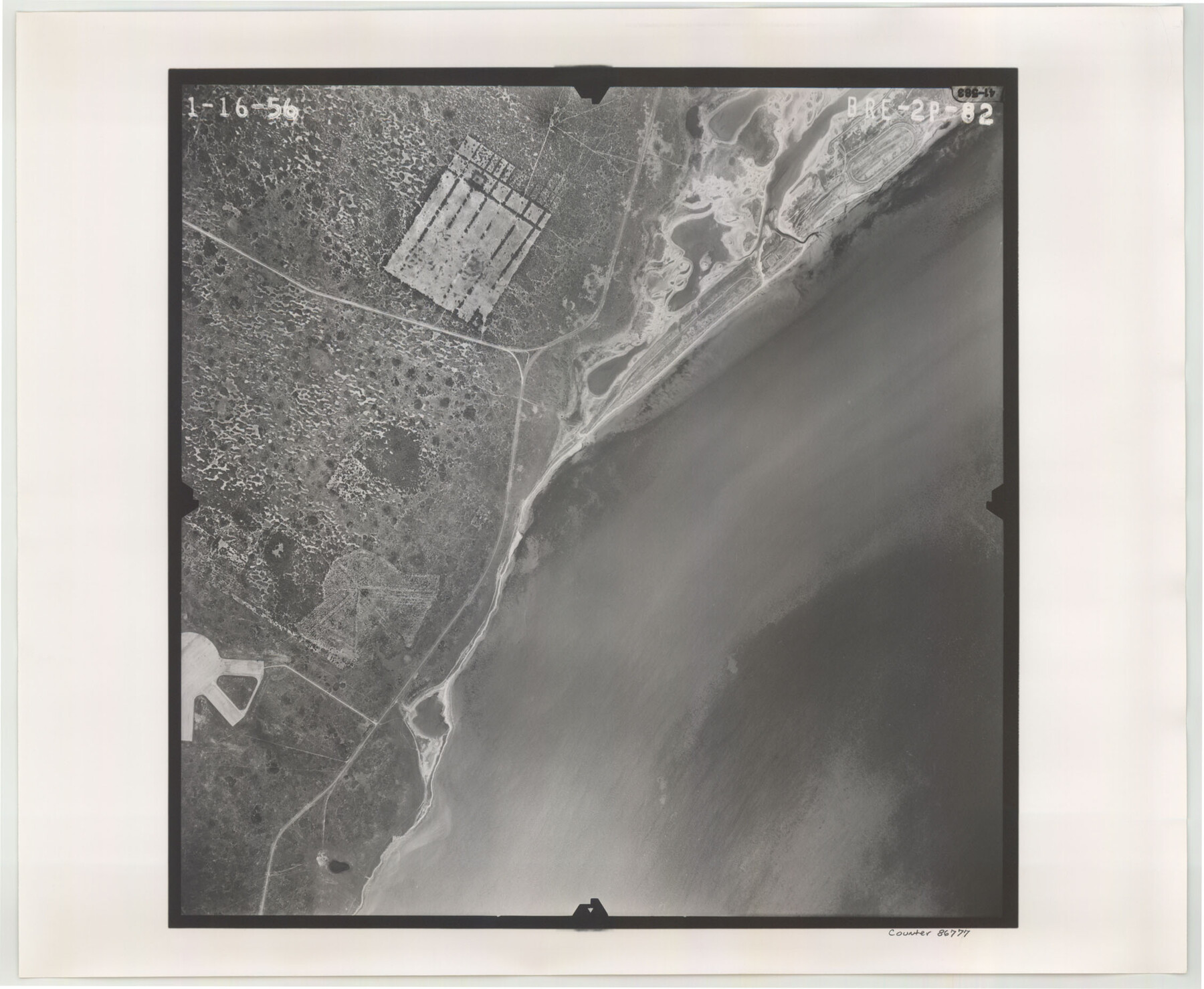
Flight Mission No. BRE-2P, Frame 82, Nueces County
BRE-2P-82
-
Map/Doc
86777
-
Collection
General Map Collection
-
Object Dates
1956/1/16 (Creation Date)
-
People and Organizations
U. S. Department of Agriculture (Publisher)
-
Counties
Nueces
-
Subjects
Aerial Photograph
-
Height x Width
18.5 x 22.6 inches
47.0 x 57.4 cm
-
Comments
Flown by V. L. Beavers and Associates of San Antonio, Texas.
Part of: General Map Collection
Galveston Bay and Approaches

Print $20.00
- Digital $50.00
Galveston Bay and Approaches
1938
Size 45.4 x 34.6 inches
Map/Doc 69875
Kinney County Sketch File 38

Print $8.00
- Digital $50.00
Kinney County Sketch File 38
1882
Size 14.3 x 8.7 inches
Map/Doc 29188
[Map of Navarro County]
![81900, [Map of Navarro County], General Map Collection](https://historictexasmaps.com/wmedia_w700/maps/81900.tif.jpg)
Print $20.00
- Digital $50.00
[Map of Navarro County]
1858
Size 18.0 x 23.5 inches
Map/Doc 81900
Travis County Sketch File 56

Print $6.00
- Digital $50.00
Travis County Sketch File 56
1945
Size 14.2 x 9.0 inches
Map/Doc 38398
Brazoria County NRC Article 33.136 Sketch 12

Print $26.00
- Digital $50.00
Brazoria County NRC Article 33.136 Sketch 12
2010
Size 21.0 x 34.0 inches
Map/Doc 93407
Fayette County Sketch File 5

Print $4.00
- Digital $50.00
Fayette County Sketch File 5
Size 14.3 x 8.7 inches
Map/Doc 22506
Presidio County Sketch File 103

Print $24.00
- Digital $50.00
Presidio County Sketch File 103
1949
Size 14.4 x 8.8 inches
Map/Doc 34795
Bee County Boundary File 8

Print $52.00
- Digital $50.00
Bee County Boundary File 8
Size 9.2 x 7.8 inches
Map/Doc 50464
Anderson County Rolled Sketch 10

Print $20.00
- Digital $50.00
Anderson County Rolled Sketch 10
1956
Size 33.4 x 34.6 inches
Map/Doc 8365

Fisher County Sketch File 8

Print $16.00
- Digital $50.00
Fisher County Sketch File 8
1898
Size 14.7 x 9.1 inches
Map/Doc 22567
Wheeler County Boundary File 1c

Print $4.00
- Digital $50.00
Wheeler County Boundary File 1c
Size 11.4 x 8.9 inches
Map/Doc 59870
You may also like
Parmer County Working Sketch Graphic Index

Print $20.00
- Digital $50.00
Parmer County Working Sketch Graphic Index
1926
Map/Doc 76662
Refugio County NRC Article 33.136 Sketch 2

Print $26.00
- Digital $50.00
Refugio County NRC Article 33.136 Sketch 2
2003
Size 24.5 x 36.5 inches
Map/Doc 78536
Medina County

Print $40.00
- Digital $50.00
Medina County
1976
Size 50.6 x 40.9 inches
Map/Doc 77370

Harris County Sketch File 99

Print $10.00
- Digital $50.00
Harris County Sketch File 99
1896
Size 14.5 x 8.9 inches
Map/Doc 25669
Sutton County

Print $40.00
- Digital $50.00
Sutton County
1941
Size 42.3 x 56.8 inches
Map/Doc 63052
Goliad County Working Sketch 8

Print $20.00
- Digital $50.00
Goliad County Working Sketch 8
1937
Size 29.7 x 36.0 inches
Map/Doc 63198
Harris County Working Sketch 125

Print $20.00
- Digital $50.00
Harris County Working Sketch 125
1995
Size 42.0 x 34.0 inches
Map/Doc 66017
Galveston County NRC Article 33.136 Sketch 60

Print $88.00
- Digital $50.00
Galveston County NRC Article 33.136 Sketch 60
2009
Size 24.0 x 36.0 inches
Map/Doc 89263
Oil Map of Texas and Oklahoma showing the location and approximate area of the Oil and Gas Fields

Print $20.00
- Digital $50.00
Oil Map of Texas and Oklahoma showing the location and approximate area of the Oil and Gas Fields
1920
Size 20.8 x 23.9 inches
Map/Doc 95897
Tyler County Sketch File 10

Print $4.00
- Digital $50.00
Tyler County Sketch File 10
Size 8.6 x 6.7 inches
Map/Doc 38648
Lubbock County Working Sketch 5

Print $20.00
- Digital $50.00
Lubbock County Working Sketch 5
1950
Size 14.3 x 31.0 inches
Map/Doc 70665