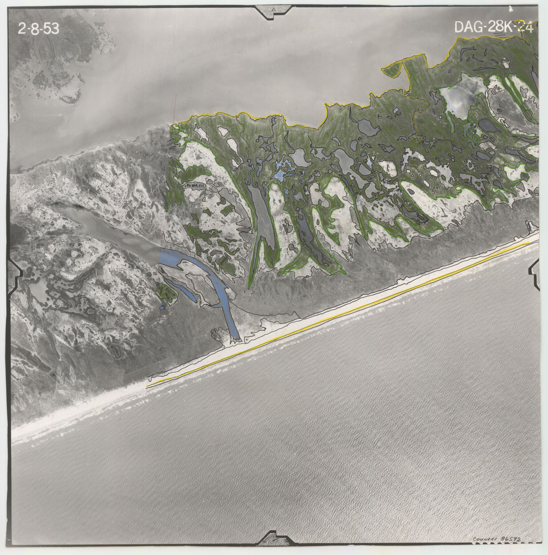
Flight Mission No. DAG-28K, Frame 24, Matagorda County
DAG-28K-24
-
Map/Doc
86592
-
Collection
General Map Collection
-
Object Dates
1953/2/8 (Creation Date)
-
People and Organizations
U. S. Department of Agriculture (Publisher)
-
Counties
Matagorda
-
Subjects
Aerial Photograph
-
Height x Width
16.2 x 16.0 inches
41.1 x 40.6 cm
-
Comments
Flown by Aero Exploration Company of Tulsa, Oklahoma.
Part of: General Map Collection
Nacogdoches County Rolled Sketch 2

Print $20.00
- Digital $50.00
Nacogdoches County Rolled Sketch 2
1949
Size 44.3 x 42.3 inches
Map/Doc 46837
Ward County Working Sketch 46

Print $20.00
- Digital $50.00
Ward County Working Sketch 46
1974
Size 35.0 x 38.3 inches
Map/Doc 72352
Cameron County Working Sketch Graphic Index

Print $20.00
- Digital $50.00
Cameron County Working Sketch Graphic Index
1976
Size 32.0 x 39.4 inches
Map/Doc 76486
[Corpus Christi & Rio Grande Certificates]
![64492, [Corpus Christi & Rio Grande Certificates], General Map Collection](https://historictexasmaps.com/wmedia_w700/pdf_converted_jpg/qi_pdf_thumbnail_19225.jpg)
Print $16.00
- Digital $50.00
[Corpus Christi & Rio Grande Certificates]
1874
Size 14.3 x 8.7 inches
Map/Doc 64492
Red River County Working Sketch 39

Print $20.00
- Digital $50.00
Red River County Working Sketch 39
1967
Size 33.4 x 23.8 inches
Map/Doc 72022

Hockley County

Print $20.00
- Digital $50.00
Hockley County
1914
Size 25.9 x 23.1 inches
Map/Doc 4980

Montgomery County Working Sketch 64

Print $20.00
- Digital $50.00
Montgomery County Working Sketch 64
1965
Size 27.9 x 33.7 inches
Map/Doc 71171
Triangulation Net of the United States

Print $20.00
- Digital $50.00
Triangulation Net of the United States
1938
Size 28.1 x 42.2 inches
Map/Doc 3117
Angelina County Sketch File 20

Print $40.00
- Digital $50.00
Angelina County Sketch File 20
1882
Size 19.7 x 29.4 inches
Map/Doc 10816
Schleicher County Working Sketch 22

Print $20.00
- Digital $50.00
Schleicher County Working Sketch 22
1953
Size 26.2 x 15.3 inches
Map/Doc 63824
You may also like
Brewster County Sketch File NS-8

Print $311.00
- Digital $50.00
Brewster County Sketch File NS-8
Size 15.0 x 9.1 inches
Map/Doc 15999
Camp County Working Sketch 2

Print $20.00
- Digital $50.00
Camp County Working Sketch 2
1975
Size 24.8 x 24.5 inches
Map/Doc 67878
Armstrong County Sketch File 9

Print $12.00
- Digital $50.00
Armstrong County Sketch File 9
1904
Size 11.6 x 9.1 inches
Map/Doc 41460
Jefferson County Working Sketch 7

Print $20.00
- Digital $50.00
Jefferson County Working Sketch 7
1931
Size 18.0 x 18.6 inches
Map/Doc 66550
Anderson County

Print $20.00
- Digital $50.00
Anderson County
1871
Size 20.2 x 21.9 inches
Map/Doc 3227
Ride the Texas Mountain Trail [Verso]
![94165, Ride the Texas Mountain Trail [Verso], General Map Collection](https://historictexasmaps.com/wmedia_w700/maps/94165.tif.jpg)
Ride the Texas Mountain Trail [Verso]
1968
Size 18.3 x 24.4 inches
Map/Doc 94165
Freestone County Working Sketch 20

Print $40.00
- Digital $50.00
Freestone County Working Sketch 20
1980
Size 52.4 x 39.6 inches
Map/Doc 69262
[Map of Encinal County]
![3517, [Map of Encinal County], General Map Collection](https://historictexasmaps.com/wmedia_w700/maps/3517-1.tif.jpg)
Print $20.00
- Digital $50.00
[Map of Encinal County]
1872
Size 27.9 x 21.9 inches
Map/Doc 3517
Upton County Sketch File 27

Print $20.00
- Digital $50.00
Upton County Sketch File 27
1928
Size 42.9 x 22.6 inches
Map/Doc 10416
Dimmit County Working Sketch 43

Print $20.00
- Digital $50.00
Dimmit County Working Sketch 43
1978
Size 20.0 x 30.0 inches
Map/Doc 68704
Neches River, City of Lufkin

Print $20.00
- Digital $50.00
Neches River, City of Lufkin
1940
Size 37.5 x 29.7 inches
Map/Doc 65081
Texas 1973 Official Highway Travel Map

Texas 1973 Official Highway Travel Map
Size 28.1 x 36.3 inches
Map/Doc 94406