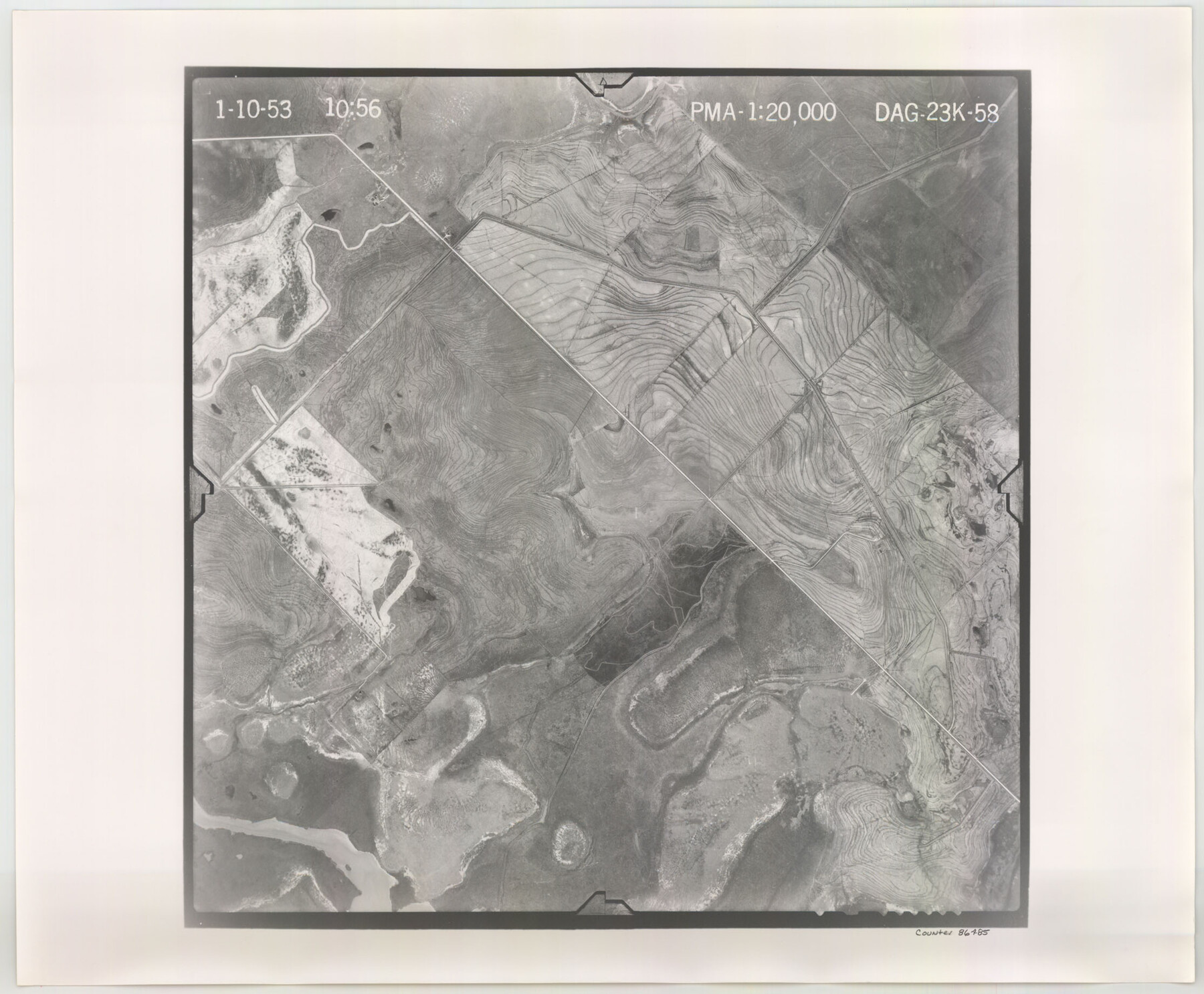
Flight Mission No. DAG-23K, Frame 58, Matagorda County
DAG-23K-58
-
Map/Doc
86485
-
Collection
General Map Collection
-
Object Dates
1953/1/10 (Creation Date)
-
People and Organizations
U. S. Department of Agriculture (Publisher)
-
Counties
Matagorda
-
Subjects
Aerial Photograph
-
Height x Width
18.4 x 22.3 inches
46.7 x 56.6 cm
-
Comments
Flown by Aero Exploration Company of Tulsa, Oklahoma.
Part of: General Map Collection
Colorado River, Bull Creek Sheet[/Champion 125 Acre Tract]
![65323, Colorado River, Bull Creek Sheet[/Champion 125 Acre Tract], General Map Collection](https://historictexasmaps.com/wmedia_w700/maps/65323.tif.jpg)
Print $6.00
- Digital $50.00
Colorado River, Bull Creek Sheet[/Champion 125 Acre Tract]
1934
Size 19.3 x 32.0 inches
Map/Doc 65323
Flight Mission No. BRA-6M, Frame 95, Jefferson County

Print $20.00
- Digital $50.00
Flight Mission No. BRA-6M, Frame 95, Jefferson County
1953
Size 18.5 x 22.2 inches
Map/Doc 85438
Southern Part of Laguna Madre

Print $20.00
- Digital $50.00
Southern Part of Laguna Madre
1952
Size 44.7 x 35.2 inches
Map/Doc 73537
Matagorda County Rolled Sketch 12

Print $20.00
- Digital $50.00
Matagorda County Rolled Sketch 12
Size 30.0 x 28.0 inches
Map/Doc 6681
Runnels County Rolled Sketch 33

Print $20.00
- Digital $50.00
Runnels County Rolled Sketch 33
Size 22.5 x 43.5 inches
Map/Doc 7520
Flight Mission No. BRA-7M, Frame 30, Jefferson County

Print $20.00
- Digital $50.00
Flight Mission No. BRA-7M, Frame 30, Jefferson County
1953
Size 18.6 x 22.3 inches
Map/Doc 85481
[Sketch for Mineral Application 16777]
![65655, [Sketch for Mineral Application 16777], General Map Collection](https://historictexasmaps.com/wmedia_w700/maps/65655-1.tif.jpg)
Print $40.00
- Digital $50.00
[Sketch for Mineral Application 16777]
Size 19.8 x 80.3 inches
Map/Doc 65655
DeWitt County Boundary File 2a

Print $2.00
- Digital $50.00
DeWitt County Boundary File 2a
Size 10.7 x 8.1 inches
Map/Doc 52513
Childress County Rolled Sketch 9

Print $20.00
- Digital $50.00
Childress County Rolled Sketch 9
Size 19.3 x 22.9 inches
Map/Doc 5446
Plan of the C. C. S. D. & R. G. N. G. R.R.

Print $20.00
- Digital $50.00
Plan of the C. C. S. D. & R. G. N. G. R.R.
1878
Size 14.3 x 40.9 inches
Map/Doc 64481
Map of Kinney County

Print $40.00
- Digital $50.00
Map of Kinney County
1889
Size 50.1 x 41.1 inches
Map/Doc 16869
South Part of Webb County

Print $40.00
- Digital $50.00
South Part of Webb County
1984
Size 41.2 x 61.5 inches
Map/Doc 77453
You may also like
Levelland, Hockley County, Texas

Print $20.00
- Digital $50.00
Levelland, Hockley County, Texas
1950
Size 13.1 x 14.9 inches
Map/Doc 92241
Part of Fisher County [around Bastrop County School Land Leagues 313 and 314, Thos. H. Cosby League 315 and El Paso County School Land League 316]
![90820, Part of Fisher County [around Bastrop County School Land Leagues 313 and 314, Thos. H. Cosby League 315 and El Paso County School Land League 316], Twichell Survey Records](https://historictexasmaps.com/wmedia_w700/maps/90820-2.tif.jpg)
Print $20.00
- Digital $50.00
Part of Fisher County [around Bastrop County School Land Leagues 313 and 314, Thos. H. Cosby League 315 and El Paso County School Land League 316]
1883
Size 20.0 x 24.7 inches
Map/Doc 90820
Cochran County Rolled Sketch 4

Print $20.00
- Digital $50.00
Cochran County Rolled Sketch 4
1945
Size 16.8 x 23.7 inches
Map/Doc 5501
Gillespie County Sketch File 9

Print $4.00
- Digital $50.00
Gillespie County Sketch File 9
1873
Size 8.2 x 10.5 inches
Map/Doc 24145
Floyd County Sketch File 19

Print $6.00
- Digital $50.00
Floyd County Sketch File 19
1913
Size 9.8 x 8.4 inches
Map/Doc 22769
Flight Mission No. BRE-1P, Frame 25, Nueces County

Print $20.00
- Digital $50.00
Flight Mission No. BRE-1P, Frame 25, Nueces County
1956
Size 18.6 x 22.4 inches
Map/Doc 86620
Red River County Working Sketch 46

Print $20.00
- Digital $50.00
Red River County Working Sketch 46
Size 34.3 x 38.9 inches
Map/Doc 72029
[County Line between Dickens and Kent Counties]
![90938, [County Line between Dickens and Kent Counties], Twichell Survey Records](https://historictexasmaps.com/wmedia_w700/maps/90938-1.tif.jpg)
Print $20.00
- Digital $50.00
[County Line between Dickens and Kent Counties]
1891
Size 42.4 x 7.4 inches
Map/Doc 90938
Presidio County Rolled Sketch 121

Print $40.00
- Digital $50.00
Presidio County Rolled Sketch 121
1939
Size 50.4 x 43.1 inches
Map/Doc 9797
Titus County Sketch File 5

Print $4.00
- Digital $50.00
Titus County Sketch File 5
1853
Size 11.7 x 8.2 inches
Map/Doc 38138
Wichita County Sketch File 1

Print $22.00
- Digital $50.00
Wichita County Sketch File 1
1856
Size 13.5 x 16.8 inches
Map/Doc 40028
Harris County Rolled Sketch 95

Print $20.00
- Digital $50.00
Harris County Rolled Sketch 95
1987
Size 34.2 x 27.8 inches
Map/Doc 6134