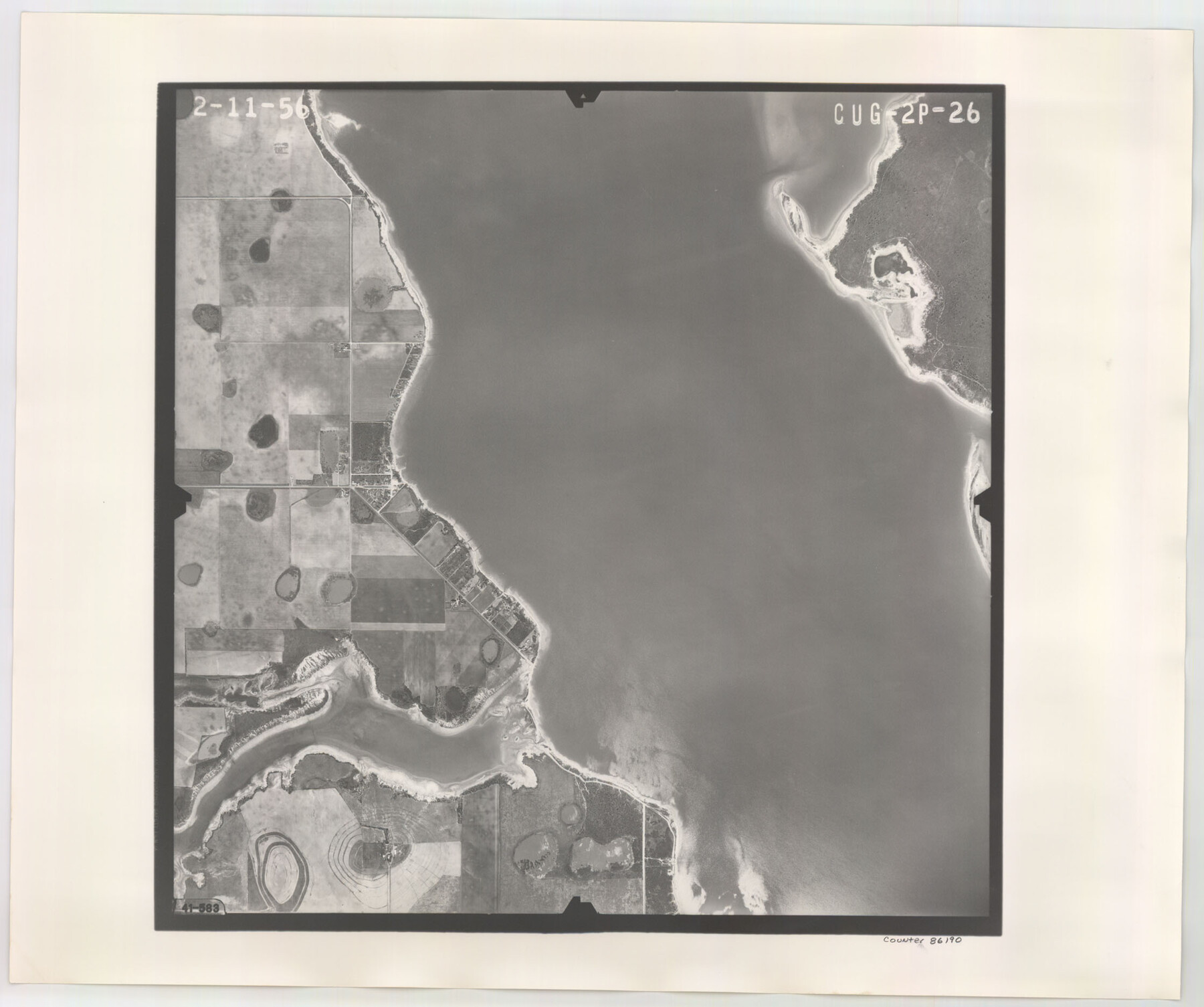
Flight Mission No. CUG-2P, Frame 26, Kleberg County
CUG-2P-26
-
Map/Doc
86190
-
Collection
General Map Collection
-
Object Dates
1956/2/11 (Creation Date)
-
People and Organizations
U. S. Department of Agriculture (Publisher)
-
Counties
Kleberg
-
Subjects
Aerial Photograph
-
Height x Width
18.7 x 22.4 inches
47.5 x 56.9 cm
-
Comments
Flown by V. L. Beavers and Associates of San Antonio, Texas.
Part of: General Map Collection
Brewster County Rolled Sketch 97

Print $20.00
- Digital $50.00
Brewster County Rolled Sketch 97
1952
Size 31.6 x 30.7 inches
Map/Doc 5254

Falls County State Real Property Sketch 1

Print $40.00
- Digital $50.00
Falls County State Real Property Sketch 1
1999
Size 23.6 x 23.5 inches
Map/Doc 61669
Andrews County Rolled Sketch 45

Print $40.00
- Digital $50.00
Andrews County Rolled Sketch 45
1946
Size 111.7 x 41.0 inches
Map/Doc 8402
Smith County Sketch File 12

Print $4.00
- Digital $50.00
Smith County Sketch File 12
1859
Size 8.3 x 12.0 inches
Map/Doc 36769
Taylor County Sketch File 4

Print $2.00
- Digital $50.00
Taylor County Sketch File 4
Size 7.2 x 9.8 inches
Map/Doc 37780

Surveys in Austin's Colony along the Colorado River below the San Antonio Road

Print $20.00
- Digital $50.00
Surveys in Austin's Colony along the Colorado River below the San Antonio Road
1830
Size 38.2 x 13.5 inches
Map/Doc 193
Pecos County Working Sketch 120

Print $20.00
- Digital $50.00
Pecos County Working Sketch 120
1973
Size 34.7 x 29.1 inches
Map/Doc 71593
Webb County Sketch File 65

Print $10.00
- Digital $50.00
Webb County Sketch File 65
1949
Size 14.5 x 8.9 inches
Map/Doc 39865
Ward County Working Sketch 16

Print $20.00
- Digital $50.00
Ward County Working Sketch 16
1948
Size 29.6 x 33.9 inches
Map/Doc 72322
Baylor County

Print $20.00
- Digital $50.00
Baylor County
1961
Size 40.6 x 33.0 inches
Map/Doc 77209
You may also like
Polk County Rolled Sketch 33

Print $20.00
- Digital $50.00
Polk County Rolled Sketch 33
Size 26.5 x 38.5 inches
Map/Doc 7319
Louisiana and Texas Intracoastal Waterway, Section 7, Galveston Bay to Brazos River and Section 8, Brazos River to Matagorda Bay

Print $20.00
- Digital $50.00
Louisiana and Texas Intracoastal Waterway, Section 7, Galveston Bay to Brazos River and Section 8, Brazos River to Matagorda Bay
1929
Size 30.8 x 43.0 inches
Map/Doc 61841
Matagorda County Sketch File 25

Print $20.00
- Digital $50.00
Matagorda County Sketch File 25
1903
Size 18.1 x 30.3 inches
Map/Doc 12041
Martin County Sketch File 13

Print $4.00
- Digital $50.00
Martin County Sketch File 13
1941
Size 14.2 x 9.1 inches
Map/Doc 30669
Trinity River, Slate Rock Ferry Sheet/East Fork of Trinity River

Print $6.00
- Digital $50.00
Trinity River, Slate Rock Ferry Sheet/East Fork of Trinity River
1922
Size 35.1 x 34.3 inches
Map/Doc 65185
Dimmit County Rolled Sketch 3

Print $20.00
- Digital $50.00
Dimmit County Rolled Sketch 3
Size 31.9 x 36.2 inches
Map/Doc 76142
Hunt County Sketch File 5

Print $4.00
- Digital $50.00
Hunt County Sketch File 5
1851
Size 12.9 x 8.2 inches
Map/Doc 27091
Lynn County Boundary File 9a

Print $80.00
- Digital $50.00
Lynn County Boundary File 9a
Size 9.3 x 6.4 inches
Map/Doc 56669
Map representing the surveys made in Bexar County

Print $40.00
- Digital $50.00
Map representing the surveys made in Bexar County
1839
Size 75.7 x 37.9 inches
Map/Doc 93364
Pecos County Working Sketch 95

Print $20.00
- Digital $50.00
Pecos County Working Sketch 95
1970
Size 42.6 x 40.6 inches
Map/Doc 71568

Denton County Sketch File C

Print $10.00
- Digital $50.00
Denton County Sketch File C
1882
Size 10.9 x 8.3 inches
Map/Doc 20682