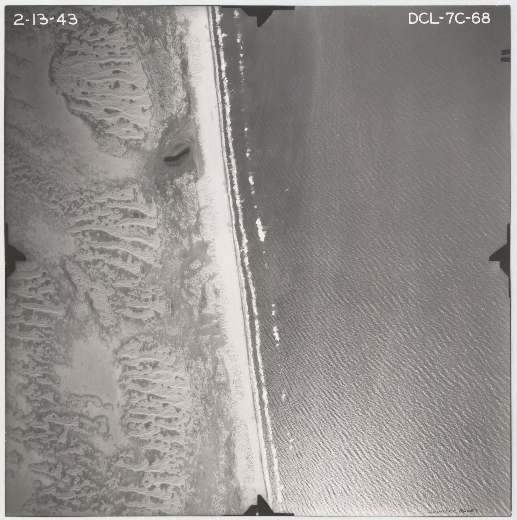
Flight Mission No. DCL-7C, Frame 68, Kenedy County
DCL-7C-68
-
Map/Doc
86054
-
Collection
General Map Collection
-
Object Dates
1943/2/13 (Creation Date)
-
People and Organizations
U. S. Department of Agriculture (Publisher)
-
Counties
Kenedy
-
Subjects
Aerial Photograph
-
Height x Width
15.3 x 15.2 inches
38.9 x 38.6 cm
-
Comments
Flown by Aerial Surveys of Pittsburgh, Inc. of Pittsburgh, Pennsylvania.
Part of: General Map Collection
Stephens County Boundary File 81

Print $44.00
- Digital $50.00
Stephens County Boundary File 81
Size 9.2 x 3.8 inches
Map/Doc 58906
Right of Way & Track Map, St. Louis, Brownsville & Mexico Ry. operated by St. Louis, Brownsville & Mexico Ry. Co.

Print $40.00
- Digital $50.00
Right of Way & Track Map, St. Louis, Brownsville & Mexico Ry. operated by St. Louis, Brownsville & Mexico Ry. Co.
1919
Size 25.4 x 56.9 inches
Map/Doc 64614
Corpus Christi Bay

Print $20.00
- Digital $50.00
Corpus Christi Bay
1976
Size 36.2 x 47.8 inches
Map/Doc 73476
Montgomery County Sketch File 36a

Print $8.00
- Digital $50.00
Montgomery County Sketch File 36a
1953
Size 14.4 x 8.8 inches
Map/Doc 31912
Randall County Rolled Sketch 6

Print $20.00
- Digital $50.00
Randall County Rolled Sketch 6
Size 25.0 x 23.9 inches
Map/Doc 7426
Map of Henderson County

Print $20.00
- Digital $50.00
Map of Henderson County
1871
Size 16.3 x 30.3 inches
Map/Doc 4563
McLennan County Working Sketch 2

Print $20.00
- Digital $50.00
McLennan County Working Sketch 2
1941
Size 21.8 x 30.0 inches
Map/Doc 70695
Flight Mission No. DIX-7P, Frame 18, Aransas County

Print $20.00
- Digital $50.00
Flight Mission No. DIX-7P, Frame 18, Aransas County
1956
Size 19.0 x 22.6 inches
Map/Doc 83870
Newton County Working Sketch 30

Print $20.00
- Digital $50.00
Newton County Working Sketch 30
1955
Size 18.2 x 17.8 inches
Map/Doc 71276
Flight Mission No. CUG-1P, Frame 84, Kleberg County

Print $20.00
- Digital $50.00
Flight Mission No. CUG-1P, Frame 84, Kleberg County
1956
Size 18.4 x 22.3 inches
Map/Doc 86149

Burleson County Working Sketch 20

Print $20.00
- Digital $50.00
Burleson County Working Sketch 20
1980
Size 19.5 x 16.6 inches
Map/Doc 67739
You may also like
Flight Mission No. CLL-3N, Frame 45, Willacy County

Print $20.00
- Digital $50.00
Flight Mission No. CLL-3N, Frame 45, Willacy County
1954
Size 18.4 x 22.1 inches
Map/Doc 87103
Clay County Sketch File 39

Print $10.00
- Digital $50.00
Clay County Sketch File 39
1940
Size 14.3 x 8.7 inches
Map/Doc 18472
Jeff Davis County Working Sketch 24

Print $40.00
- Digital $50.00
Jeff Davis County Working Sketch 24
1958
Size 24.9 x 52.9 inches
Map/Doc 66519
Val Verde Co.

Print $20.00
- Digital $50.00
Val Verde Co.
1908
Size 42.4 x 38.7 inches
Map/Doc 16912
[Blocks T1, T2, T3, Leagues 574, 575, 634- 637

Print $20.00
- Digital $50.00
[Blocks T1, T2, T3, Leagues 574, 575, 634- 637
Size 30.2 x 33.5 inches
Map/Doc 91051
Flight Mission No. DQO-7K, Frame 80, Galveston County

Print $20.00
- Digital $50.00
Flight Mission No. DQO-7K, Frame 80, Galveston County
1952
Size 18.8 x 22.4 inches
Map/Doc 85107
General Highway Map. Detail of Cities and Towns in Jim Wells County, Texas. City Map of Alice, Jim Wells County, Texas

Print $20.00
General Highway Map. Detail of Cities and Towns in Jim Wells County, Texas. City Map of Alice, Jim Wells County, Texas
1961
Size 24.6 x 18.3 inches
Map/Doc 79544
Flight Mission No. DIX-10P, Frame 66, Aransas County

Print $20.00
- Digital $50.00
Flight Mission No. DIX-10P, Frame 66, Aransas County
1956
Size 18.8 x 22.5 inches
Map/Doc 83927
Fort Worth, Tarrant Co[unty], Texas
![89081, Fort Worth, Tarrant Co[unty], Texas, Non-GLO Digital Images](https://historictexasmaps.com/wmedia_w700/maps/89081.tif.jpg)
Print $20.00
Fort Worth, Tarrant Co[unty], Texas
1876
Size 14.9 x 18.0 inches
Map/Doc 89081
Foard County Sketch File 1

Print $6.00
- Digital $50.00
Foard County Sketch File 1
Size 10.0 x 9.5 inches
Map/Doc 22804
Smith County Rolled Sketch 1

Print $20.00
- Digital $50.00
Smith County Rolled Sketch 1
Size 42.4 x 34.8 inches
Map/Doc 9932
Hays County Working Sketch 9

Print $40.00
- Digital $50.00
Hays County Working Sketch 9
1949
Size 22.8 x 50.5 inches
Map/Doc 66083