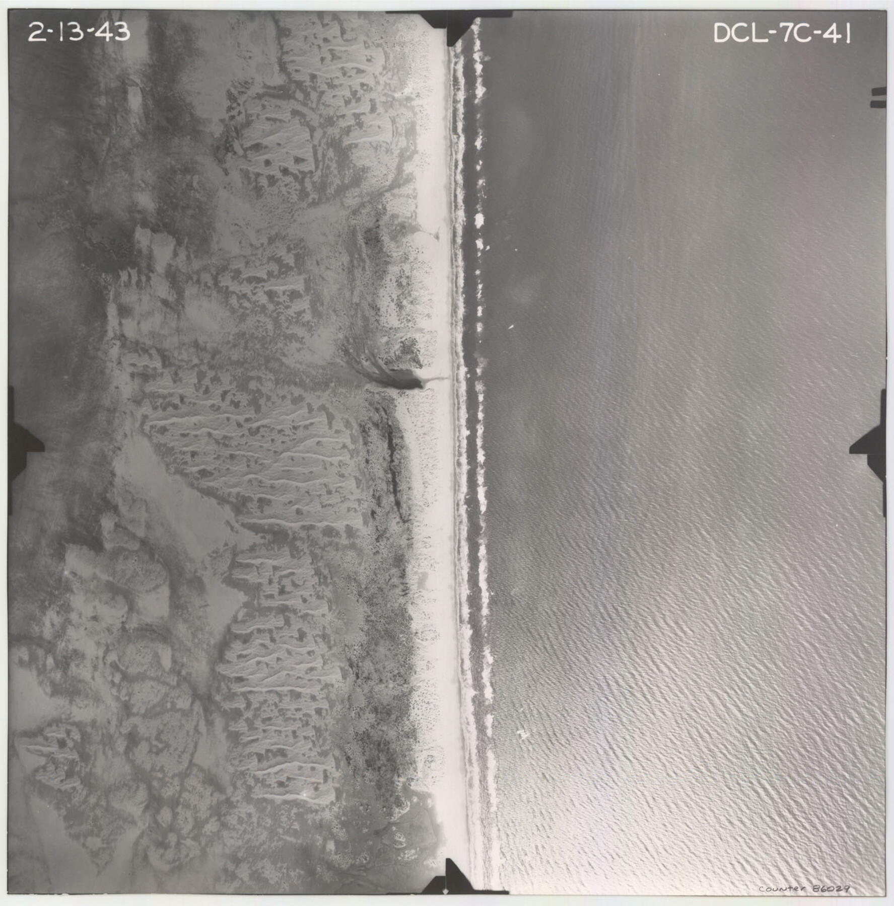
Flight Mission No. DCL-7C, Frame 41, Kenedy County
DCL-7C-41
-
Map/Doc
86029
-
Collection
General Map Collection
-
Object Dates
1943/2/13 (Creation Date)
-
People and Organizations
U. S. Department of Agriculture (Publisher)
-
Counties
Kenedy
-
Subjects
Aerial Photograph
-
Height x Width
15.4 x 15.2 inches
39.1 x 38.6 cm
-
Comments
Flown by Aerial Surveys of Pittsburgh, Inc. of Pittsburgh, Pennsylvania.
Part of: General Map Collection
San Patricio County Working Sketch 11

Print $20.00
- Digital $50.00
San Patricio County Working Sketch 11
1948
Size 34.7 x 31.3 inches
Map/Doc 63773
Crockett County Sketch File 51

Print $16.00
- Digital $50.00
Crockett County Sketch File 51
Size 10.1 x 9.1 inches
Map/Doc 19799
Colorado County Working Sketch 28

Print $20.00
- Digital $50.00
Colorado County Working Sketch 28
1979
Size 33.5 x 24.3 inches
Map/Doc 68128
Hopkins County Sketch File 26

Print $4.00
- Digital $50.00
Hopkins County Sketch File 26
Size 8.4 x 6.1 inches
Map/Doc 26736
Crane County Working Sketch 21

Print $20.00
- Digital $50.00
Crane County Working Sketch 21
1961
Size 34.5 x 37.1 inches
Map/Doc 68298
Polk County Sketch File 11a

Print $4.00
- Digital $50.00
Polk County Sketch File 11a
Size 8.1 x 9.7 inches
Map/Doc 34144
Flight Mission No. DQN-2K, Frame 114, Calhoun County

Print $20.00
- Digital $50.00
Flight Mission No. DQN-2K, Frame 114, Calhoun County
1953
Size 18.5 x 22.2 inches
Map/Doc 84290
Fannin County Sketch File 20a

Print $7.00
- Digital $50.00
Fannin County Sketch File 20a
1889
Size 10.4 x 8.4 inches
Map/Doc 22482
Montgomery County Rolled Sketch 26

Print $40.00
- Digital $50.00
Montgomery County Rolled Sketch 26
Size 50.0 x 65.4 inches
Map/Doc 9535

Runnels County Sketch File 27

Print $6.00
Runnels County Sketch File 27
1949
Size 11.5 x 8.9 inches
Map/Doc 35490
Gillespie County Rolled Sketch 9

Print $20.00
- Digital $50.00
Gillespie County Rolled Sketch 9
2014
Size 23.6 x 36.2 inches
Map/Doc 93713
You may also like
Presidio County Sketch File 96

Print $4.00
- Digital $50.00
Presidio County Sketch File 96
1958
Size 9.1 x 13.4 inches
Map/Doc 34775
Motley County Boundary File 2a

Print $20.00
- Digital $50.00
Motley County Boundary File 2a
Size 14.3 x 8.6 inches
Map/Doc 57511
Eastland County Rolled Sketch 3

Print $20.00
- Digital $50.00
Eastland County Rolled Sketch 3
1893
Size 24.4 x 41.3 inches
Map/Doc 5773
Crosby County Sketch File 21

Print $6.00
- Digital $50.00
Crosby County Sketch File 21
Size 13.8 x 8.8 inches
Map/Doc 20087
Outer Continental Shelf Leasing Maps (Louisiana Offshore Operations)

Print $20.00
- Digital $50.00
Outer Continental Shelf Leasing Maps (Louisiana Offshore Operations)
1959
Size 18.0 x 14.0 inches
Map/Doc 76118
Hays County Sketch File 16

Print $4.00
- Digital $50.00
Hays County Sketch File 16
1857
Size 12.8 x 8.3 inches
Map/Doc 26227
Flight Mission No. BQY-4M, Frame 126, Harris County

Print $20.00
- Digital $50.00
Flight Mission No. BQY-4M, Frame 126, Harris County
1953
Size 18.5 x 22.2 inches
Map/Doc 85295
Atascosa County Rolled Sketch 5

Print $20.00
- Digital $50.00
Atascosa County Rolled Sketch 5
1910
Size 22.1 x 15.8 inches
Map/Doc 5088
Trinity County Working Sketch 3

Print $20.00
- Digital $50.00
Trinity County Working Sketch 3
1905
Size 26.7 x 19.2 inches
Map/Doc 69451
La Salle County Sketch File 7

Print $22.00
- Digital $50.00
La Salle County Sketch File 7
Size 8.0 x 12.3 inches
Map/Doc 29456
Kleberg County Rolled Sketch 11

Print $20.00
- Digital $50.00
Kleberg County Rolled Sketch 11
1915
Size 21.0 x 26.5 inches
Map/Doc 6552
Webb County Rolled Sketch 42

Print $20.00
- Digital $50.00
Webb County Rolled Sketch 42
1941
Size 25.2 x 37.1 inches
Map/Doc 8197