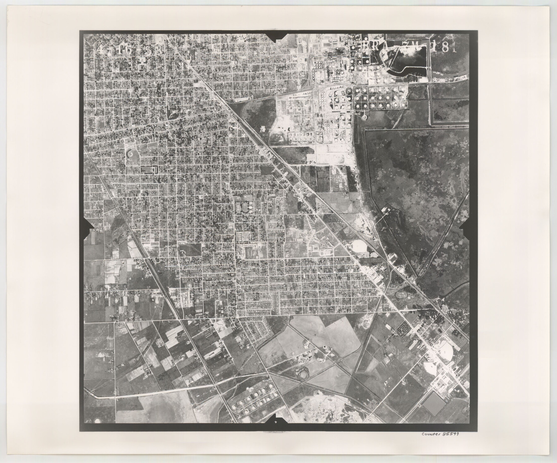
Flight Mission No. BRA-7M, Frame 181, Jefferson County
BRA-7M-181
-
Map/Doc
85549
-
Collection
General Map Collection
-
Object Dates
1953/4/16 (Creation Date)
-
People and Organizations
U. S. Department of Agriculture (Publisher)
-
Counties
Jefferson
-
Subjects
Aerial Photograph
-
Height x Width
18.6 x 22.4 inches
47.2 x 56.9 cm
-
Comments
Flown by Jack Ammann Photogrammetric Engineers of San Antonio, Texas.
Part of: General Map Collection
Maverick County Sketch File 14

Print $4.00
- Digital $50.00
Maverick County Sketch File 14
1883
Size 11.1 x 8.5 inches
Map/Doc 31111
Flight Mission No. CGI-3N, Frame 97, Cameron County

Print $20.00
- Digital $50.00
Flight Mission No. CGI-3N, Frame 97, Cameron County
1954
Size 18.6 x 22.1 inches
Map/Doc 84577
Map showing the fortification at Point Isabel

Print $20.00
- Digital $50.00
Map showing the fortification at Point Isabel
1864
Size 18.3 x 27.9 inches
Map/Doc 72921
Pecos County Rolled Sketch 61

Print $20.00
- Digital $50.00
Pecos County Rolled Sketch 61
1925
Size 26.5 x 25.5 inches
Map/Doc 7233
Flight Mission No. CRE-3R, Frame 39, Jackson County

Print $20.00
- Digital $50.00
Flight Mission No. CRE-3R, Frame 39, Jackson County
1956
Size 18.6 x 22.2 inches
Map/Doc 85386
Johnson County Sketch File 5

Print $20.00
- Digital $50.00
Johnson County Sketch File 5
1874
Size 33.3 x 14.3 inches
Map/Doc 11890
Red River County Working Sketch 83

Print $20.00
- Digital $50.00
Red River County Working Sketch 83
1996
Size 21.0 x 22.3 inches
Map/Doc 72069
Williamson County Sketch File 12

Print $4.00
- Digital $50.00
Williamson County Sketch File 12
1860
Size 12.6 x 3.4 inches
Map/Doc 40326
Freestone County

Print $40.00
- Digital $50.00
Freestone County
1918
Size 48.4 x 41.6 inches
Map/Doc 66830
Liberty County Sketch File 2

Print $2.00
- Digital $50.00
Liberty County Sketch File 2
Size 7.7 x 3.3 inches
Map/Doc 29883
Presidio County Sketch File 94

Print $6.00
- Digital $50.00
Presidio County Sketch File 94
1955
Size 14.2 x 8.8 inches
Map/Doc 34770
Zapata County Rolled Sketch 4

Print $20.00
- Digital $50.00
Zapata County Rolled Sketch 4
1884
Size 15.6 x 13.8 inches
Map/Doc 8306
You may also like
Lee County & Burleson County

Print $20.00
- Digital $50.00
Lee County & Burleson County
1867
Size 18.0 x 31.9 inches
Map/Doc 3346
Newton County Rolled Sketch 6A

Digital $50.00
Newton County Rolled Sketch 6A
Size 10.3 x 15.4 inches
Map/Doc 46838
Tarrant County Boundary File 1

Print $20.00
- Digital $50.00
Tarrant County Boundary File 1
Size 9.2 x 34.6 inches
Map/Doc 59110
Sketch Showing Surveys Made for W. R. Cartledge

Print $20.00
- Digital $50.00
Sketch Showing Surveys Made for W. R. Cartledge
1945
Size 16.9 x 14.4 inches
Map/Doc 2059
Wheeler County Sketch File 4

Print $30.00
- Digital $50.00
Wheeler County Sketch File 4
1886
Size 9.1 x 8.4 inches
Map/Doc 40000
Jeff Davis County Working Sketch Graphic Index - central part

Print $40.00
- Digital $50.00
Jeff Davis County Working Sketch Graphic Index - central part
1982
Size 55.7 x 42.6 inches
Map/Doc 76593
[H. T. & B. RR. Company, Block 10]
![91397, [H. T. & B. RR. Company, Block 10], Twichell Survey Records](https://historictexasmaps.com/wmedia_w700/maps/91397-1.tif.jpg)
Print $20.00
- Digital $50.00
[H. T. & B. RR. Company, Block 10]
Size 18.3 x 4.0 inches
Map/Doc 91397
Freestone County Sketch File 12

Print $6.00
- Digital $50.00
Freestone County Sketch File 12
Size 8.2 x 6.3 inches
Map/Doc 23060
Stephens County Working Sketch 16

Print $20.00
- Digital $50.00
Stephens County Working Sketch 16
1968
Size 21.4 x 30.4 inches
Map/Doc 63959
Nueces County Rolled Sketch 120

Print $100.00
Nueces County Rolled Sketch 120
1989
Size 11.2 x 10.7 inches
Map/Doc 9636
Dickens County Sketch File F

Print $4.00
- Digital $50.00
Dickens County Sketch File F
1901
Size 6.9 x 10.7 inches
Map/Doc 20847
Kendall County Working Sketch 28a

Print $20.00
- Digital $50.00
Kendall County Working Sketch 28a
2006
Size 29.8 x 45.0 inches
Map/Doc 83097