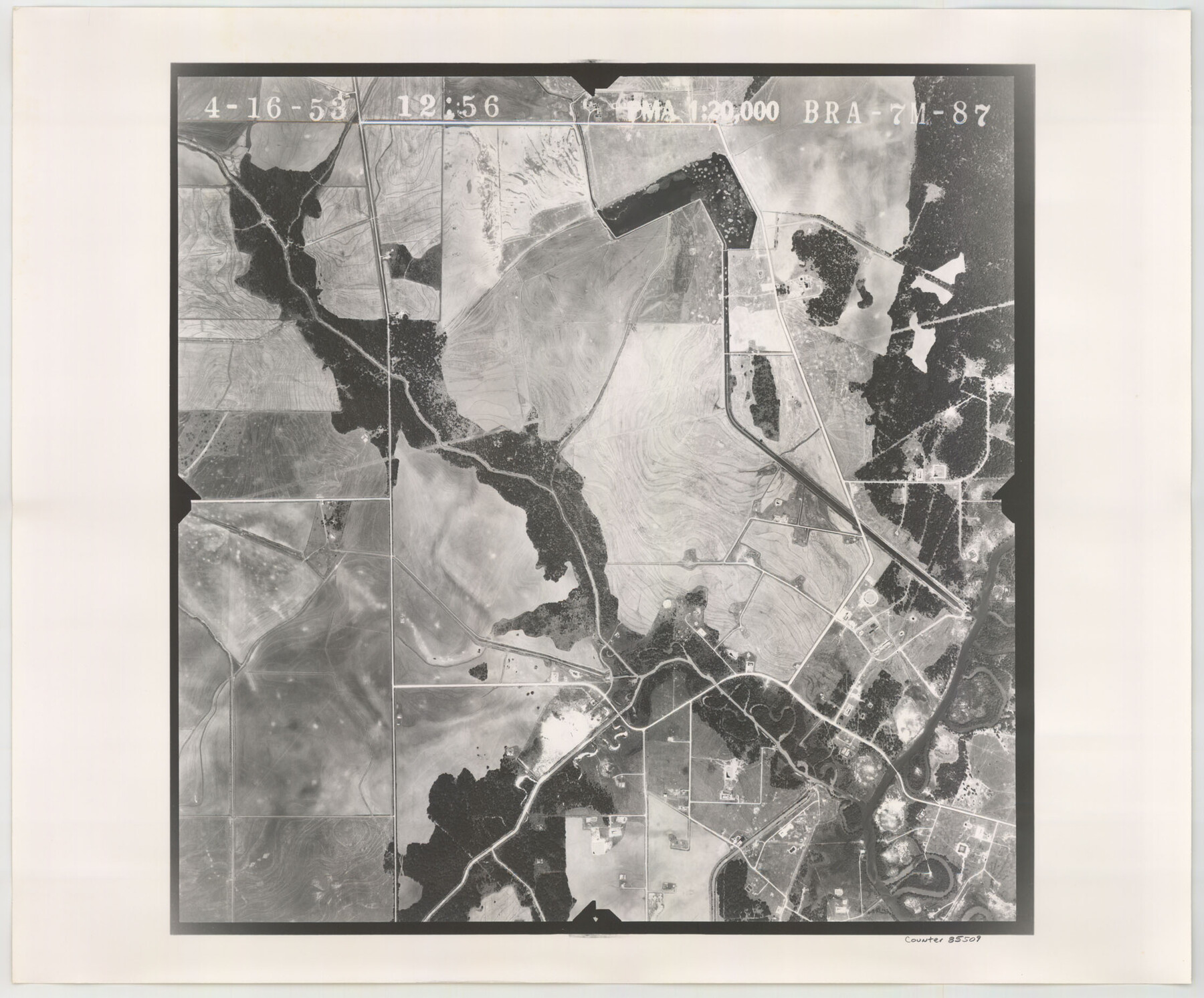
Flight Mission No. BRA-7M, Frame 87, Jefferson County
BRA-7M-87
-
Map/Doc
85509
-
Collection
General Map Collection
-
Object Dates
1953/4/16 (Creation Date)
-
People and Organizations
U. S. Department of Agriculture (Publisher)
-
Counties
Jefferson
-
Subjects
Aerial Photograph
-
Height x Width
18.5 x 22.3 inches
47.0 x 56.6 cm
-
Comments
Flown by Jack Ammann Photogrammetric Engineers of San Antonio, Texas.
Part of: General Map Collection
Red River County Working Sketch 8

Print $20.00
- Digital $50.00
Red River County Working Sketch 8
1920
Size 16.2 x 14.2 inches
Map/Doc 71991
San Patricio County Rolled Sketch 36

Print $40.00
- Digital $50.00
San Patricio County Rolled Sketch 36
Size 42.3 x 48.1 inches
Map/Doc 9899
Nacogdoches County

Print $20.00
- Digital $50.00
Nacogdoches County
1950
Size 47.0 x 43.1 inches
Map/Doc 73248
Hudspeth county Sketch File 12a

Print $20.00
- Digital $50.00
Hudspeth county Sketch File 12a
1894
Size 13.3 x 34.7 inches
Map/Doc 11800
Hopkins County Sketch File 1

Print $4.00
- Digital $50.00
Hopkins County Sketch File 1
1854
Size 5.2 x 10.2 inches
Map/Doc 26676
San Jacinto County Working Sketch 13

Print $20.00
- Digital $50.00
San Jacinto County Working Sketch 13
1935
Size 25.0 x 18.8 inches
Map/Doc 63726
Sketch of surveys in Harrison & Marion Cos. Showing Caddo Lake & Subdivisions

Print $20.00
- Digital $50.00
Sketch of surveys in Harrison & Marion Cos. Showing Caddo Lake & Subdivisions
1955
Size 33.8 x 32.4 inches
Map/Doc 93284
Flight Mission No. DQN-2K, Frame 50, Calhoun County

Print $20.00
- Digital $50.00
Flight Mission No. DQN-2K, Frame 50, Calhoun County
1953
Size 18.5 x 22.1 inches
Map/Doc 84255
La Salle County Rolled Sketch 16

Print $20.00
- Digital $50.00
La Salle County Rolled Sketch 16
1948
Size 26.7 x 20.9 inches
Map/Doc 6580
Supreme Court of the United States, October Term, 1923, No. 15, Original - The State of Oklahoma, Complainant vs. The State of Texas, Defendant, The United States, Intervener; Report of the Boundary Commissioners

Print $20.00
- Digital $50.00
Supreme Court of the United States, October Term, 1923, No. 15, Original - The State of Oklahoma, Complainant vs. The State of Texas, Defendant, The United States, Intervener; Report of the Boundary Commissioners
1923
Size 39.4 x 39.6 inches
Map/Doc 75116
Knox County Rolled Sketch 8

Print $20.00
- Digital $50.00
Knox County Rolled Sketch 8
Size 28.2 x 32.5 inches
Map/Doc 9406
Current Miscellaneous File 95

Print $24.00
- Digital $50.00
Current Miscellaneous File 95
1994
Size 8.8 x 11.3 inches
Map/Doc 74270
You may also like
State Mineral Subdivisions and Shoreline Meanders of Upper Trinity Bay and Trinity River Delta Area, Chambers County

Print $20.00
- Digital $50.00
State Mineral Subdivisions and Shoreline Meanders of Upper Trinity Bay and Trinity River Delta Area, Chambers County
1950
Size 42.8 x 44.7 inches
Map/Doc 1933
Presidio County Sketch File K

Print $8.00
- Digital $50.00
Presidio County Sketch File K
1907
Size 13.6 x 8.6 inches
Map/Doc 34456
Webb County Rolled Sketch 15

Print $20.00
- Digital $50.00
Webb County Rolled Sketch 15
Size 25.1 x 15.1 inches
Map/Doc 8179
Burnet County Sketch File 31

Print $4.00
- Digital $50.00
Burnet County Sketch File 31
1875
Size 12.7 x 8.1 inches
Map/Doc 16748
Hemphill County Working Sketch 7

Print $20.00
- Digital $50.00
Hemphill County Working Sketch 7
1964
Size 41.1 x 46.8 inches
Map/Doc 66102

Culberson County Rolled Sketch 52

Print $20.00
- Digital $50.00
Culberson County Rolled Sketch 52
Size 19.1 x 24.7 inches
Map/Doc 5672
[Rosebud Station Map - Tracks and Structures - Lands, San Antonio and Aransas Pass Railway Co.]
![62566, [Rosebud Station Map - Tracks and Structures - Lands, San Antonio and Aransas Pass Railway Co.], General Map Collection](https://historictexasmaps.com/wmedia_w700/maps/62566.tif.jpg)
Print $4.00
- Digital $50.00
[Rosebud Station Map - Tracks and Structures - Lands, San Antonio and Aransas Pass Railway Co.]
1919
Size 11.7 x 18.6 inches
Map/Doc 62566
Parker County

Print $20.00
- Digital $50.00
Parker County
1942
Size 46.7 x 37.9 inches
Map/Doc 73258
[Sketch of 'San Salvador del Tule', Juan Jose Balli Grant, Hidalgo County, Texas]
![10756, [Sketch of 'San Salvador del Tule', Juan Jose Balli Grant, Hidalgo County, Texas], Maddox Collection](https://historictexasmaps.com/wmedia_w700/maps/10756.tif.jpg)
Print $20.00
- Digital $50.00
[Sketch of 'San Salvador del Tule', Juan Jose Balli Grant, Hidalgo County, Texas]
Size 22.0 x 17.5 inches
Map/Doc 10756
Erath County Sketch File 8

Print $4.00
- Digital $50.00
Erath County Sketch File 8
Size 8.6 x 13.0 inches
Map/Doc 22269
Webb County Working Sketch 40

Print $20.00
- Digital $50.00
Webb County Working Sketch 40
1941
Size 19.6 x 20.6 inches
Map/Doc 72405