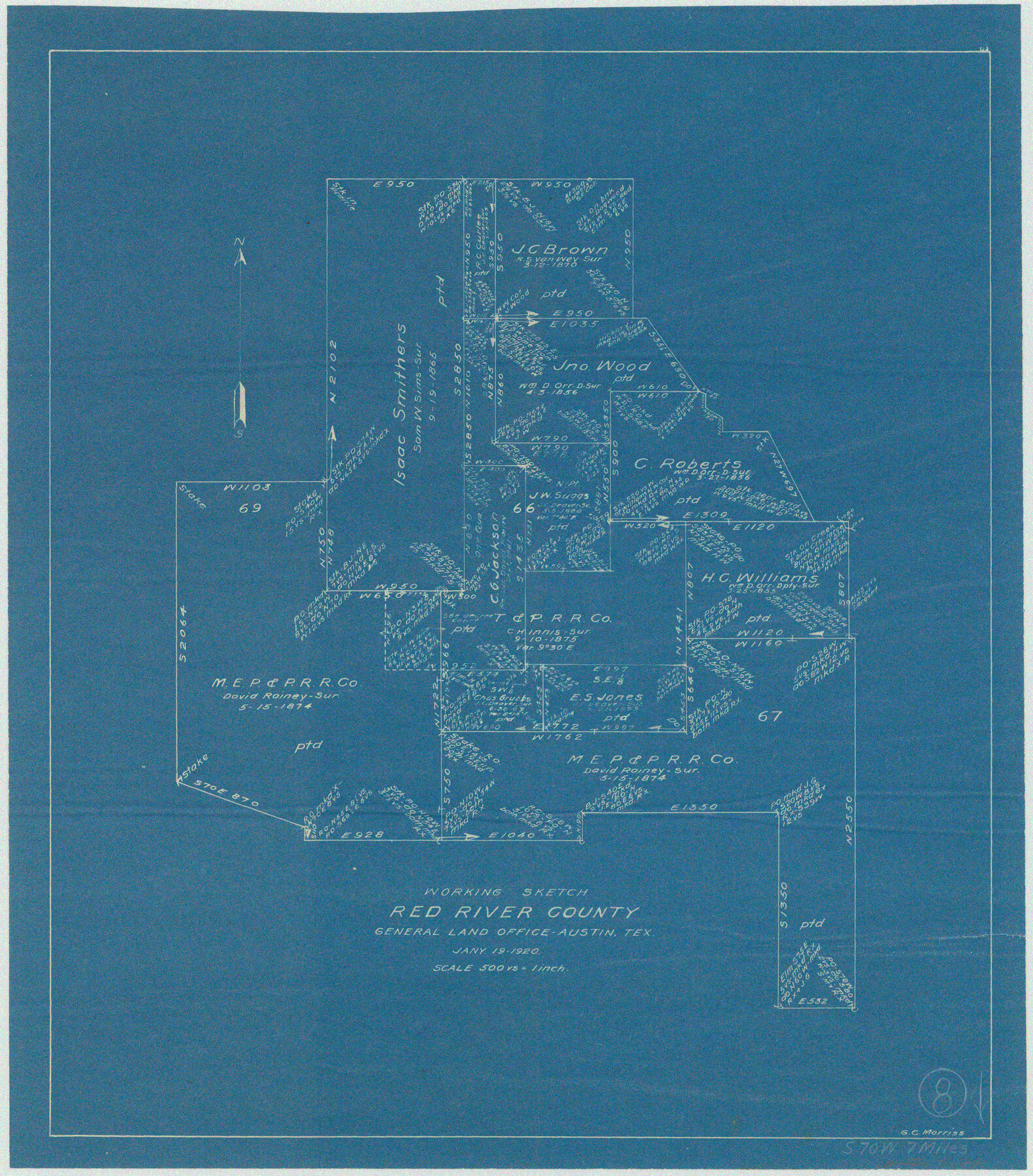
Red River County Working Sketch 8
-
Map/Doc
71991
-
Collection
General Map Collection
-
Object Dates
1/19/1920 (Creation Date)
-
People and Organizations
G.C. Morriss (Draftsman)
-
Counties
Red River
-
Subjects
Surveying Working Sketch
-
Height x Width
16.2 x 14.2 inches
41.2 x 36.1 cm
-
Scale
1" = 500 varas
Part of: General Map Collection
El Paso County Rolled Sketch 36

Digital $50.00
El Paso County Rolled Sketch 36
Size 43.3 x 77.6 inches
Map/Doc 8863
Flight Mission No. DQN-1K, Frame 103, Calhoun County

Print $20.00
- Digital $50.00
Flight Mission No. DQN-1K, Frame 103, Calhoun County
1953
Size 18.5 x 22.1 inches
Map/Doc 84170
Matagorda County Sketch File 47

Print $68.00
- Digital $50.00
Matagorda County Sketch File 47
Size 11.2 x 8.6 inches
Map/Doc 30976
Galveston County NRC Article 33.136 Sketch 66

Print $42.00
- Digital $50.00
Galveston County NRC Article 33.136 Sketch 66
2012
Size 23.0 x 34.8 inches
Map/Doc 95000
Mills County Sketch File 14a

Print $4.00
- Digital $50.00
Mills County Sketch File 14a
Size 13.0 x 8.2 inches
Map/Doc 31663
McCulloch County Sketch File 2

Print $4.00
- Digital $50.00
McCulloch County Sketch File 2
1872
Size 12.8 x 8.1 inches
Map/Doc 31167
Kimble County Working Sketch 31

Print $20.00
- Digital $50.00
Kimble County Working Sketch 31
1944
Size 34.8 x 34.6 inches
Map/Doc 70099
Coryell County Working Sketch 19

Print $20.00
- Digital $50.00
Coryell County Working Sketch 19
1970
Size 38.7 x 33.2 inches
Map/Doc 68226
Bowie County Rolled Sketch 3

Print $57.00
- Digital $50.00
Bowie County Rolled Sketch 3
1970
Size 10.0 x 15.3 inches
Map/Doc 42739
Hutchinson County Sketch File 38

Print $40.00
- Digital $50.00
Hutchinson County Sketch File 38
1935
Size 17.6 x 14.2 inches
Map/Doc 27280
Andrews County Sketch File 8a

Print $8.00
- Digital $50.00
Andrews County Sketch File 8a
1943
Size 11.3 x 8.8 inches
Map/Doc 12849
Flight Mission No. BRE-1P, Frame 5, Nueces County

Print $20.00
- Digital $50.00
Flight Mission No. BRE-1P, Frame 5, Nueces County
1956
Size 18.3 x 22.1 inches
Map/Doc 86613
You may also like
Dallas County Boundary File 8 and 8a

Print $4.00
- Digital $50.00
Dallas County Boundary File 8 and 8a
Size 11.2 x 8.7 inches
Map/Doc 52311

Old Miscellaneous File 2

Print $16.00
- Digital $50.00
Old Miscellaneous File 2
1838
Size 13.0 x 8.0 inches
Map/Doc 75406
Flight Mission No. BRA-8M, Frame 22, Jefferson County

Print $20.00
- Digital $50.00
Flight Mission No. BRA-8M, Frame 22, Jefferson County
1953
Size 18.5 x 22.4 inches
Map/Doc 85577
S.P.O. Co. No. 7, State Submerged Tract No. 12, Laguna Madre, Nueces Co., Texas

Print $20.00
- Digital $50.00
S.P.O. Co. No. 7, State Submerged Tract No. 12, Laguna Madre, Nueces Co., Texas
1937
Size 27.9 x 27.4 inches
Map/Doc 3026
Working Sketch Cottle County

Print $20.00
- Digital $50.00
Working Sketch Cottle County
1916
Size 31.7 x 29.6 inches
Map/Doc 4434
Kimble County Sketch File 1

Print $4.00
- Digital $50.00
Kimble County Sketch File 1
1854
Size 7.2 x 10.0 inches
Map/Doc 28907
McMullen County Sketch File 17

Print $4.00
- Digital $50.00
McMullen County Sketch File 17
Size 8.0 x 10.0 inches
Map/Doc 31369
Travis County Sketch File 32

Print $20.00
- Digital $50.00
Travis County Sketch File 32
Size 25.3 x 32.7 inches
Map/Doc 12460
Map of Bee County State of Texas

Print $20.00
- Digital $50.00
Map of Bee County State of Texas
1863
Size 31.1 x 25.3 inches
Map/Doc 3286
Flight Mission No. DCL-6C, Frame 98, Kenedy County

Print $20.00
- Digital $50.00
Flight Mission No. DCL-6C, Frame 98, Kenedy County
1943
Size 18.6 x 22.3 inches
Map/Doc 85928
Tom Green County Rolled Sketch 8

Print $20.00
- Digital $50.00
Tom Green County Rolled Sketch 8
Size 18.3 x 26.0 inches
Map/Doc 7996