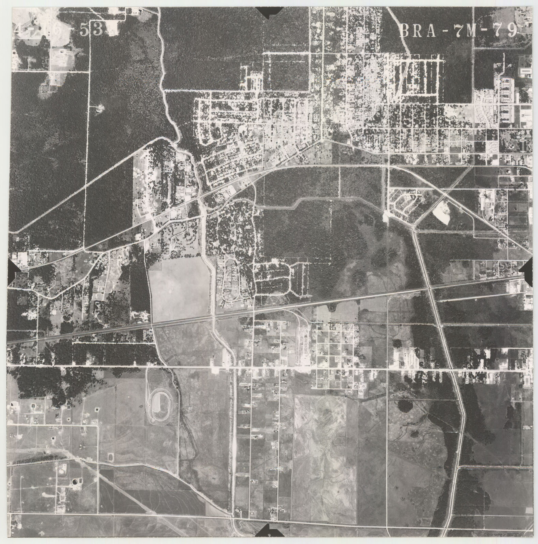
Flight Mission No. BRA-7M, Frame 79, Jefferson County
BRA-7M-79
-
Map/Doc
85501
-
Collection
General Map Collection
-
Object Dates
1953/4/16 (Creation Date)
-
People and Organizations
U. S. Department of Agriculture (Publisher)
-
Counties
Jefferson
-
Subjects
Aerial Photograph
-
Height x Width
16.0 x 15.8 inches
40.6 x 40.1 cm
-
Comments
Flown by Jack Ammann Photogrammetric Engineers of San Antonio, Texas.
Part of: General Map Collection

Webb County Sketch File EF

Print $38.00
- Digital $50.00
Webb County Sketch File EF
1932
Size 9.2 x 8.5 inches
Map/Doc 39681
Milam County Boundary File 65a

Print $40.00
- Digital $50.00
Milam County Boundary File 65a
Size 17.2 x 30.4 inches
Map/Doc 57256
Lee County & Burleson County

Print $20.00
- Digital $50.00
Lee County & Burleson County
1867
Size 18.0 x 31.9 inches
Map/Doc 3346
Duval County Rolled Sketch 36

Print $20.00
- Digital $50.00
Duval County Rolled Sketch 36
1952
Size 27.7 x 21.9 inches
Map/Doc 5751
Williamson County Boundary File 4

Print $40.00
- Digital $50.00
Williamson County Boundary File 4
Size 8.3 x 13.3 inches
Map/Doc 60013
Arlington Street Map & Guide

Digital $50.00
Arlington Street Map & Guide
Size 35.5 x 23.2 inches
Map/Doc 94436
Coryell County Working Sketch Graphic Index

Print $20.00
- Digital $50.00
Coryell County Working Sketch Graphic Index
1936
Size 44.8 x 40.5 inches
Map/Doc 76505
Schleicher County Sketch File 17

Print $20.00
- Digital $50.00
Schleicher County Sketch File 17
Size 23.4 x 17.8 inches
Map/Doc 12299
Wilson County Sketch File A

Print $4.00
- Digital $50.00
Wilson County Sketch File A
1898
Size 8.3 x 7.4 inches
Map/Doc 40423
Garza County Sketch File 2

Print $20.00
- Digital $50.00
Garza County Sketch File 2
Size 33.1 x 30.3 inches
Map/Doc 10462
Hudspeth County Rolled Sketch 64

Print $40.00
- Digital $50.00
Hudspeth County Rolled Sketch 64
1986
Size 39.1 x 81.9 inches
Map/Doc 9228
You may also like
Martin County Working Sketch 1

Print $20.00
- Digital $50.00
Martin County Working Sketch 1
1922
Size 21.8 x 16.9 inches
Map/Doc 70819
Edwards County Working Sketch 77

Print $20.00
- Digital $50.00
Edwards County Working Sketch 77
1960
Size 32.8 x 39.9 inches
Map/Doc 68953
Galveston County Sketch File 73g

Print $20.00
- Digital $50.00
Galveston County Sketch File 73g
Size 32.1 x 41.2 inches
Map/Doc 10460
Tarrant County State Real Property Sketch 2

Print $20.00
- Digital $50.00
Tarrant County State Real Property Sketch 2
1994
Size 21.3 x 27.6 inches
Map/Doc 61668
[Galveston, Harrisburg & San Antonio Railway]
![64402, [Galveston, Harrisburg & San Antonio Railway], General Map Collection](https://historictexasmaps.com/wmedia_w700/maps/64402.tif.jpg)
Print $20.00
- Digital $50.00
[Galveston, Harrisburg & San Antonio Railway]
1892
Size 13.5 x 33.7 inches
Map/Doc 64402
Map of the Northeast Part of the Pitchfork Ranch

Print $20.00
- Digital $50.00
Map of the Northeast Part of the Pitchfork Ranch
1916
Size 23.4 x 23.4 inches
Map/Doc 90980
Western Territories of the United States

Print $20.00
- Digital $50.00
Western Territories of the United States
1847
Size 12.1 x 19.0 inches
Map/Doc 93543
Starr County Working Sketch 13

Print $20.00
- Digital $50.00
Starr County Working Sketch 13
1951
Size 19.3 x 28.8 inches
Map/Doc 63929
Flight Mission No. DAG-18K, Frame 74, Matagorda County

Print $20.00
- Digital $50.00
Flight Mission No. DAG-18K, Frame 74, Matagorda County
1952
Size 18.5 x 22.4 inches
Map/Doc 86367
[Right of Way & Track Map, The Texas & Pacific Ry. Co. Main Line]
![64676, [Right of Way & Track Map, The Texas & Pacific Ry. Co. Main Line], General Map Collection](https://historictexasmaps.com/wmedia_w700/maps/64676.tif.jpg)
Print $20.00
- Digital $50.00
[Right of Way & Track Map, The Texas & Pacific Ry. Co. Main Line]
Size 11.0 x 18.6 inches
Map/Doc 64676
Fisher County Working Sketch 9

Print $20.00
- Digital $50.00
Fisher County Working Sketch 9
1947
Size 18.1 x 17.9 inches
Map/Doc 69143
Motley County Sketch File 2D (N)

Print $20.00
- Digital $50.00
Motley County Sketch File 2D (N)
Size 14.3 x 9.0 inches
Map/Doc 31984