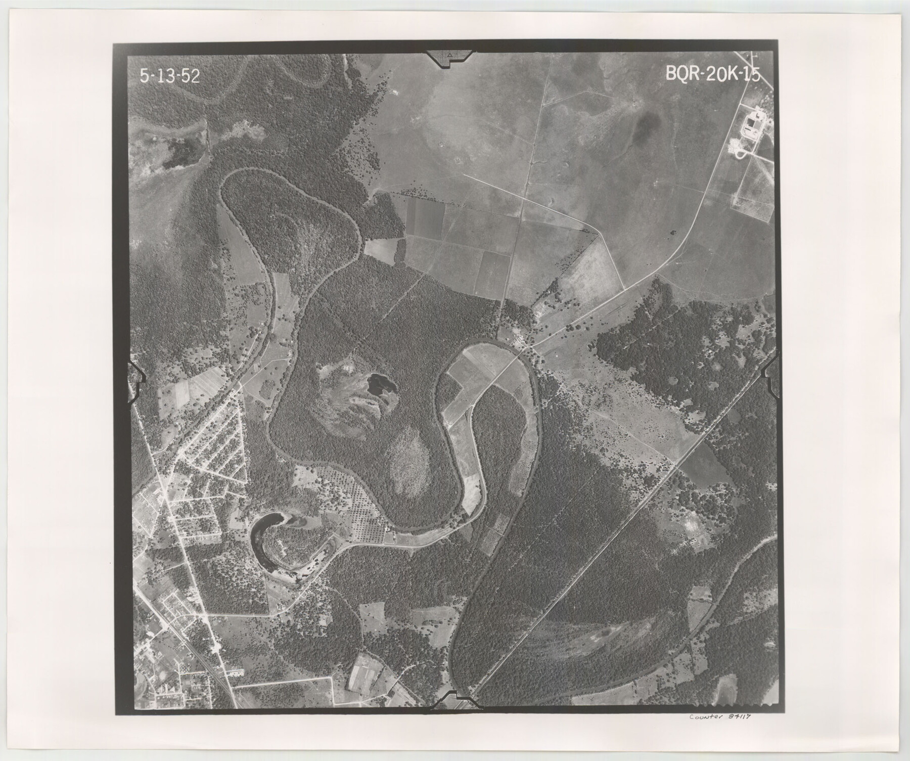
Flight Mission No. BQR-20K, Frame 15, Brazoria County
BQR-20K-15
-
Map/Doc
84117
-
Collection
General Map Collection
-
Object Dates
1952/5/13 (Creation Date)
-
People and Organizations
U. S. Department of Agriculture (Publisher)
-
Counties
Brazoria
-
Subjects
Aerial Photograph
-
Height x Width
18.6 x 22.3 inches
47.2 x 56.6 cm
-
Comments
Flown by Aero Exploration Company of Tulsa, Oklahoma.
Part of: General Map Collection
Gregg County Rolled Sketch 18A

Print $313.00
- Digital $50.00
Gregg County Rolled Sketch 18A
1934
Size 10.5 x 15.5 inches
Map/Doc 45469
Dimmit County Working Sketch 22

Print $20.00
- Digital $50.00
Dimmit County Working Sketch 22
1951
Size 37.3 x 38.7 inches
Map/Doc 68683
Trinity River, Reagor Springs Sheet/Waxahachie Creek

Print $4.00
- Digital $50.00
Trinity River, Reagor Springs Sheet/Waxahachie Creek
1931
Size 29.9 x 25.6 inches
Map/Doc 65236
Wilson County Working Sketch 3

Print $20.00
- Digital $50.00
Wilson County Working Sketch 3
1952
Size 33.6 x 33.2 inches
Map/Doc 72583
Presidio County Working Sketch 77

Print $20.00
- Digital $50.00
Presidio County Working Sketch 77
1964
Size 36.0 x 39.0 inches
Map/Doc 71754
Edwards County Working Sketch 93

Print $20.00
- Digital $50.00
Edwards County Working Sketch 93
1966
Size 30.7 x 35.7 inches
Map/Doc 68969
Flight Mission No. DAG-17K, Frame 126, Matagorda County

Print $20.00
- Digital $50.00
Flight Mission No. DAG-17K, Frame 126, Matagorda County
1952
Size 18.6 x 22.3 inches
Map/Doc 86346
Flight Mission No. DQN-5K, Frame 145, Calhoun County

Print $20.00
- Digital $50.00
Flight Mission No. DQN-5K, Frame 145, Calhoun County
1953
Size 18.5 x 22.1 inches
Map/Doc 84420
No. 2 Chart of Corpus Christi Pass, Texas

Print $20.00
- Digital $50.00
No. 2 Chart of Corpus Christi Pass, Texas
1878
Size 18.2 x 27.3 inches
Map/Doc 73017
Crosby County Working Sketch 16

Print $40.00
- Digital $50.00
Crosby County Working Sketch 16
1979
Size 37.4 x 59.3 inches
Map/Doc 68450
Terrell County Rolled Sketch 50

Print $20.00
- Digital $50.00
Terrell County Rolled Sketch 50
1963
Size 35.9 x 20.5 inches
Map/Doc 7967
Travis County State Real Property Sketch 10

Print $20.00
- Digital $50.00
Travis County State Real Property Sketch 10
2002
Size 35.5 x 25.2 inches
Map/Doc 83550
You may also like
Duval County Rolled Sketch 20

Print $20.00
- Digital $50.00
Duval County Rolled Sketch 20
Size 33.2 x 42.0 inches
Map/Doc 8811
Right of Way & Track Map, St. Louis, Brownsville & Mexico Ry. operated by St. Louis, Brownsville & Mexico Ry. Co.

Print $40.00
- Digital $50.00
Right of Way & Track Map, St. Louis, Brownsville & Mexico Ry. operated by St. Louis, Brownsville & Mexico Ry. Co.
1919
Size 25.4 x 56.9 inches
Map/Doc 64623
Reeves County Working Sketch 55

Print $20.00
- Digital $50.00
Reeves County Working Sketch 55
1978
Size 36.1 x 34.7 inches
Map/Doc 63498
Jefferson County Sketch File 11

Print $6.00
- Digital $50.00
Jefferson County Sketch File 11
1862
Size 8.0 x 6.4 inches
Map/Doc 28132
[Right of Way Map, Belton Branch of the M.K.&T. RR.]
![64223, [Right of Way Map, Belton Branch of the M.K.&T. RR.], General Map Collection](https://historictexasmaps.com/wmedia_w700/maps/64223.tif.jpg)
Print $20.00
- Digital $50.00
[Right of Way Map, Belton Branch of the M.K.&T. RR.]
1896
Size 21.7 x 7.2 inches
Map/Doc 64223
Americae Nova Descriptio

Print $20.00
- Digital $50.00
Americae Nova Descriptio
1652
Size 19.7 x 23.5 inches
Map/Doc 95370
Crockett County Rolled Sketch 88L

Print $20.00
- Digital $50.00
Crockett County Rolled Sketch 88L
1963
Size 19.0 x 24.6 inches
Map/Doc 5628
[Blks. B9, J, D19, John Walker]
![90480, [Blks. B9, J, D19, John Walker], Twichell Survey Records](https://historictexasmaps.com/wmedia_w700/maps/90480-1.tif.jpg)
Print $20.00
- Digital $50.00
[Blks. B9, J, D19, John Walker]
Size 28.6 x 15.9 inches
Map/Doc 90480
Stonewall County Boundary File 4b

Print $18.00
- Digital $50.00
Stonewall County Boundary File 4b
Size 9.1 x 8.8 inches
Map/Doc 58993
Crockett County Rolled Sketch 3

Print $20.00
- Digital $50.00
Crockett County Rolled Sketch 3
1886
Size 18.1 x 22.9 inches
Map/Doc 5579
Map of Caldwell County, Texas

Print $20.00
Map of Caldwell County, Texas
1880
Size 18.7 x 22.0 inches
Map/Doc 88915
Chicago, Rock Island, Texas & Mexico

Print $20.00
- Digital $50.00
Chicago, Rock Island, Texas & Mexico
1920
Size 23.9 x 13.8 inches
Map/Doc 64423