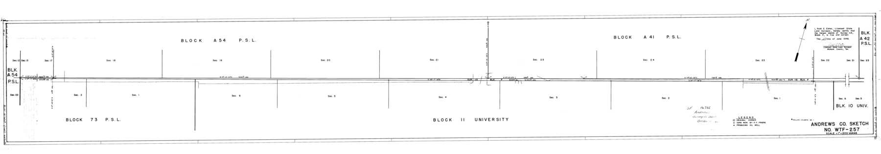
Andrews County Rolled Sketch 23
Andrews Co. Sketch No. WTF-257 [relating to SF 14766]
-
Map/Doc
8396
-
Collection
General Map Collection
-
Object Dates
1946/6/15 (Creation Date)
1946/10/11 (File Date)
-
People and Organizations
Robt. E. Estes (Surveyor/Engineer)
-
Counties
Andrews
-
Subjects
Surveying Rolled Sketch
-
Height x Width
78.0 x 13.7 inches
198.1 x 34.8 cm
-
Medium
linen, manuscript
-
Scale
1" = 200 varas
-
Comments
For a revised version of this sketch, see Andrews County Rolled Sketch 26 (8398)
Related maps
Andrews County Rolled Sketch 26

Print $40.00
- Digital $50.00
Andrews County Rolled Sketch 26
1948
Size 78.3 x 13.2 inches
Map/Doc 8398
Part of: General Map Collection
Uvalde County Working Sketch 23

Print $20.00
- Digital $50.00
Uvalde County Working Sketch 23
1952
Size 32.0 x 26.6 inches
Map/Doc 72093
Live Oak County Sketch File 4

Print $20.00
- Digital $50.00
Live Oak County Sketch File 4
1858
Size 16.3 x 19.2 inches
Map/Doc 12006
Young County Sketch File 18

Print $10.00
- Digital $50.00
Young County Sketch File 18
1929
Size 11.5 x 8.7 inches
Map/Doc 40882
Red River County Working Sketch 62

Print $20.00
- Digital $50.00
Red River County Working Sketch 62
1973
Size 27.1 x 40.0 inches
Map/Doc 72045
Edwards County Working Sketch 92

Print $20.00
- Digital $50.00
Edwards County Working Sketch 92
1966
Size 31.8 x 47.5 inches
Map/Doc 68968
Connected Map of Austin's Colony

Print $40.00
- Digital $50.00
Connected Map of Austin's Colony
1837
Size 90.6 x 80.9 inches
Map/Doc 1943
Plan of the City of Austin

Print $40.00
- Digital $50.00
Plan of the City of Austin
1840
Size 54.0 x 38.9 inches
Map/Doc 2176
Map of Location of the Pecos & Northern Texas Railway from Station 7879+36 to Station 8010+08 = 2.48 Miles through Castro County, Texas

Print $20.00
- Digital $50.00
Map of Location of the Pecos & Northern Texas Railway from Station 7879+36 to Station 8010+08 = 2.48 Miles through Castro County, Texas
1898
Size 14.1 x 25.3 inches
Map/Doc 64060
Flight Mission No. DCL-6C, Frame 65, Kenedy County

Print $20.00
- Digital $50.00
Flight Mission No. DCL-6C, Frame 65, Kenedy County
1943
Size 18.5 x 22.3 inches
Map/Doc 85907
Cameron County Sketch File 5

Print $4.00
- Digital $50.00
Cameron County Sketch File 5
1978
Size 11.1 x 8.7 inches
Map/Doc 17030
Harris County Sketch File 25

Print $8.00
- Digital $50.00
Harris County Sketch File 25
Size 9.0 x 11.8 inches
Map/Doc 25389
[Surveys along the boundary between Jasper and Jefferson Counties]
![99, [Surveys along the boundary between Jasper and Jefferson Counties], General Map Collection](https://historictexasmaps.com/wmedia_w700/maps/99.tif.jpg)
Print $3.00
- Digital $50.00
[Surveys along the boundary between Jasper and Jefferson Counties]
1841
Size 9.3 x 16.9 inches
Map/Doc 99
You may also like
[Sketch showing county line between Randall and Potter Counties]
![91760, [Sketch showing county line between Randall and Potter Counties], Twichell Survey Records](https://historictexasmaps.com/wmedia_w700/maps/91760-1.tif.jpg)
Print $20.00
- Digital $50.00
[Sketch showing county line between Randall and Potter Counties]
Size 18.8 x 37.0 inches
Map/Doc 91760
Terrell County Working Sketch 22a

Print $20.00
- Digital $50.00
Terrell County Working Sketch 22a
1939
Size 39.8 x 40.9 inches
Map/Doc 71493
[Galveston, Harrisburg & San Antonio through El Paso County]
![64005, [Galveston, Harrisburg & San Antonio through El Paso County], General Map Collection](https://historictexasmaps.com/wmedia_w700/maps/64005.tif.jpg)
Print $20.00
- Digital $50.00
[Galveston, Harrisburg & San Antonio through El Paso County]
1906
Size 13.3 x 33.6 inches
Map/Doc 64005
Brewster County Rolled Sketch 60

Print $20.00
- Digital $50.00
Brewster County Rolled Sketch 60
Size 25.0 x 37.5 inches
Map/Doc 8484
Young County Sketch File 20

Print $20.00
- Digital $50.00
Young County Sketch File 20
1922
Size 27.4 x 23.9 inches
Map/Doc 12714
Brazoria County Working Sketch 1

Print $20.00
- Digital $50.00
Brazoria County Working Sketch 1
1907
Size 19.6 x 19.0 inches
Map/Doc 67486
[Surveys in the vicinity of Archer County School Land]
![90325, [Surveys in the vicinity of Archer County School Land], Twichell Survey Records](https://historictexasmaps.com/wmedia_w700/maps/90325-1.tif.jpg)
Print $20.00
- Digital $50.00
[Surveys in the vicinity of Archer County School Land]
Size 15.1 x 20.6 inches
Map/Doc 90325
Freestone County

Print $40.00
- Digital $50.00
Freestone County
1918
Size 48.4 x 41.6 inches
Map/Doc 66830
Sutton County Sketch File 50

Print $20.00
- Digital $50.00
Sutton County Sketch File 50
1941
Size 18.6 x 18.4 inches
Map/Doc 12392
Dimmit County Working Sketch 51

Print $20.00
- Digital $50.00
Dimmit County Working Sketch 51
1986
Size 25.7 x 36.1 inches
Map/Doc 68712
Presidio County Working Sketch 138

Print $20.00
- Digital $50.00
Presidio County Working Sketch 138
1990
Size 17.4 x 41.2 inches
Map/Doc 71816
Pecos County Sketch File 27c

Print $4.00
- Digital $50.00
Pecos County Sketch File 27c
Size 11.1 x 9.1 inches
Map/Doc 33681