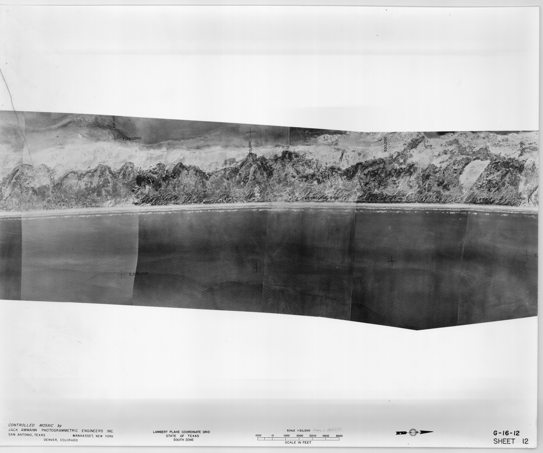
Controlled Mosaic by Jack Amman Photogrammetric Engineers, Inc - Sheet 12
[Coastal Aerial Photograph]
G-16-12
-
Map/Doc
83456
-
Collection
General Map Collection
-
Object Dates
1954 (Creation Date)
-
Subjects
Aerial Photograph
-
Height x Width
20.0 x 24.0 inches
50.8 x 61.0 cm
-
Comments
Statement on reverse side: "The reverse reflects the data shown thereon which was obtained by aerial survey made from December 31, 1953 to March 17, 1954 by Jack Ammann Photogrammetric Engineers, Inc."
Part of: General Map Collection
A Map of Harrison County

Print $20.00
- Digital $50.00
A Map of Harrison County
1846
Size 40.5 x 30.7 inches
Map/Doc 1460
Current Miscellaneous File 105

Print $18.00
- Digital $50.00
Current Miscellaneous File 105
Size 8.8 x 14.2 inches
Map/Doc 74680
Foard County Working Sketch 8

Print $40.00
- Digital $50.00
Foard County Working Sketch 8
1975
Size 57.0 x 40.0 inches
Map/Doc 69199
Cherokee County Sketch File 16

Print $44.00
- Digital $50.00
Cherokee County Sketch File 16
1862
Size 10.0 x 8.0 inches
Map/Doc 18152
Hardeman County Sketch File A1

Print $14.00
- Digital $50.00
Hardeman County Sketch File A1
1891
Size 12.7 x 8.2 inches
Map/Doc 25045
Hardin County Sketch File 5a

Print $6.00
- Digital $50.00
Hardin County Sketch File 5a
Size 8.1 x 3.5 inches
Map/Doc 25094
Starr County Rolled Sketch 24

Print $20.00
- Digital $50.00
Starr County Rolled Sketch 24
1938
Size 37.5 x 26.7 inches
Map/Doc 7808
Brooks County Boundary File 2

Print $8.00
- Digital $50.00
Brooks County Boundary File 2
Size 8.6 x 11.3 inches
Map/Doc 50839
Rockwall County Boundary File 76

Print $14.00
- Digital $50.00
Rockwall County Boundary File 76
Size 11.4 x 8.9 inches
Map/Doc 58497
Montague County Boundary File 2d

Print $4.00
- Digital $50.00
Montague County Boundary File 2d
Size 12.5 x 8.2 inches
Map/Doc 57432
Castro County Sketch File 4k

Print $4.00
- Digital $50.00
Castro County Sketch File 4k
Size 13.6 x 8.6 inches
Map/Doc 17485
Haskell County Working Sketch 11

Print $20.00
- Digital $50.00
Haskell County Working Sketch 11
1976
Size 38.0 x 33.4 inches
Map/Doc 66069
You may also like
Moore County Rolled Sketch 6

Print $20.00
- Digital $50.00
Moore County Rolled Sketch 6
1911
Size 33.4 x 30.2 inches
Map/Doc 6825
General Highway Map, Edwards County, Real County, Texas

Print $20.00
General Highway Map, Edwards County, Real County, Texas
1961
Size 18.1 x 24.7 inches
Map/Doc 79452
The Dividing Link - Mexico & Central America

The Dividing Link - Mexico & Central America
Size 20.5 x 31.2 inches
Map/Doc 95941
[Sketch of Surveys in Ward County, Texas]
![75767, [Sketch of Surveys in Ward County, Texas], Maddox Collection](https://historictexasmaps.com/wmedia_w700/maps/75767.tif.jpg)
Print $20.00
- Digital $50.00
[Sketch of Surveys in Ward County, Texas]
Size 9.7 x 37.1 inches
Map/Doc 75767
Foard County Boundary File 5a

Print $40.00
- Digital $50.00
Foard County Boundary File 5a
Size 18.2 x 44.4 inches
Map/Doc 53546
Crockett County Sketch File 92

Print $21.00
- Digital $50.00
Crockett County Sketch File 92
1925
Size 11.4 x 8.8 inches
Map/Doc 19937
Ward County Working Sketch 55

Print $20.00
- Digital $50.00
Ward County Working Sketch 55
1986
Size 30.0 x 36.8 inches
Map/Doc 72361
El Paso County Rolled Sketch 63

Print $20.00
- Digital $50.00
El Paso County Rolled Sketch 63
1996
Size 24.7 x 36.8 inches
Map/Doc 5855
Flight Mission No. BRA-7M, Frame 83, Jefferson County

Print $20.00
- Digital $50.00
Flight Mission No. BRA-7M, Frame 83, Jefferson County
1953
Size 16.1 x 16.1 inches
Map/Doc 85505
Section 10, Block Z, Cochran County, Texas

Print $20.00
- Digital $50.00
Section 10, Block Z, Cochran County, Texas
1952
Size 12.2 x 17.0 inches
Map/Doc 92521
Freestone County Sketch File 1

Print $7.00
- Digital $50.00
Freestone County Sketch File 1
1857
Size 10.6 x 8.6 inches
Map/Doc 23034
Harris County Sketch File 23a

Print $13.00
- Digital $50.00
Harris County Sketch File 23a
1839
Size 9.7 x 6.0 inches
Map/Doc 25379