University Land Field Notes for Block 13 in Crockett County, Block 11 in Reagan County, Block 12 in Crockett and Reagan Counties, Block 14 in Crockett and Upton Counties, and Block 15 in Upton County
University Field Notes
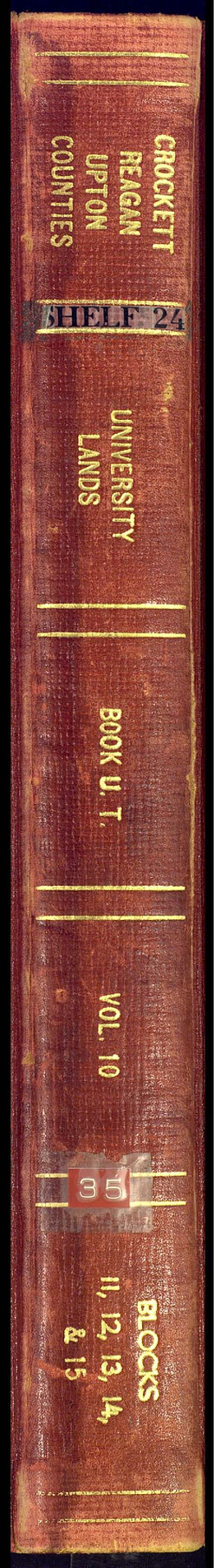
Crockett Crockett, Reagan and Upton Counties University Lands Book U.T., Vol. 10, Blocks 11, 12, 13, 14 and 15
-
Map/Doc
81717
-
Collection
General Map Collection
-
People and Organizations
J.H. Walker (GLO Commissioner)
Frank F. Friend (Surveyor/Engineer)
-
Counties
Upton Reagan Crockett
-
Subjects
Bound Volume University Land
-
Medium
paper, bound volume
-
Comments
Also includes "Report of a Re-survey, University Land Blocks 1 to 13 & 58, Crockett, Reagan, and Upton Counties" and "Report of a Re-survey, University Lands Blocks 14 & 15, Crockett & Upton Counties" both by Frank F. Friend.
See 97177 for an index to the University Land field note volumes.
Related maps
University Land Field Notes for Blocks 1, 2, 8, 9, and 10 in Reagan County, Blocks 6 and 7 in Crockett and Reagan Counties, Blocks 3, 4, and 58 in Reagan and Upton Counties, and Block 5 in Crockett, Reagan, and Upton Counties

University Land Field Notes for Blocks 1, 2, 8, 9, and 10 in Reagan County, Blocks 6 and 7 in Crockett and Reagan Counties, Blocks 3, 4, and 58 in Reagan and Upton Counties, and Block 5 in Crockett, Reagan, and Upton Counties
Map/Doc 81716
University Land Field Note Volume Index

University Land Field Note Volume Index
2023
Size 8.5 x 11.0 inches
Map/Doc 97177
Part of: General Map Collection
Roberts County Working Sketch 23

Print $20.00
- Digital $50.00
Roberts County Working Sketch 23
1979
Size 19.7 x 12.9 inches
Map/Doc 63549
Intracoastal Waterway in Texas - Corpus Christi to Point Isabel including Arroyo Colorado to Mo. Pac. R.R. Bridge Near Harlingen

Print $20.00
- Digital $50.00
Intracoastal Waterway in Texas - Corpus Christi to Point Isabel including Arroyo Colorado to Mo. Pac. R.R. Bridge Near Harlingen
1933
Size 27.9 x 41.0 inches
Map/Doc 61868
Gillespie County Rolled Sketch 7

Print $20.00
- Digital $50.00
Gillespie County Rolled Sketch 7
2008
Size 18.9 x 18.8 inches
Map/Doc 88818
Map of the City of Dallas, Texas, compiled from the records of Dallas Co., and latest surveys of the City Engineer

Map of the City of Dallas, Texas, compiled from the records of Dallas Co., and latest surveys of the City Engineer
1878
Size 22.9 x 31.1 inches
Map/Doc 76174
Map of Texas and the countries adjacent compiled in the Bureau of the Corps of Topographical Engineers from the best authorities for the State Department

Print $20.00
- Digital $50.00
Map of Texas and the countries adjacent compiled in the Bureau of the Corps of Topographical Engineers from the best authorities for the State Department
1844
Size 25.9 x 18.2 inches
Map/Doc 72714
Loving County Rolled Sketch 5

Print $40.00
- Digital $50.00
Loving County Rolled Sketch 5
1952
Size 146.0 x 14.2 inches
Map/Doc 9467
Winkler County Working Sketch 17

Print $20.00
- Digital $50.00
Winkler County Working Sketch 17
1973
Size 36.5 x 36.7 inches
Map/Doc 72611
Burnet County Working Sketch 8

Print $20.00
- Digital $50.00
Burnet County Working Sketch 8
1973
Size 27.2 x 28.0 inches
Map/Doc 67851
Parker County Sketch File 6

Print $6.00
- Digital $50.00
Parker County Sketch File 6
1858
Size 6.9 x 6.0 inches
Map/Doc 33530
Township No. 2 South Range No. 21 West of the Indian Meridian

Print $20.00
- Digital $50.00
Township No. 2 South Range No. 21 West of the Indian Meridian
1875
Size 19.3 x 24.4 inches
Map/Doc 75177
Live Oak County Working Sketch 32

Print $20.00
- Digital $50.00
Live Oak County Working Sketch 32
1992
Size 12.0 x 16.7 inches
Map/Doc 70617
1882 Map of the Texas & Pacific R-Y Reserve

Print $20.00
- Digital $50.00
1882 Map of the Texas & Pacific R-Y Reserve
1887
Size 44.5 x 31.7 inches
Map/Doc 83559
You may also like
Cass County Working Sketch 40

Print $20.00
- Digital $50.00
Cass County Working Sketch 40
1984
Size 24.6 x 24.5 inches
Map/Doc 67943
T. & P. R. R. Co. Block 44, Township 1 S

Print $20.00
- Digital $50.00
T. & P. R. R. Co. Block 44, Township 1 S
Size 18.1 x 22.8 inches
Map/Doc 90826
Right of Way and Track Map, International & Gt. Northern Ry. operated by the International & Gt. Northern Ry. Co. Gulf Division, Mineola Branch

Print $40.00
- Digital $50.00
Right of Way and Track Map, International & Gt. Northern Ry. operated by the International & Gt. Northern Ry. Co. Gulf Division, Mineola Branch
1917
Size 26.3 x 125.4 inches
Map/Doc 64700
Flight Mission No. DAG-23K, Frame 164, Matagorda County

Print $20.00
- Digital $50.00
Flight Mission No. DAG-23K, Frame 164, Matagorda County
1953
Size 18.6 x 22.3 inches
Map/Doc 86502
Dickens County Rolled Sketch P1

Print $20.00
- Digital $50.00
Dickens County Rolled Sketch P1
1915
Size 40.5 x 36.2 inches
Map/Doc 8783
Potter County Sketch File 2

Print $20.00
- Digital $50.00
Potter County Sketch File 2
1887
Size 29.3 x 39.4 inches
Map/Doc 10573
Bastrop County Working Sketch 6

Print $20.00
- Digital $50.00
Bastrop County Working Sketch 6
1923
Size 37.5 x 31.2 inches
Map/Doc 67306
Medina County Sketch File 21

Print $38.00
- Digital $50.00
Medina County Sketch File 21
2002
Size 11.2 x 8.7 inches
Map/Doc 76343

McMullen County Working Sketch 51

Print $20.00
- Digital $50.00
McMullen County Working Sketch 51
1983
Size 18.3 x 17.4 inches
Map/Doc 70752
Galveston County NRC Article 33.136 Sketch 84

Print $62.00
- Digital $50.00
Galveston County NRC Article 33.136 Sketch 84
2017
Size 17.2 x 22.0 inches
Map/Doc 94854
Flight Mission No. CLL-1N, Frame 107, Willacy County

Print $20.00
- Digital $50.00
Flight Mission No. CLL-1N, Frame 107, Willacy County
1954
Size 18.5 x 22.1 inches
Map/Doc 87041