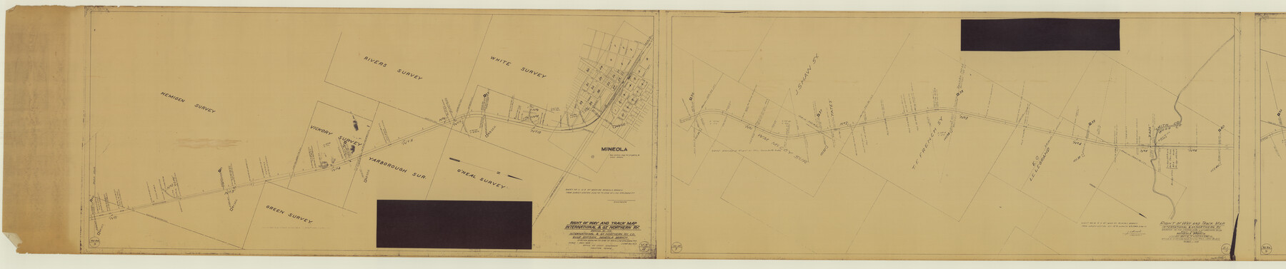
Right of Way and Track Map, International & Gt. Northern Ry. operated by the International & Gt. Northern Ry. Co. Gulf Division, Mineola Branch
Station 2106+41 to end of main line Sta. 2326+77 and Station 1895+12 to Station 2106+41
Z-2-198
-
Map/Doc
64700
-
Collection
General Map Collection
-
Object Dates
1917/6/30 (Creation Date)
-
People and Organizations
Office of Chief Engineer (Publisher)
J.C. Resch (Surveyor/Engineer)
-
Counties
Wood Smith
-
Subjects
Railroads
-
Height x Width
26.3 x 125.4 inches
66.8 x 318.5 cm
-
Medium
blueprint/diazo
-
Scale
1" = 400'
-
Comments
Segment 1; see counter nos. 64701 through 64705 for other segments.
-
Features
I&GN
Mineola
Sabine River
Tates
Eads
Part of: General Map Collection

Maverick County Sketch File 3

Print $40.00
- Digital $50.00
Maverick County Sketch File 3
Size 18.3 x 11.6 inches
Map/Doc 31033
Duval County Sketch File 5

Print $20.00
- Digital $50.00
Duval County Sketch File 5
1860
Size 20.8 x 29.6 inches
Map/Doc 11381
Williamson County Sketch File 25

Print $14.00
- Digital $50.00
Williamson County Sketch File 25
1878
Size 8.9 x 8.3 inches
Map/Doc 40361
Map of Menard County

Print $20.00
- Digital $50.00
Map of Menard County
1871
Size 18.5 x 23.3 inches
Map/Doc 3872
Chambers County Sketch File 14

Print $8.00
- Digital $50.00
Chambers County Sketch File 14
1862
Size 4.3 x 5.1 inches
Map/Doc 17560
Duval County Working Sketch 28

Print $20.00
- Digital $50.00
Duval County Working Sketch 28
1948
Size 29.7 x 37.4 inches
Map/Doc 68752
Burleson County Working Sketch 24

Print $20.00
- Digital $50.00
Burleson County Working Sketch 24
1980
Size 18.5 x 35.9 inches
Map/Doc 67743
Chambers County NRC Article 33.136 Sketch 11

Print $28.00
- Digital $50.00
Chambers County NRC Article 33.136 Sketch 11
2014
Size 24.0 x 36.0 inches
Map/Doc 94740
Webb County Rolled Sketch 54

Print $20.00
- Digital $50.00
Webb County Rolled Sketch 54
1935
Size 24.8 x 18.6 inches
Map/Doc 8207
Gulf Intracoastal Waterway, Tex. - Aransas Bay to Corpus Christi Bay - Modified Route of Main Channel/Dredging

Print $20.00
- Digital $50.00
Gulf Intracoastal Waterway, Tex. - Aransas Bay to Corpus Christi Bay - Modified Route of Main Channel/Dredging
1958
Size 31.3 x 42.8 inches
Map/Doc 61899
Dickens County Sketch File 24

Print $20.00
- Digital $50.00
Dickens County Sketch File 24
1914
Size 20.0 x 16.1 inches
Map/Doc 11325
You may also like
Val Verde County Sketch File XXX5

Print $40.00
- Digital $50.00
Val Verde County Sketch File XXX5
Size 13.2 x 13.4 inches
Map/Doc 39100
[East Line of Moore County]
![91418, [East Line of Moore County], Twichell Survey Records](https://historictexasmaps.com/wmedia_w700/maps/91418-1.tif.jpg)
Print $20.00
- Digital $50.00
[East Line of Moore County]
Size 16.1 x 18.4 inches
Map/Doc 91418
Flight Mission No. DQN-4K, Frame 7, Calhoun County

Print $20.00
- Digital $50.00
Flight Mission No. DQN-4K, Frame 7, Calhoun County
1953
Size 18.5 x 22.2 inches
Map/Doc 84372
Galveston County NRC Article 33.136 Sketch 48

Print $22.00
- Digital $50.00
Galveston County NRC Article 33.136 Sketch 48
2006
Size 24.4 x 36.7 inches
Map/Doc 88611
Guadalupe County Sketch File 21

Print $6.00
- Digital $50.00
Guadalupe County Sketch File 21
Size 9.9 x 8.5 inches
Map/Doc 24702
Dimmit County Sketch File 60

Print $4.00
- Digital $50.00
Dimmit County Sketch File 60
1991
Size 14.2 x 8.8 inches
Map/Doc 21206
McLennan County Sketch File 31

Print $22.00
- Digital $50.00
McLennan County Sketch File 31
Size 14.2 x 17.2 inches
Map/Doc 31306
Webb County Sketch File 18

Print $20.00
- Digital $50.00
Webb County Sketch File 18
1886
Size 19.9 x 17.7 inches
Map/Doc 12637
New Map of the State of Texas Compiled from J. De Cordova's large Map

Print $20.00
- Digital $50.00
New Map of the State of Texas Compiled from J. De Cordova's large Map
Size 17.5 x 27.0 inches
Map/Doc 76172
Flight Mission No. DAG-23K, Frame 172, Matagorda County

Print $20.00
- Digital $50.00
Flight Mission No. DAG-23K, Frame 172, Matagorda County
1953
Size 18.6 x 16.0 inches
Map/Doc 86510
Palo Pinto County Sketch File 21

Print $20.00
- Digital $50.00
Palo Pinto County Sketch File 21
1896
Size 18.5 x 17.5 inches
Map/Doc 12133
Newton County Sketch File O

Print $4.00
- Digital $50.00
Newton County Sketch File O
Size 6.8 x 8.3 inches
Map/Doc 32413