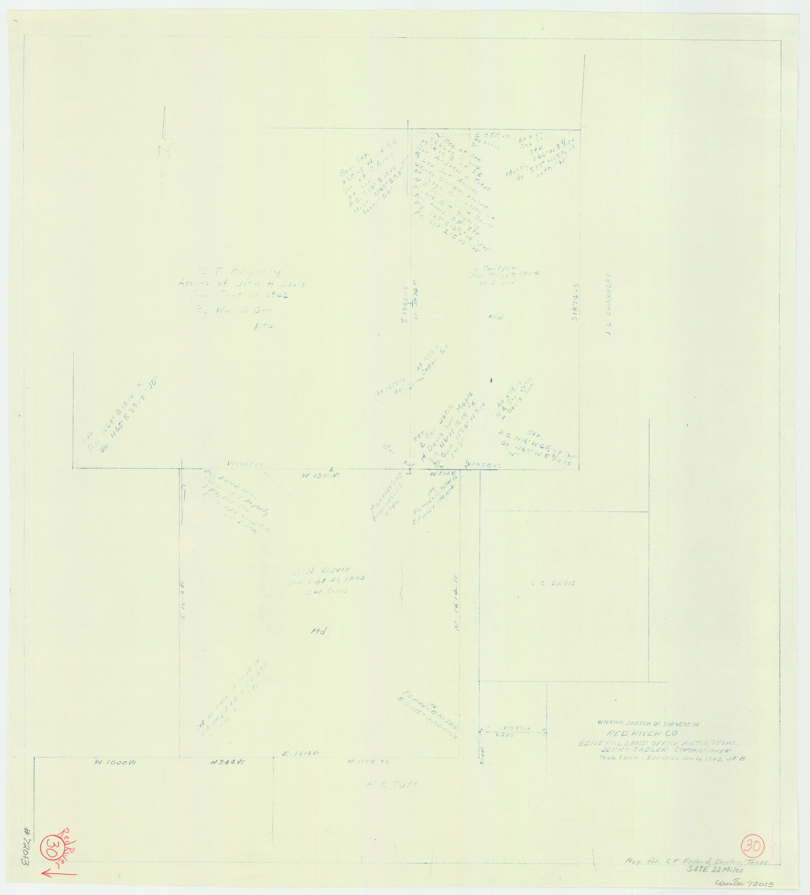
Red River County Working Sketch 30
-
Map/Doc
72013
-
Collection
General Map Collection
-
Object Dates
1/16/1962 (Creation Date)
-
Counties
Red River
-
Subjects
Surveying Working Sketch
-
Height x Width
25.2 x 22.8 inches
64.0 x 57.9 cm
-
Scale
1" = 200 varas
Part of: General Map Collection
Real County Rolled Sketch 18

Print $20.00
- Digital $50.00
Real County Rolled Sketch 18
Size 22.0 x 28.0 inches
Map/Doc 7463
Dallas County Working Sketch 18

Print $20.00
- Digital $50.00
Dallas County Working Sketch 18
1989
Size 39.9 x 37.4 inches
Map/Doc 68584
Tourist Map of San Antonio showing points of interest, places of amusements, main thoroughfares and highways in and out of city and where they go

Print $20.00
- Digital $50.00
Tourist Map of San Antonio showing points of interest, places of amusements, main thoroughfares and highways in and out of city and where they go
Size 22.2 x 15.3 inches
Map/Doc 95956
[Surveys near the Sabine River in the Jasper District]
![323, [Surveys near the Sabine River in the Jasper District], General Map Collection](https://historictexasmaps.com/wmedia_w700/maps/323.tif.jpg)
Print $20.00
- Digital $50.00
[Surveys near the Sabine River in the Jasper District]
1847
Size 18.1 x 10.4 inches
Map/Doc 323
Map of Navarro County

Print $20.00
- Digital $50.00
Map of Navarro County
1858
Size 19.3 x 25.8 inches
Map/Doc 3912
Current Miscellaneous File 50

Print $30.00
- Digital $50.00
Current Miscellaneous File 50
Size 11.9 x 9.2 inches
Map/Doc 74014
Frio County Sketch File 19

Print $20.00
- Digital $50.00
Frio County Sketch File 19
1963
Size 14.7 x 30.6 inches
Map/Doc 11519
Midland County Rolled Sketch 2

Print $20.00
- Digital $50.00
Midland County Rolled Sketch 2
1949
Size 39.3 x 36.5 inches
Map/Doc 9513
Presidio County Sketch File F

Print $2.00
- Digital $50.00
Presidio County Sketch File F
Size 15.5 x 8.2 inches
Map/Doc 34428
Coleman County

Print $20.00
- Digital $50.00
Coleman County
1858
Size 25.2 x 22.5 inches
Map/Doc 3409
Flight Mission No. BRE-1P, Frame 153, Nueces County

Print $20.00
- Digital $50.00
Flight Mission No. BRE-1P, Frame 153, Nueces County
1956
Size 18.5 x 22.5 inches
Map/Doc 86714
Map of Polk County

Print $20.00
- Digital $50.00
Map of Polk County
1863
Size 21.4 x 28.5 inches
Map/Doc 3960
You may also like
General Highway Map. Detail of Cities and Towns in McLennan County, Texas

Print $20.00
General Highway Map. Detail of Cities and Towns in McLennan County, Texas
1961
Size 18.2 x 24.6 inches
Map/Doc 79591
Sterling County Sketch File 8

Print $20.00
- Digital $50.00
Sterling County Sketch File 8
1916
Size 27.2 x 25.2 inches
Map/Doc 12357
Glasscock County Sketch File 23

Print $10.00
- Digital $50.00
Glasscock County Sketch File 23
1948
Size 11.4 x 8.8 inches
Map/Doc 24199
Flight Mission No. BRA-16M, Frame 168, Jefferson County

Print $20.00
- Digital $50.00
Flight Mission No. BRA-16M, Frame 168, Jefferson County
1953
Size 18.7 x 22.5 inches
Map/Doc 85766
Aransas County Working Sketch 16

Print $40.00
- Digital $50.00
Aransas County Working Sketch 16
1965
Size 55.3 x 43.1 inches
Map/Doc 67183
Jackson County Working Sketch 2

Print $20.00
- Digital $50.00
Jackson County Working Sketch 2
1937
Size 41.5 x 38.0 inches
Map/Doc 66450
Flight Mission No. DQN-2K, Frame 196, Calhoun County

Print $20.00
- Digital $50.00
Flight Mission No. DQN-2K, Frame 196, Calhoun County
1953
Size 16.3 x 16.1 inches
Map/Doc 84335

El Paso County Working Sketch 42

Print $20.00
- Digital $50.00
El Paso County Working Sketch 42
Size 24.6 x 26.6 inches
Map/Doc 69064
Trinity County Sketch File 14

Print $4.00
- Digital $50.00
Trinity County Sketch File 14
1862
Size 8.7 x 12.0 inches
Map/Doc 38540
Flight Mission No. CRC-3R, Frame 100, Chambers County

Print $20.00
- Digital $50.00
Flight Mission No. CRC-3R, Frame 100, Chambers County
1956
Size 18.6 x 22.3 inches
Map/Doc 84838
Edwards County Sketch File 51

Print $32.00
- Digital $50.00
Edwards County Sketch File 51
1965
Size 11.6 x 9.0 inches
Map/Doc 21800