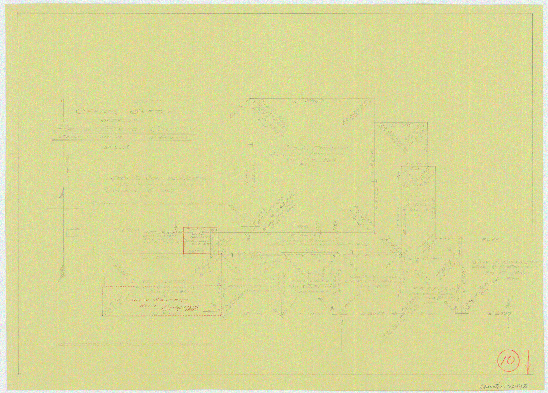
Palo Pinto County Working Sketch 10
-
Map/Doc
71393
-
Collection
General Map Collection
-
People and Organizations
William Shirriffs (Draftsman)
-
Counties
Palo Pinto
-
Subjects
Surveying Working Sketch
-
Height x Width
12.5 x 17.4 inches
31.8 x 44.2 cm
-
Scale
1" = 1000 varas
Part of: General Map Collection
Coast of Texas and its defences

Print $20.00
- Digital $50.00
Coast of Texas and its defences
Size 27.6 x 18.2 inches
Map/Doc 72685
[Surveys in Austin's Colony along the Brazos River and Oyster Creek]
![206, [Surveys in Austin's Colony along the Brazos River and Oyster Creek], General Map Collection](https://historictexasmaps.com/wmedia_w700/maps/206.tif.jpg)
Print $20.00
- Digital $50.00
[Surveys in Austin's Colony along the Brazos River and Oyster Creek]
1824
Size 23.1 x 17.2 inches
Map/Doc 206
Hudspeth County Rolled Sketch 73

Print $40.00
- Digital $50.00
Hudspeth County Rolled Sketch 73
1992
Size 38.9 x 49.3 inches
Map/Doc 9236
New Map of Greater San Antonio

Print $20.00
- Digital $50.00
New Map of Greater San Antonio
1941
Size 24.5 x 19.7 inches
Map/Doc 95954
Wichita County Rolled Sketch 16

Print $20.00
- Digital $50.00
Wichita County Rolled Sketch 16
1940
Size 36.5 x 35.0 inches
Map/Doc 10658
Jeff Davis County Sketch File 36

Print $40.00
- Digital $50.00
Jeff Davis County Sketch File 36
1951
Size 17.1 x 14.3 inches
Map/Doc 28048
Louisiana and Texas Intracoastal Waterway, Section 7, Galveston Bay to Brazos River and Section 8, Brazos River to Matagorda Bay

Print $20.00
- Digital $50.00
Louisiana and Texas Intracoastal Waterway, Section 7, Galveston Bay to Brazos River and Section 8, Brazos River to Matagorda Bay
1929
Size 30.8 x 43.0 inches
Map/Doc 61841
Montgomery County Rolled Sketch 10A
Print $20.00
- Digital $50.00
Montgomery County Rolled Sketch 10A
Size 12.1 x 18.1 inches
Map/Doc 6800
Webb County Working Sketch 41

Print $20.00
- Digital $50.00
Webb County Working Sketch 41
1941
Size 15.7 x 18.8 inches
Map/Doc 72406
Loving County Working Sketch 11

Print $40.00
- Digital $50.00
Loving County Working Sketch 11
1957
Size 21.6 x 50.9 inches
Map/Doc 70644
[Drawings of individual counties for Pressler and Langermann's 1879 Map of Texas]
![[Drawings of individual counties for Pressler and Langermann's 1879 Map of Texas]](https://historictexasmaps.com/wmedia_w700/maps/4864.tif.jpg)
Print $20.00
- Digital $50.00
[Drawings of individual counties for Pressler and Langermann's 1879 Map of Texas]
1878
Size 38.3 x 26.8 inches
Map/Doc 4864
Red River County Working Sketch 64

Print $20.00
- Digital $50.00
Red River County Working Sketch 64
1973
Size 26.1 x 32.3 inches
Map/Doc 72047
You may also like
Baylor County Sketch File A6

Print $80.00
- Digital $50.00
Baylor County Sketch File A6
1899
Size 22.5 x 31.7 inches
Map/Doc 10912
Bee County Boundary File 7

Print $8.00
- Digital $50.00
Bee County Boundary File 7
Size 12.7 x 8.1 inches
Map/Doc 50460
Coke County Rolled Sketch 14A

Print $20.00
- Digital $50.00
Coke County Rolled Sketch 14A
Size 21.0 x 14.1 inches
Map/Doc 5515

Kendall County Working Sketch 10

Print $20.00
- Digital $50.00
Kendall County Working Sketch 10
1954
Size 21.2 x 24.9 inches
Map/Doc 66682
Jeff Davis County Rolled Sketch 5

Print $40.00
- Digital $50.00
Jeff Davis County Rolled Sketch 5
Size 34.7 x 48.6 inches
Map/Doc 9262
Kimble County Sketch File 11

Print $40.00
- Digital $50.00
Kimble County Sketch File 11
1882
Size 20.5 x 10.2 inches
Map/Doc 28933
Crockett County Working Sketch 101

Print $20.00
- Digital $50.00
Crockett County Working Sketch 101
Size 16.3 x 20.3 inches
Map/Doc 67436
Williamson County

Print $40.00
- Digital $50.00
Williamson County
1946
Size 39.0 x 56.3 inches
Map/Doc 73326
Terrell County Sketch File 25

Print $4.00
- Digital $50.00
Terrell County Sketch File 25
1935
Size 13.5 x 8.1 inches
Map/Doc 37959
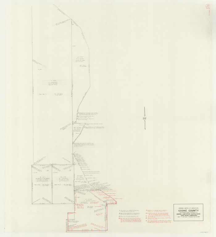
Cooke County Working Sketch 34
Print $20.00
- Digital $50.00
Cooke County Working Sketch 34
1984
Size 41.7 x 38.0 inches
Map/Doc 68271
Flight Mission No. BRE-2P, Frame 67, Nueces County

Print $20.00
- Digital $50.00
Flight Mission No. BRE-2P, Frame 67, Nueces County
1956
Size 18.5 x 22.3 inches
Map/Doc 86762