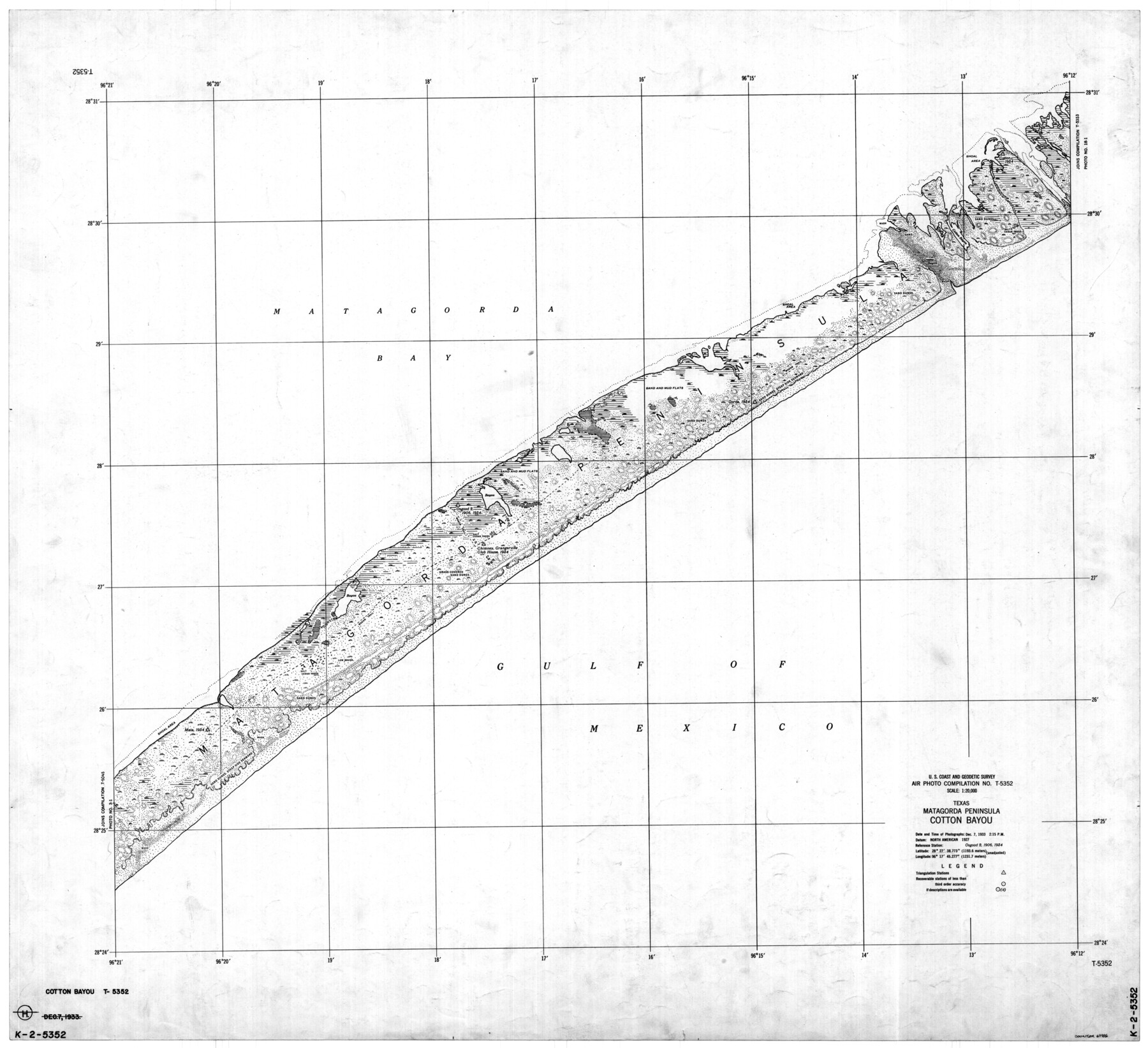
Texas, Matagorda Peninsula, Cotton Bayou
K-2-5352
-
Map/Doc
69986
-
Collection
General Map Collection
-
Counties
Matagorda
-
Subjects
Nautical Charts
-
Height x Width
31.5 x 34.6 inches
80.0 x 87.9 cm
Part of: General Map Collection
Flight Mission No. DIX-7P, Frame 84, Aransas County

Print $20.00
- Digital $50.00
Flight Mission No. DIX-7P, Frame 84, Aransas County
1956
Size 18.8 x 22.8 inches
Map/Doc 83878
Flight Mission No. BRA-16M, Frame 59, Jefferson County

Print $20.00
- Digital $50.00
Flight Mission No. BRA-16M, Frame 59, Jefferson County
1953
Size 18.3 x 22.5 inches
Map/Doc 85676
Reeves County

Print $20.00
- Digital $50.00
Reeves County
1915
Size 46.5 x 35.7 inches
Map/Doc 16797

Terrell County Working Sketch 77

Print $20.00
- Digital $50.00
Terrell County Working Sketch 77
1983
Size 22.9 x 33.7 inches
Map/Doc 69598
Duval County Rolled Sketch 49
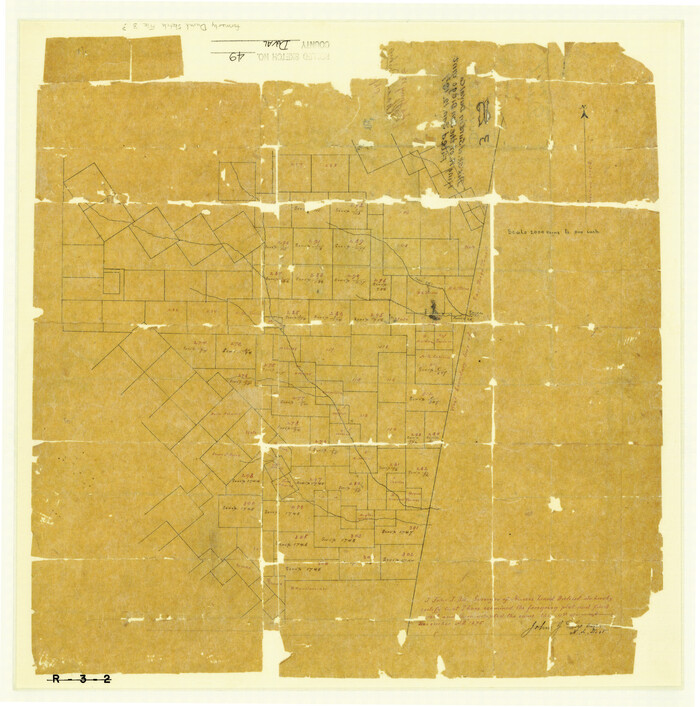
Print $20.00
- Digital $50.00
Duval County Rolled Sketch 49
1875
Size 17.8 x 17.6 inches
Map/Doc 5763
Haskell County Rolled Sketch 16

Print $20.00
- Digital $50.00
Haskell County Rolled Sketch 16
1991
Size 45.3 x 39.4 inches
Map/Doc 9148
Val Verde County Working Sketch 104

Print $20.00
- Digital $50.00
Val Verde County Working Sketch 104
1982
Size 26.4 x 19.0 inches
Map/Doc 72239
Aransas County Rolled Sketch 7A

Print $20.00
- Digital $50.00
Aransas County Rolled Sketch 7A
1954
Size 30.5 x 37.6 inches
Map/Doc 76009
Kimble County Rolled Sketch 44

Print $20.00
- Digital $50.00
Kimble County Rolled Sketch 44
Size 35.9 x 24.2 inches
Map/Doc 96810
Hardin County Working Sketch 25

Print $20.00
- Digital $50.00
Hardin County Working Sketch 25
1950
Size 10.8 x 20.1 inches
Map/Doc 63423
[Jack District]
![1992, [Jack District], General Map Collection](https://historictexasmaps.com/wmedia_w700/maps/1992.tif.jpg)
Print $40.00
- Digital $50.00
[Jack District]
1880
Size 52.7 x 43.4 inches
Map/Doc 1992
You may also like
Stephens County Working Sketch 28

Print $20.00
- Digital $50.00
Stephens County Working Sketch 28
1976
Size 38.4 x 31.8 inches
Map/Doc 63971
Marion County Working Sketch 33

Print $20.00
- Digital $50.00
Marion County Working Sketch 33
1983
Size 16.0 x 20.7 inches
Map/Doc 70809
Throckmorton County Sketch File 11

Print $30.00
- Digital $50.00
Throckmorton County Sketch File 11
1884
Size 8.9 x 11.6 inches
Map/Doc 38105
Burleson County Working Sketch 3

Print $20.00
- Digital $50.00
Burleson County Working Sketch 3
1979
Size 26.5 x 22.5 inches
Map/Doc 67722
Mason County Working Sketch 19

Print $20.00
- Digital $50.00
Mason County Working Sketch 19
1981
Size 27.0 x 37.1 inches
Map/Doc 70855
Trinity County

Print $20.00
- Digital $50.00
Trinity County
1857
Size 19.2 x 30.8 inches
Map/Doc 4094
Map of Brett Ranch situated in McMullen & La Salle Counties

Print $20.00
- Digital $50.00
Map of Brett Ranch situated in McMullen & La Salle Counties
Size 20.0 x 22.3 inches
Map/Doc 5068
San Jacinto County Working Sketch 3

Print $20.00
- Digital $50.00
San Jacinto County Working Sketch 3
1926
Size 16.7 x 19.7 inches
Map/Doc 63716
G No. 2 - Reconnaissance of Channel No. IV Cedar-Keys, Florida

Print $20.00
- Digital $50.00
G No. 2 - Reconnaissance of Channel No. IV Cedar-Keys, Florida
1852
Size 10.8 x 12.6 inches
Map/Doc 97220
Irion County Sketch File 10

Print $20.00
- Digital $50.00
Irion County Sketch File 10
1936
Size 16.7 x 30.5 inches
Map/Doc 11825
Map of Clay County

Print $20.00
- Digital $50.00
Map of Clay County
1883
Size 26.0 x 23.3 inches
Map/Doc 3396
Flight Mission No. CGI-3N, Frame 158, Cameron County

Print $20.00
- Digital $50.00
Flight Mission No. CGI-3N, Frame 158, Cameron County
1954
Size 18.5 x 22.4 inches
Map/Doc 84622