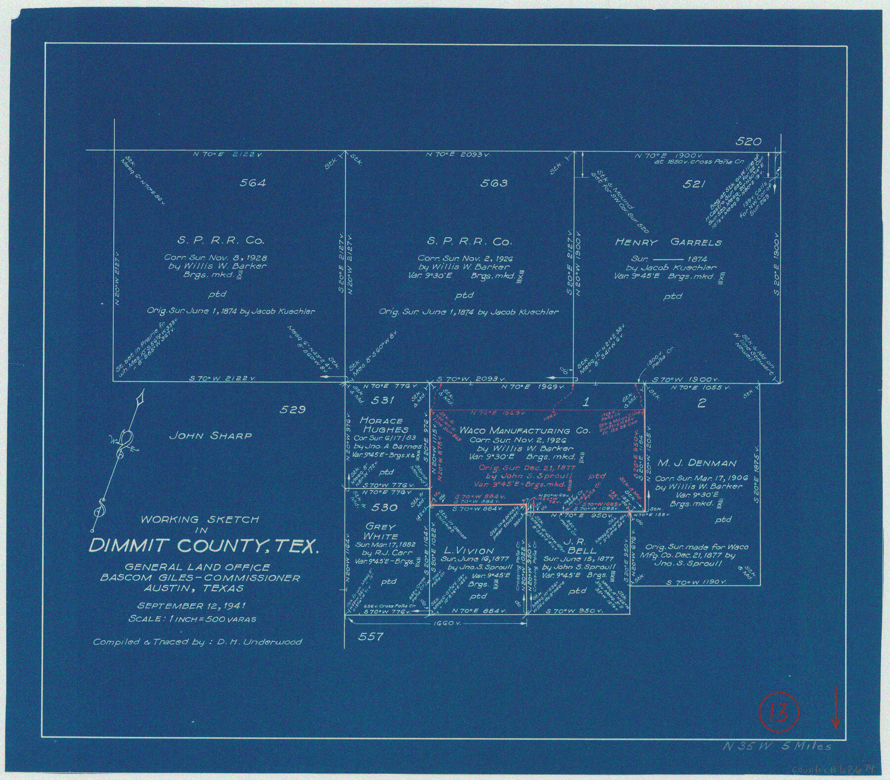
Dimmit County Working Sketch 13
-
Map/Doc
68674
-
Collection
General Map Collection
-
Object Dates
9/12/1941 (Creation Date)
-
People and Organizations
D.H. Underwood (Draftsman)
-
Counties
Dimmit
-
Subjects
Surveying Working Sketch
-
Height x Width
14.3 x 16.3 inches
36.3 x 41.4 cm
-
Scale
1" = 500 varas
Part of: General Map Collection

Map of the Fort Worth and Denver City Railway, through Wilbarger County Texas, 1882

Print $40.00
- Digital $50.00
Map of the Fort Worth and Denver City Railway, through Wilbarger County Texas, 1882
Size 22.9 x 121.1 inches
Map/Doc 64426
Station Map, the Missouri, Kansas and Texas Ry. Of Texas - Henrietta Division

Print $20.00
- Digital $50.00
Station Map, the Missouri, Kansas and Texas Ry. Of Texas - Henrietta Division
1918
Size 11.9 x 26.9 inches
Map/Doc 64765
Hale County Boundary File 3

Print $40.00
- Digital $50.00
Hale County Boundary File 3
Size 31.4 x 41.5 inches
Map/Doc 54046
McMullen County Sketch File 4

Print $4.00
- Digital $50.00
McMullen County Sketch File 4
Size 7.9 x 10.1 inches
Map/Doc 31341
Cram's Superior Map of Illinois

Print $40.00
- Digital $50.00
Cram's Superior Map of Illinois
1903
Size 50.2 x 40.5 inches
Map/Doc 97110
Flight Mission No. BRA-8M, Frame 129, Jefferson County

Print $20.00
- Digital $50.00
Flight Mission No. BRA-8M, Frame 129, Jefferson County
1953
Size 16.0 x 16.0 inches
Map/Doc 85625
Castro County Working Sketch 4

Print $20.00
- Digital $50.00
Castro County Working Sketch 4
1920
Size 17.0 x 16.2 inches
Map/Doc 67899
Wise County Sketch File 27

Print $4.00
- Digital $50.00
Wise County Sketch File 27
1857
Size 12.4 x 8.2 inches
Map/Doc 40576
Amistad International Reservoir on Rio Grande 92

Print $20.00
- Digital $50.00
Amistad International Reservoir on Rio Grande 92
1950
Size 28.5 x 40.6 inches
Map/Doc 75522
Denton County Working Sketch 2

Print $20.00
- Digital $50.00
Denton County Working Sketch 2
Size 21.2 x 17.7 inches
Map/Doc 68607
Montgomery County Rolled Sketch 32

Print $40.00
- Digital $50.00
Montgomery County Rolled Sketch 32
1949
Size 59.9 x 40.4 inches
Map/Doc 9540
You may also like
Harrison County Working Sketch 28

Print $20.00
- Digital $50.00
Harrison County Working Sketch 28
1992
Size 17.0 x 17.0 inches
Map/Doc 66048
Flight Mission No. BRA-16M, Frame 88, Jefferson County

Print $20.00
- Digital $50.00
Flight Mission No. BRA-16M, Frame 88, Jefferson County
1953
Size 18.5 x 22.3 inches
Map/Doc 85700
Maps of Gulf Intracoastal Waterway, Texas - Sabine River to the Rio Grande and connecting waterways including ship channels

Print $20.00
- Digital $50.00
Maps of Gulf Intracoastal Waterway, Texas - Sabine River to the Rio Grande and connecting waterways including ship channels
1966
Size 14.6 x 22.3 inches
Map/Doc 61930
Flight Mission No. DCL-7C, Frame 72, Kenedy County

Print $20.00
- Digital $50.00
Flight Mission No. DCL-7C, Frame 72, Kenedy County
1943
Size 15.4 x 15.1 inches
Map/Doc 86058
Val Verde County Working Sketch 73

Print $20.00
- Digital $50.00
Val Verde County Working Sketch 73
1970
Size 37.6 x 34.5 inches
Map/Doc 72208
Crane County Sketch File 11

Print $40.00
- Digital $50.00
Crane County Sketch File 11
Size 18.5 x 8.9 inches
Map/Doc 19569
The Republic County of Matagorda. September 17, 1838

Print $20.00
The Republic County of Matagorda. September 17, 1838
2020
Size 21.0 x 21.7 inches
Map/Doc 96217
Ownership Map Upton Co., Texas

Ownership Map Upton Co., Texas
1951
Size 45.6 x 56.9 inches
Map/Doc 89904
Zapata County Rolled Sketch 24

Print $20.00
- Digital $50.00
Zapata County Rolled Sketch 24
Size 38.8 x 28.0 inches
Map/Doc 8318
[PSL Block A7, Sections 1 and 10]
![90831, [PSL Block A7, Sections 1 and 10], Twichell Survey Records](https://historictexasmaps.com/wmedia_w700/maps/90831-2.tif.jpg)
Print $3.00
- Digital $50.00
[PSL Block A7, Sections 1 and 10]
Size 11.9 x 9.3 inches
Map/Doc 90831
Upshur County Sketch File 7

Print $4.00
- Digital $50.00
Upshur County Sketch File 7
1849
Size 8.2 x 10.2 inches
Map/Doc 38744
Moore County Sketch File X

Print $20.00
- Digital $50.00
Moore County Sketch File X
Size 34.3 x 24.6 inches
Map/Doc 42131