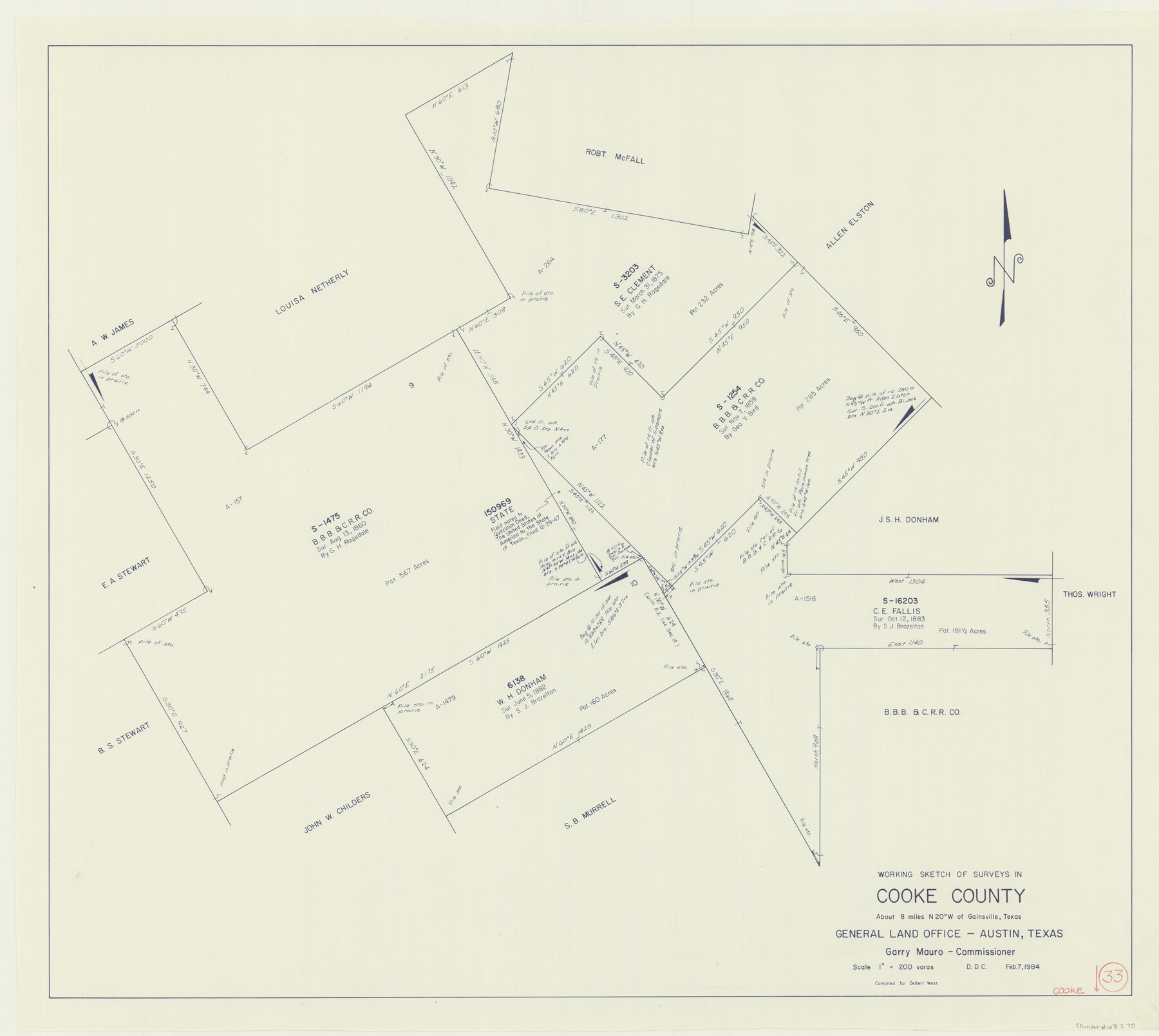
Cooke County Working Sketch 33
-
Map/Doc
68270
-
Collection
General Map Collection
-
Object Dates
2/7/1984 (Creation Date)
-
Counties
Cooke
-
Subjects
Surveying Working Sketch
-
Height x Width
25.6 x 28.6 inches
65.0 x 72.6 cm
-
Scale
1" = 200 varas
Part of: General Map Collection
Bastrop County Working Sketch 3

Print $20.00
- Digital $50.00
Bastrop County Working Sketch 3
1921
Size 22.9 x 15.4 inches
Map/Doc 67303
Kerr County Working Sketch 11

Print $20.00
- Digital $50.00
Kerr County Working Sketch 11
1951
Size 30.3 x 29.9 inches
Map/Doc 70042
Uvalde County Working Sketch 48

Print $20.00
- Digital $50.00
Uvalde County Working Sketch 48
1980
Size 15.6 x 17.9 inches
Map/Doc 72118
Lampasas County Boundary File 16

Print $14.00
- Digital $50.00
Lampasas County Boundary File 16
Size 8.9 x 8.2 inches
Map/Doc 56216

Wise County Sketch File 20

Print $14.00
- Digital $50.00
Wise County Sketch File 20
1860
Size 12.8 x 7.9 inches
Map/Doc 40557
Harris County Sketch File 83

Print $20.00
- Digital $50.00
Harris County Sketch File 83
1898
Size 18.5 x 27.3 inches
Map/Doc 11671
Gregg County Working Sketch 8

Print $20.00
- Digital $50.00
Gregg County Working Sketch 8
1936
Size 26.0 x 23.3 inches
Map/Doc 63274
Coast Chart No. 211 - Padre I. and Laguna Madre Lat. 27° 12' to Lat. 26° 33' Texas

Print $20.00
- Digital $50.00
Coast Chart No. 211 - Padre I. and Laguna Madre Lat. 27° 12' to Lat. 26° 33' Texas
1890
Size 27.5 x 18.3 inches
Map/Doc 72823
Map of Padre Island Showing Location of Zoning Districts

Print $20.00
- Digital $50.00
Map of Padre Island Showing Location of Zoning Districts
1971
Size 26.2 x 18.5 inches
Map/Doc 4811
Travis County Working Sketch 38

Print $20.00
- Digital $50.00
Travis County Working Sketch 38
1974
Size 17.5 x 34.8 inches
Map/Doc 69422
Liberty County Working Sketch 21

Print $20.00
- Digital $50.00
Liberty County Working Sketch 21
1940
Size 20.1 x 15.0 inches
Map/Doc 70480
You may also like
Polk County Sketch File 20

Print $4.00
- Digital $50.00
Polk County Sketch File 20
Size 6.1 x 8.2 inches
Map/Doc 34167
San Jacinto County Rolled Sketch 13

Print $20.00
- Digital $50.00
San Jacinto County Rolled Sketch 13
1994
Size 32.2 x 23.7 inches
Map/Doc 7562
Map of Texas Before Admission to the Union and Adjoining State with Northern Portions of the Mexican States of Coahulia & Chihuahua

Print $20.00
- Digital $50.00
Map of Texas Before Admission to the Union and Adjoining State with Northern Portions of the Mexican States of Coahulia & Chihuahua
1834
Size 18.8 x 21.2 inches
Map/Doc 2107
Travis County Appraisal District Plat Map 2_0801

Print $20.00
- Digital $50.00
Travis County Appraisal District Plat Map 2_0801
Size 21.4 x 26.4 inches
Map/Doc 94237
Falls County Sketch File 32

Print $20.00
- Digital $50.00
Falls County Sketch File 32
Size 36.3 x 24.7 inches
Map/Doc 11468
Coke County Working Sketch 21

Print $20.00
- Digital $50.00
Coke County Working Sketch 21
1949
Size 22.9 x 29.4 inches
Map/Doc 68058
Flight Mission No. BRA-6M, Frame 142, Jefferson County

Print $20.00
- Digital $50.00
Flight Mission No. BRA-6M, Frame 142, Jefferson County
1953
Size 18.6 x 22.3 inches
Map/Doc 85443
Connected Map of Austin's Colony

Print $40.00
- Digital $50.00
Connected Map of Austin's Colony
1837
Size 93.2 x 43.7 inches
Map/Doc 93377
Henderson County Rolled Sketch 11

Print $20.00
- Digital $50.00
Henderson County Rolled Sketch 11
1915
Size 29.7 x 42.5 inches
Map/Doc 75951
Flight Mission No. BRA-8M, Frame 23, Jefferson County

Print $20.00
- Digital $50.00
Flight Mission No. BRA-8M, Frame 23, Jefferson County
1953
Size 18.7 x 22.3 inches
Map/Doc 85578
Tom Green County Rolled Sketch 27

Print $20.00
- Digital $50.00
Tom Green County Rolled Sketch 27
Size 36.1 x 45.4 inches
Map/Doc 10008
Donley County Sketch File 13

Print $8.00
- Digital $50.00
Donley County Sketch File 13
1881
Size 5.8 x 9.0 inches
Map/Doc 21249