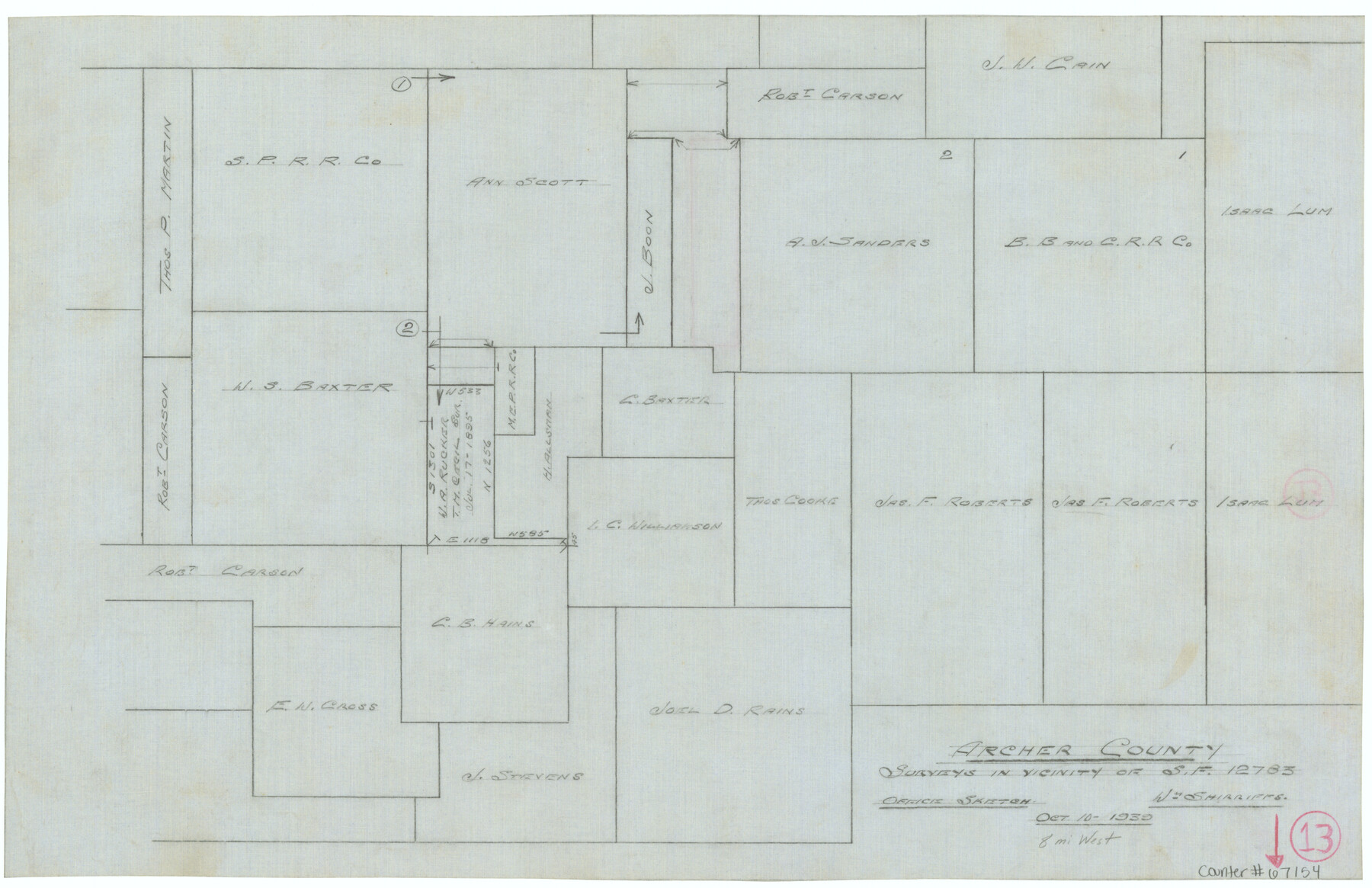
Archer County Working Sketch 13
Office sketch of surveys in vicinity of Scrap File 12783
-
Map/Doc
67154
-
Collection
General Map Collection
-
Object Dates
10/10/1939 (Creation Date)
-
People and Organizations
William Shirriffs (Draftsman)
-
Counties
Archer
-
Subjects
Surveying Working Sketch
-
Height x Width
12.0 x 18.5 inches
30.5 x 47.0 cm
-
Comments
Surveys located about eight miles West of Archer City, Texas.
Part of: General Map Collection
Anderson County Sketch File 2

Print $4.00
- Digital $50.00
Anderson County Sketch File 2
1847
Size 12.6 x 8.2 inches
Map/Doc 12739
Hemphill County Working Sketch 6

Print $20.00
- Digital $50.00
Hemphill County Working Sketch 6
1950
Size 20.3 x 27.0 inches
Map/Doc 66101
Eastland County Working Sketch 62

Print $20.00
- Digital $50.00
Eastland County Working Sketch 62
1989
Size 20.7 x 28.0 inches
Map/Doc 68843
Austin County Sketch File EF

Print $40.00
- Digital $50.00
Austin County Sketch File EF
1895
Size 15.1 x 17.0 inches
Map/Doc 10879
[Surveys along Trinity River]
![7, [Surveys along Trinity River], General Map Collection](https://historictexasmaps.com/wmedia_w700/maps/7.tif.jpg)
Print $20.00
- Digital $50.00
[Surveys along Trinity River]
1844
Size 21.4 x 12.6 inches
Map/Doc 7
Flight Mission No. DIX-5P, Frame 108, Aransas County

Print $20.00
- Digital $50.00
Flight Mission No. DIX-5P, Frame 108, Aransas County
1956
Size 17.2 x 18.1 inches
Map/Doc 83787

Hunt County Working Sketch 2

Print $20.00
- Digital $50.00
Hunt County Working Sketch 2
Size 20.5 x 16.5 inches
Map/Doc 66349
Texas Land Commissioner George P. Bush's Energy Map of Texas Showing Significant Events and Well & Pipeline Locations Between 1543 and 2015

Print $20.00
- Digital $50.00
Texas Land Commissioner George P. Bush's Energy Map of Texas Showing Significant Events and Well & Pipeline Locations Between 1543 and 2015
2015
Size 33.3 x 36.3 inches
Map/Doc 93978
Gaines County Rolled Sketch 9

Print $20.00
- Digital $50.00
Gaines County Rolled Sketch 9
Size 20.9 x 29.8 inches
Map/Doc 5929
Montague County Working Sketch 6

Print $20.00
- Digital $50.00
Montague County Working Sketch 6
1923
Size 16.9 x 27.2 inches
Map/Doc 71072
Edwards County Rolled Sketch 30

Print $20.00
- Digital $50.00
Edwards County Rolled Sketch 30
1980
Size 31.6 x 44.0 inches
Map/Doc 8848
You may also like
Ellis Addition to the City of Lubbock, Being a Subdivision of a Part of the SW/4 of SW/4 Sec. 4, Blk. A

Print $3.00
- Digital $50.00
Ellis Addition to the City of Lubbock, Being a Subdivision of a Part of the SW/4 of SW/4 Sec. 4, Blk. A
1952
Size 9.5 x 12.0 inches
Map/Doc 92710
Brewster County Sketch File A-1

Print $8.00
- Digital $50.00
Brewster County Sketch File A-1
1911
Size 14.2 x 8.7 inches
Map/Doc 15712
Southern Pacific Transportation Company, Right of Way and Track Map, Beeville Branch

Print $40.00
- Digital $50.00
Southern Pacific Transportation Company, Right of Way and Track Map, Beeville Branch
Size 24.1 x 56.1 inches
Map/Doc 76163
Montgomery County Boundary File 3

Print $6.00
- Digital $50.00
Montgomery County Boundary File 3
Size 17.0 x 9.9 inches
Map/Doc 57450
Matagorda County Sketch File 1

Print $4.00
- Digital $50.00
Matagorda County Sketch File 1
1876
Size 13.0 x 8.8 inches
Map/Doc 30728
Kinney County Working Sketch 17

Print $20.00
- Digital $50.00
Kinney County Working Sketch 17
1947
Size 29.4 x 38.7 inches
Map/Doc 70199
Angelina County Working Sketch 52

Print $20.00
- Digital $50.00
Angelina County Working Sketch 52
1978
Size 20.8 x 20.3 inches
Map/Doc 67136
Zavala County Rolled Sketch 24

Print $20.00
- Digital $50.00
Zavala County Rolled Sketch 24
1945
Size 21.7 x 18.2 inches
Map/Doc 8327
Runnels County Rolled Sketch 46

Print $20.00
- Digital $50.00
Runnels County Rolled Sketch 46
1954
Size 32.3 x 38.5 inches
Map/Doc 10622

Mason County Rolled Sketch 7

Print $20.00
- Digital $50.00
Mason County Rolled Sketch 7
1986
Size 24.3 x 20.3 inches
Map/Doc 6679
Flight Mission No. CGI-4N, Frame 161, Cameron County

Print $20.00
- Digital $50.00
Flight Mission No. CGI-4N, Frame 161, Cameron County
1955
Size 18.7 x 22.4 inches
Map/Doc 84669