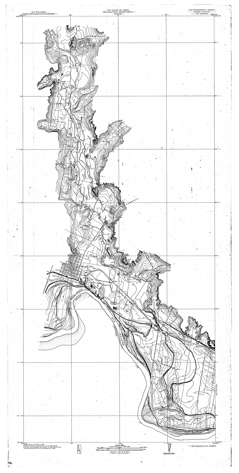
Rio Grande - Rio Grande Sheet
-
Map/Doc
65105
-
Collection
General Map Collection
-
Object Dates
1929 (Creation Date)
-
People and Organizations
Texas State Reclamation Department (Publisher)
H.U. von Rosenberg (Draftsman)
H.U. von Rosenberg (Compiler)
C.R. Hale (Surveyor/Engineer)
E.J. von Rosenberg (Surveyor/Engineer)
-
Counties
Starr
-
Subjects
City River Surveys Topographic
-
Height x Width
53.9 x 27.3 inches
136.9 x 69.3 cm
-
Comments
Rio Grande City Sheet located west of the La Puerta Sheet.
Part of: General Map Collection
Hudspeth County Rolled Sketch 53

Print $77.00
- Digital $50.00
Hudspeth County Rolled Sketch 53
1977
Size 9.9 x 15.1 inches
Map/Doc 45849
Flight Mission No. CGN-3P, Frame 140, San Patricio County

Print $20.00
- Digital $50.00
Flight Mission No. CGN-3P, Frame 140, San Patricio County
1956
Size 18.5 x 22.3 inches
Map/Doc 86984
[Surveys along the Frio River]
![129, [Surveys along the Frio River], General Map Collection](https://historictexasmaps.com/wmedia_w700/maps/129.tif.jpg)
Print $20.00
- Digital $50.00
[Surveys along the Frio River]
1841
Size 12.0 x 16.6 inches
Map/Doc 129
Lampasas County Boundary File 15

Print $14.00
- Digital $50.00
Lampasas County Boundary File 15
Size 8.8 x 6.6 inches
Map/Doc 56203

Throckmorton County Boundary File 3

Print $40.00
- Digital $50.00
Throckmorton County Boundary File 3
Size 18.9 x 17.9 inches
Map/Doc 59281
Outer Continental Shelf Leasing Maps (Louisiana Offshore Operations)

Print $20.00
- Digital $50.00
Outer Continental Shelf Leasing Maps (Louisiana Offshore Operations)
1955
Size 15.9 x 10.8 inches
Map/Doc 76082
Childress County Sketch File 7

Print $20.00
- Digital $50.00
Childress County Sketch File 7
Size 14.9 x 17.6 inches
Map/Doc 11079
[Surveys between the Caddo River and south fork of the Sabine River]
![280, [Surveys between the Caddo River and south fork of the Sabine River], General Map Collection](https://historictexasmaps.com/wmedia_w700/maps/280.tif.jpg)
Print $2.00
- Digital $50.00
[Surveys between the Caddo River and south fork of the Sabine River]
Size 7.8 x 6.5 inches
Map/Doc 280
Lampasas County Boundary File 3a

Print $8.00
- Digital $50.00
Lampasas County Boundary File 3a
Size 13.2 x 8.2 inches
Map/Doc 56106

Stephens County Working Sketch 17

Print $20.00
- Digital $50.00
Stephens County Working Sketch 17
1968
Size 22.7 x 29.1 inches
Map/Doc 63960
You may also like
Pecos County Rolled Sketch 53

Print $20.00
- Digital $50.00
Pecos County Rolled Sketch 53
1915
Size 26.2 x 38.5 inches
Map/Doc 7228

The Judicial District/County of Panola. June 24, 1841

Print $20.00
The Judicial District/County of Panola. June 24, 1841
2020
Size 19.3 x 21.7 inches
Map/Doc 96341
Presidio County Rolled Sketch 74

Print $20.00
- Digital $50.00
Presidio County Rolled Sketch 74
Size 20.5 x 14.0 inches
Map/Doc 7362
Working Sketch No. II in Pecos County

Print $20.00
- Digital $50.00
Working Sketch No. II in Pecos County
1886
Size 31.3 x 24.1 inches
Map/Doc 3953
Swisher County

Print $20.00
- Digital $50.00
Swisher County
1900
Size 45.5 x 39.0 inches
Map/Doc 63053
Gonzales County Working Sketch 7

Print $20.00
- Digital $50.00
Gonzales County Working Sketch 7
1981
Size 19.1 x 17.0 inches
Map/Doc 63223
Bandera County Sketch File 30A

Print $40.00
- Digital $50.00
Bandera County Sketch File 30A
Size 18.7 x 17.0 inches
Map/Doc 10899
Caldwell County Working Sketch 10

Print $40.00
- Digital $50.00
Caldwell County Working Sketch 10
1977
Size 46.2 x 50.5 inches
Map/Doc 67840
PSL Field Notes for Blocks C1, C2, and C3 in Pecos and Reeves Counties and Blocks C4 through C10 in Reeves County

PSL Field Notes for Blocks C1, C2, and C3 in Pecos and Reeves Counties and Blocks C4 through C10 in Reeves County
Map/Doc 81671
Stonewall County

Print $20.00
- Digital $50.00
Stonewall County
1879
Size 22.7 x 19.1 inches
Map/Doc 4058
Wichita County

Print $20.00
- Digital $50.00
Wichita County
1892
Size 20.2 x 24.3 inches
Map/Doc 75804