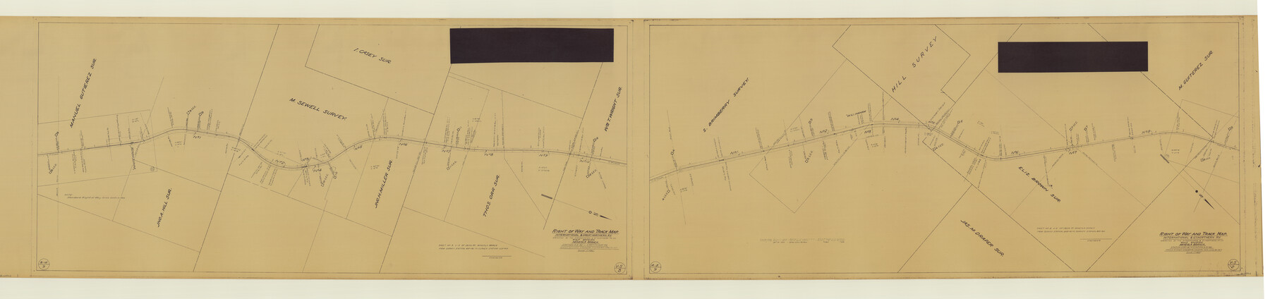
Right of Way and Track Map, International & Gt. Northern Ry. operated by the International & Gt. Northern Ry. Co. Gulf Division, Mineola Branch
Station 413+82 to Station 623+48 and Station 203+18 to Station 413+82
Z-2-198
-
Map/Doc
64704
-
Collection
General Map Collection
-
Object Dates
1917/6/30 (Creation Date)
-
People and Organizations
Office of Chief Engineer (Publisher)
-
Counties
Smith
-
Subjects
Railroads
-
Height x Width
27.8 x 118.1 inches
70.6 x 300.0 cm
-
Medium
blueprint/diazo
-
Scale
1" = 400'
-
Comments
Segment 5; see 64700 through 64703 and 64705 for other segments.
-
Features
I&GN
Whitehouse
Willingham
Part of: General Map Collection
Baylor County Sketch File 12g

Print $50.00
- Digital $50.00
Baylor County Sketch File 12g
Size 11.4 x 8.9 inches
Map/Doc 14170
J. De Cordova's Map of the State of Texas Compiled from the records of the General Land Office of the State

Print $20.00
- Digital $50.00
J. De Cordova's Map of the State of Texas Compiled from the records of the General Land Office of the State
1849
Size 34.0 x 31.5 inches
Map/Doc 656
Karte des Staates, Texas

Print $20.00
- Digital $50.00
Karte des Staates, Texas
1851
Size 25.5 x 30.8 inches
Map/Doc 2123
Val Verde County Working Sketch 65

Print $20.00
- Digital $50.00
Val Verde County Working Sketch 65
1960
Size 30.9 x 31.8 inches
Map/Doc 72200
Upton County Working Sketch 39

Print $20.00
- Digital $50.00
Upton County Working Sketch 39
1958
Size 25.4 x 30.1 inches
Map/Doc 69535
Plan of the Battle of Buena-Vista fought February 22nd and 23rd, 1847

Print $20.00
- Digital $50.00
Plan of the Battle of Buena-Vista fought February 22nd and 23rd, 1847
1847
Size 17.8 x 21.5 inches
Map/Doc 94112
Flight Mission No. DQN-1K, Frame 67, Calhoun County

Print $20.00
- Digital $50.00
Flight Mission No. DQN-1K, Frame 67, Calhoun County
1953
Size 18.3 x 22.1 inches
Map/Doc 84154
Webb County Sketch File 71

Print $44.00
- Digital $50.00
Webb County Sketch File 71
Size 14.4 x 7.6 inches
Map/Doc 39888
Treaty to Resolve Pending Boundary Differences and Maintain the Rio Grande and Colorado River as the International Boundary Between the United States of American and Mexico

Print $20.00
- Digital $50.00
Treaty to Resolve Pending Boundary Differences and Maintain the Rio Grande and Colorado River as the International Boundary Between the United States of American and Mexico
1970
Size 10.9 x 35.6 inches
Map/Doc 83104
La Salle County Working Sketch 38

Print $20.00
- Digital $50.00
La Salle County Working Sketch 38
1961
Size 26.6 x 18.4 inches
Map/Doc 70339

Burleson County Working Sketch 32

Print $20.00
- Digital $50.00
Burleson County Working Sketch 32
1981
Size 26.3 x 13.5 inches
Map/Doc 67751
You may also like
[Movements & Objectives of the 143rd & 144th Infantry and many other divisions and regiments, 1918]
![94138, [Movements & Objectives of the 143rd & 144th Infantry and many other divisions and regiments, 1918], Non-GLO Digital Images](https://historictexasmaps.com/wmedia_w700/maps/94138-1.tif.jpg)
Print $40.00
[Movements & Objectives of the 143rd & 144th Infantry and many other divisions and regiments, 1918]
1918
Size 64.2 x 37.5 inches
Map/Doc 94138
Newton County Working Sketch 14

Print $20.00
- Digital $50.00
Newton County Working Sketch 14
1947
Size 22.3 x 21.9 inches
Map/Doc 71260
Robertson County Working Sketch 12

Print $20.00
- Digital $50.00
Robertson County Working Sketch 12
1984
Size 20.6 x 22.4 inches
Map/Doc 63585
Map of Martin County, Texas

Print $20.00
- Digital $50.00
Map of Martin County, Texas
Size 17.7 x 22.6 inches
Map/Doc 91362
Cameron County Rolled Sketch 19

Print $20.00
- Digital $50.00
Cameron County Rolled Sketch 19
Size 27.1 x 24.3 inches
Map/Doc 5388
Ed Gordon Irrigated Farm NE Quarter Section 14, Block E

Print $20.00
- Digital $50.00
Ed Gordon Irrigated Farm NE Quarter Section 14, Block E
1943
Size 16.0 x 18.6 inches
Map/Doc 92325
Val Verde County Working Sketch 121

Print $40.00
- Digital $50.00
Val Verde County Working Sketch 121
2005
Size 34.0 x 54.2 inches
Map/Doc 83590
Flight Mission No. DQO-11K, Frame 20, Galveston County

Print $20.00
- Digital $50.00
Flight Mission No. DQO-11K, Frame 20, Galveston County
1952
Size 18.8 x 22.4 inches
Map/Doc 85215
Tom Green County Rolled Sketch 26

Print $40.00
- Digital $50.00
Tom Green County Rolled Sketch 26
Size 40.0 x 48.3 inches
Map/Doc 10007
Flight Mission No. DAG-21K, Frame 82, Matagorda County

Print $20.00
- Digital $50.00
Flight Mission No. DAG-21K, Frame 82, Matagorda County
1952
Size 18.5 x 22.3 inches
Map/Doc 86411
San Saba County Sketch File 11

Print $8.00
- Digital $50.00
San Saba County Sketch File 11
1882
Size 12.4 x 8.3 inches
Map/Doc 36435
Jeff Davis County Rolled Sketch 8

Print $20.00
- Digital $50.00
Jeff Davis County Rolled Sketch 8
Size 40.0 x 41.6 inches
Map/Doc 9264