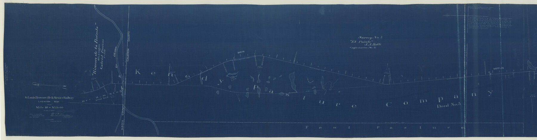
St. Louis, Brownsville & Mexico Railway Location map from Mile 40 to Mile 60
Z-2-21
-
Map/Doc
64079
-
Collection
General Map Collection
-
Object Dates
1905/12/18 (Creation Date)
-
People and Organizations
W. O. Homan (Surveyor/Engineer)
J. F. Hinckley (Surveyor/Engineer)
-
Counties
Cameron Nueces
-
Subjects
Railroads
-
Height x Width
19.6 x 74.9 inches
49.8 x 190.2 cm
-
Medium
blueprint/diazo
-
Scale
1" = 1000 feet
-
Comments
Segment 1. See counter no. 64076 for segment 2.
See counter 89280 for digital composite.
See counter nos. 64077 through 64080 for other related sheets and counters 89281 and 89282 for related digital composites. -
Features
SLB&M
Mifflin
Sarita
Arroyo de los Olmos
Part of: General Map Collection
Ward County Rolled Sketch 27

Print $20.00
- Digital $50.00
Ward County Rolled Sketch 27
1982
Size 22.7 x 16.5 inches
Map/Doc 8166
Jefferson County Sketch File 50

Print $5.00
- Digital $50.00
Jefferson County Sketch File 50
1841
Size 8.2 x 9.7 inches
Map/Doc 28247
Webb County Sketch File 12-2

Print $20.00
- Digital $50.00
Webb County Sketch File 12-2
1936
Size 24.5 x 20.1 inches
Map/Doc 12630
Hutchinson County

Print $20.00
- Digital $50.00
Hutchinson County
1922
Size 40.7 x 34.8 inches
Map/Doc 77321
Matagorda County Boundary File 1

Print $10.00
- Digital $50.00
Matagorda County Boundary File 1
Size 14.1 x 8.6 inches
Map/Doc 56884
Harris County Working Sketch 102

Print $20.00
- Digital $50.00
Harris County Working Sketch 102
1980
Size 33.6 x 18.9 inches
Map/Doc 65994
Flight Mission No. DQN-5K, Frame 48, Calhoun County

Print $20.00
- Digital $50.00
Flight Mission No. DQN-5K, Frame 48, Calhoun County
1953
Size 18.7 x 22.2 inches
Map/Doc 84393
Flight Mission No. DQN-2K, Frame 68, Calhoun County

Print $20.00
- Digital $50.00
Flight Mission No. DQN-2K, Frame 68, Calhoun County
1953
Size 18.6 x 22.2 inches
Map/Doc 84260
Flight Mission No. DAG-26K, Frame 61, Matagorda County

Print $20.00
- Digital $50.00
Flight Mission No. DAG-26K, Frame 61, Matagorda County
1953
Size 18.7 x 22.6 inches
Map/Doc 86581
Liberty County Working Sketch 79

Print $40.00
- Digital $50.00
Liberty County Working Sketch 79
1981
Size 63.7 x 41.4 inches
Map/Doc 70539
Wise County Rolled Sketch 7

Print $20.00
- Digital $50.00
Wise County Rolled Sketch 7
Size 23.9 x 18.4 inches
Map/Doc 8281
Survey plat of State Land, A. G. McMath No. 298, SF-10723 in El Paso County, Texas

Print $4.00
- Digital $50.00
Survey plat of State Land, A. G. McMath No. 298, SF-10723 in El Paso County, Texas
1984
Size 25.6 x 26.1 inches
Map/Doc 2254
You may also like
Parker County Sketch File 11

Print $4.00
- Digital $50.00
Parker County Sketch File 11
1859
Size 12.8 x 8.1 inches
Map/Doc 33542
Harris County Working Sketch 88

Print $20.00
- Digital $50.00
Harris County Working Sketch 88
1972
Size 30.3 x 38.4 inches
Map/Doc 65980
Flight Mission No. CLL-1N, Frame 33, Willacy County

Print $20.00
- Digital $50.00
Flight Mission No. CLL-1N, Frame 33, Willacy County
1954
Size 18.4 x 22.1 inches
Map/Doc 87014
Webb County Rolled Sketch 2

Print $20.00
- Digital $50.00
Webb County Rolled Sketch 2
1881
Size 19.4 x 27.6 inches
Map/Doc 8169
Magnetic Declination in the United States - Epoch 1980

Print $20.00
- Digital $50.00
Magnetic Declination in the United States - Epoch 1980
1980
Size 41.3 x 33.2 inches
Map/Doc 92367
DeWitt County Working Sketch 16

Print $20.00
- Digital $50.00
DeWitt County Working Sketch 16
1920
Size 23.0 x 25.1 inches
Map/Doc 69016
Flight Mission No. DQO-7K, Frame 83, Galveston County

Print $20.00
- Digital $50.00
Flight Mission No. DQO-7K, Frame 83, Galveston County
1952
Size 18.8 x 22.5 inches
Map/Doc 85110
Freestone County Sketch File 27

Print $2.00
- Digital $50.00
Freestone County Sketch File 27
1934
Size 11.3 x 8.6 inches
Map/Doc 23098
Lampasas County Sketch File 18

Print $4.00
- Digital $50.00
Lampasas County Sketch File 18
Size 8.1 x 4.8 inches
Map/Doc 29430
Texas Gulf Coast, from the Sabine River to the Rio Grande as Subdivided for Mineral Development; Aransas, Nueces, Kleberg, Kenedy, Willacy, and Cameron Counties

Print $40.00
- Digital $50.00
Texas Gulf Coast, from the Sabine River to the Rio Grande as Subdivided for Mineral Development; Aransas, Nueces, Kleberg, Kenedy, Willacy, and Cameron Counties
1976
Size 118.0 x 43.0 inches
Map/Doc 1940
Trinity County Working Sketch 6

Print $20.00
- Digital $50.00
Trinity County Working Sketch 6
1920
Size 19.6 x 14.6 inches
Map/Doc 69454
Lubbock County Sketch File 15

Print $6.00
- Digital $50.00
Lubbock County Sketch File 15
1902
Size 11.2 x 8.8 inches
Map/Doc 30440