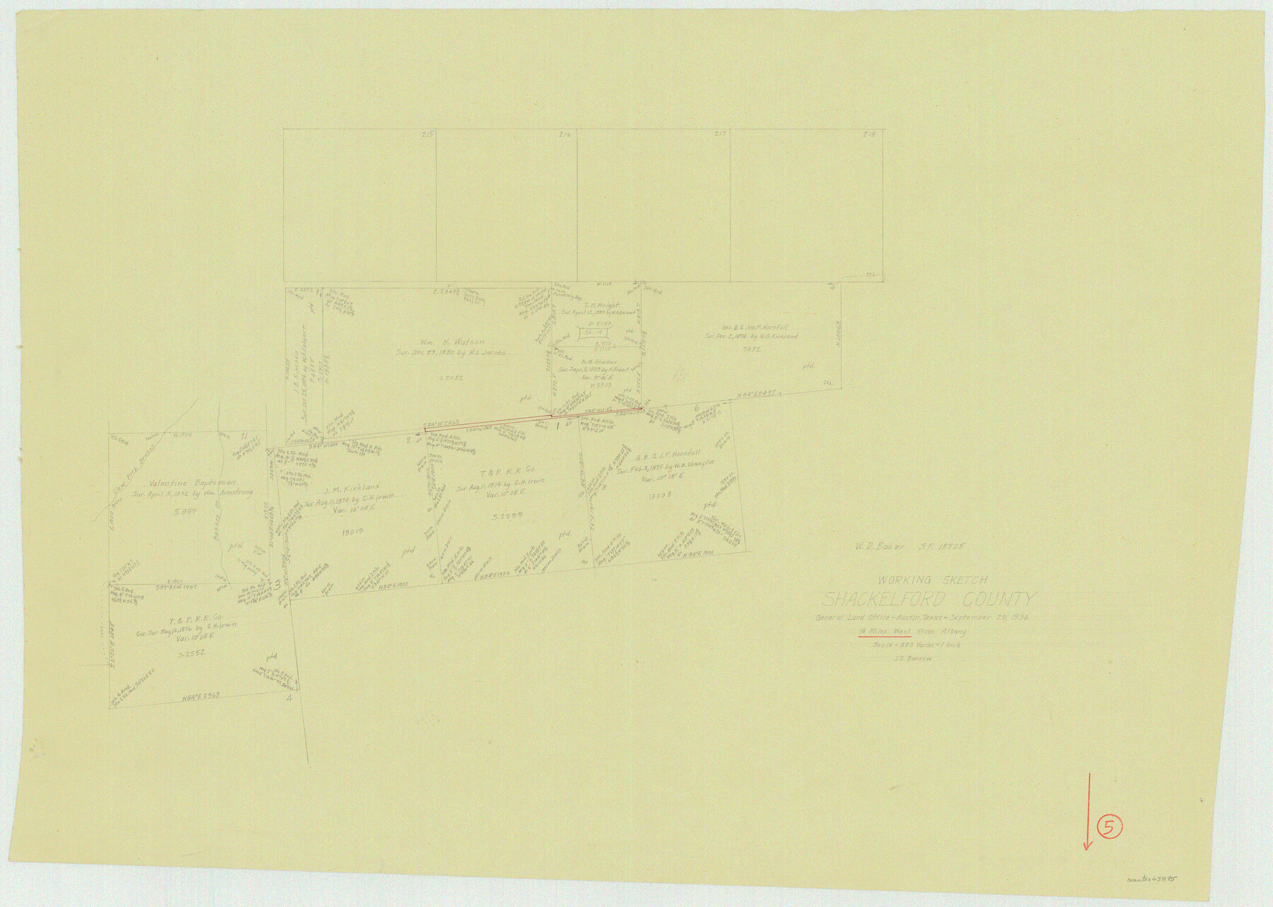
Shackelford County Working Sketch 5
-
Map/Doc
63845
-
Collection
General Map Collection
-
Object Dates
9/29/1936 (Creation Date)
-
People and Organizations
J.O. Barrow (Draftsman)
-
Counties
Shackelford
-
Subjects
Surveying Working Sketch
-
Height x Width
22.5 x 31.6 inches
57.2 x 80.3 cm
-
Scale
1" = 500 varas
Part of: General Map Collection
Val Verde County Sketch File Z6

Print $20.00
- Digital $50.00
Val Verde County Sketch File Z6
Size 29.3 x 26.2 inches
Map/Doc 10425
Hopkins County Sketch File 22

Print $4.00
- Digital $50.00
Hopkins County Sketch File 22
1870
Size 10.2 x 8.1 inches
Map/Doc 26730
Wilbarger County Rolled Sketch 3

Print $40.00
- Digital $50.00
Wilbarger County Rolled Sketch 3
Size 39.5 x 67.4 inches
Map/Doc 10141
Menard County Boundary File 13

Print $32.00
- Digital $50.00
Menard County Boundary File 13
Size 8.9 x 9.4 inches
Map/Doc 57121
Haskell County Rolled Sketch 2

Print $20.00
- Digital $50.00
Haskell County Rolled Sketch 2
1902
Size 34.5 x 27.1 inches
Map/Doc 6163
Texas, Brazos River, Freeport

Print $40.00
- Digital $50.00
Texas, Brazos River, Freeport
1933
Size 28.4 x 48.3 inches
Map/Doc 69994
Harris County Rolled Sketch 96A

Print $20.00
- Digital $50.00
Harris County Rolled Sketch 96A
Size 45.7 x 37.7 inches
Map/Doc 9143
San Saba County Working Sketch 6

Print $20.00
- Digital $50.00
San Saba County Working Sketch 6
1959
Size 17.5 x 23.4 inches
Map/Doc 63794
Jefferson County Sketch File 15a

Print $8.00
- Digital $50.00
Jefferson County Sketch File 15a
1872
Size 15.6 x 6.7 inches
Map/Doc 28156
San Saba County Working Sketch 10

Print $40.00
- Digital $50.00
San Saba County Working Sketch 10
1985
Size 33.4 x 52.9 inches
Map/Doc 63798
Sutton County Working Sketch 62

Print $20.00
- Digital $50.00
Sutton County Working Sketch 62
1959
Size 31.3 x 38.1 inches
Map/Doc 62405
Aransas County Sketch File 33

Print $34.00
- Digital $50.00
Aransas County Sketch File 33
1919
Size 14.4 x 8.8 inches
Map/Doc 13303
You may also like
Limestone County Working Sketch 3

Print $20.00
- Digital $50.00
Limestone County Working Sketch 3
1919
Size 28.9 x 28.5 inches
Map/Doc 70553
Culberson County Rolled Sketch 47

Print $20.00
- Digital $50.00
Culberson County Rolled Sketch 47
1959
Size 35.1 x 31.5 inches
Map/Doc 8755
Pecos County Working Sketch 135

Print $20.00
- Digital $50.00
Pecos County Working Sketch 135
1979
Size 46.4 x 37.3 inches
Map/Doc 71609
[Terry County Highways]
![92905, [Terry County Highways], Twichell Survey Records](https://historictexasmaps.com/wmedia_w700/maps/92905-1.tif.jpg)
Print $20.00
- Digital $50.00
[Terry County Highways]
Size 17.0 x 16.8 inches
Map/Doc 92905
Gaines County Sketch

Print $3.00
- Digital $50.00
Gaines County Sketch
Size 9.7 x 16.1 inches
Map/Doc 92948
Hopkins County Sketch File 27

Print $6.00
- Digital $50.00
Hopkins County Sketch File 27
1873
Size 16.6 x 11.0 inches
Map/Doc 26738

Laneer vs. Bivins, Potter County, Texas

Print $20.00
- Digital $50.00
Laneer vs. Bivins, Potter County, Texas
Size 21.2 x 19.0 inches
Map/Doc 93101
Flight Mission No. DQN-7K, Frame 91, Calhoun County

Print $20.00
- Digital $50.00
Flight Mission No. DQN-7K, Frame 91, Calhoun County
1953
Size 18.4 x 22.2 inches
Map/Doc 84482
Corpus Christi Pass, Texas

Print $3.00
- Digital $50.00
Corpus Christi Pass, Texas
1869
Size 16.7 x 11.2 inches
Map/Doc 73456
[Map to illustrate possible mineral resources on the lands belonging to the University of Texas]
![62963, [Map to illustrate possible mineral resources on the lands belonging to the University of Texas], General Map Collection](https://historictexasmaps.com/wmedia_w700/maps/62963.tif.jpg)
Print $2.00
- Digital $50.00
[Map to illustrate possible mineral resources on the lands belonging to the University of Texas]
Size 10.2 x 7.7 inches
Map/Doc 62963
Wichita County Working Sketch 18

Print $20.00
- Digital $50.00
Wichita County Working Sketch 18
1948
Size 34.9 x 20.8 inches
Map/Doc 72528