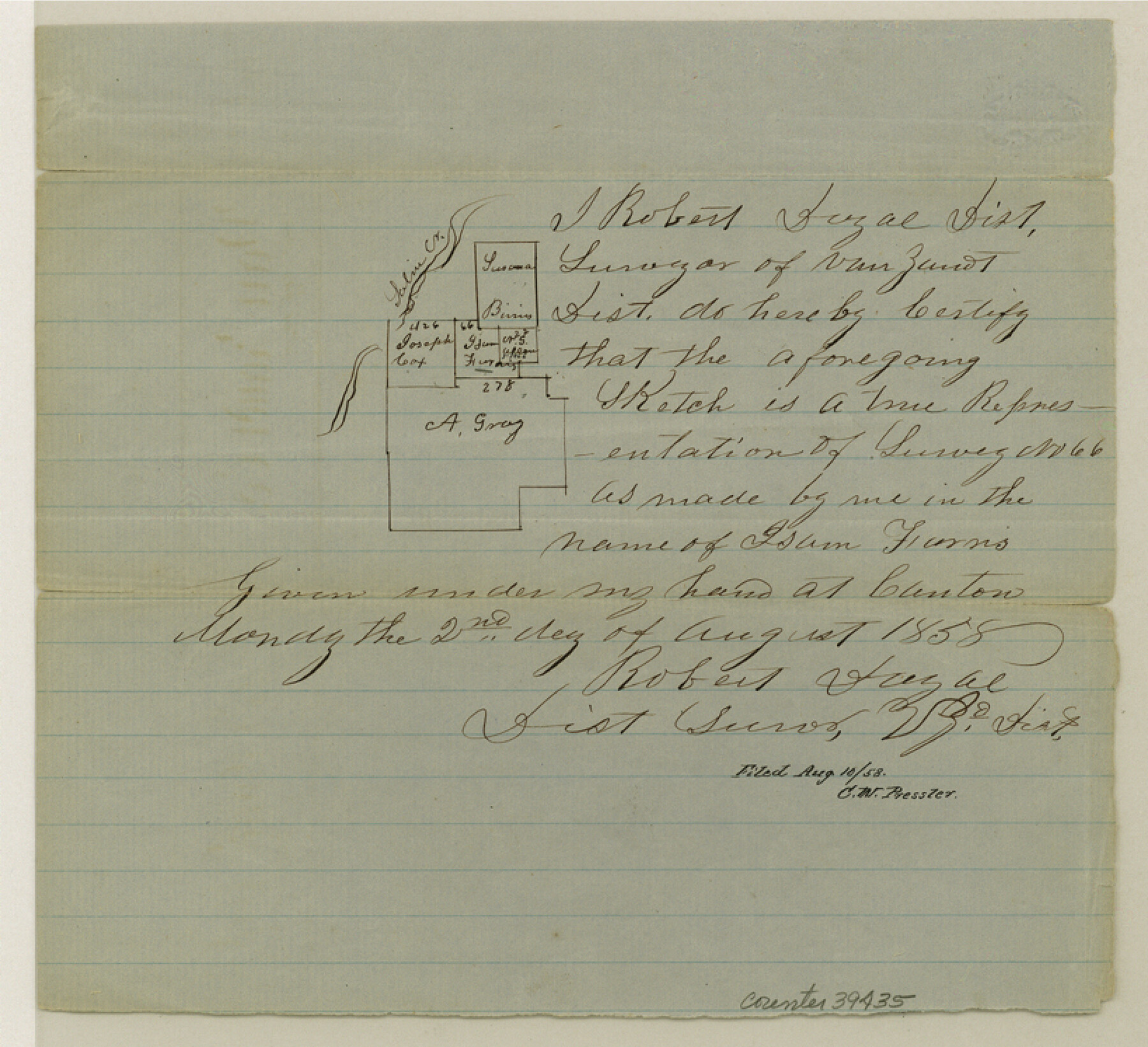
Van Zandt County Sketch File 22a
[Sketch of the large A. Gray survey and surrounding area northeast of Canton]
-
Map/Doc
39435
-
Collection
General Map Collection
-
Object Dates
8/2/1858 (Creation Date)
8/10/1858 (File Date)
-
People and Organizations
Robert Doyal (Surveyor/Engineer)
-
Counties
Van Zandt
-
Subjects
Surveying Sketch File
-
Height x Width
7.5 x 8.2 inches
19.1 x 20.8 cm
-
Medium
paper, manuscript
-
Features
Sabine River
Part of: General Map Collection
Hockley County Sketch File 11

Print $8.00
- Digital $50.00
Hockley County Sketch File 11
Size 14.3 x 9.0 inches
Map/Doc 26544
Flight Mission No. CRE-1R, Frame 63, Jackson County

Print $20.00
- Digital $50.00
Flight Mission No. CRE-1R, Frame 63, Jackson County
1956
Size 18.6 x 18.9 inches
Map/Doc 85326
Childress County Rolled Sketch 18A

Print $20.00
- Digital $50.00
Childress County Rolled Sketch 18A
1913
Size 18.5 x 39.8 inches
Map/Doc 5452
Armstrong County Boundary File 2

Print $8.00
- Digital $50.00
Armstrong County Boundary File 2
Size 14.1 x 8.7 inches
Map/Doc 50137
Live Oak County

Print $40.00
- Digital $50.00
Live Oak County
1899
Size 52.1 x 37.5 inches
Map/Doc 78423
Improving Sabine Pass, Texas. Surveyed May 10th to June 30th, 1894 under the direction of Major James B. Quinn, Corps of Engineers, USA

Print $20.00
- Digital $50.00
Improving Sabine Pass, Texas. Surveyed May 10th to June 30th, 1894 under the direction of Major James B. Quinn, Corps of Engineers, USA
1894
Size 9.3 x 13.2 inches
Map/Doc 94155
Travis County

Print $40.00
- Digital $50.00
Travis County
1936
Size 45.6 x 52.3 inches
Map/Doc 77438
Aransas County Rolled Sketch 2

Print $40.00
- Digital $50.00
Aransas County Rolled Sketch 2
1950
Size 42.5 x 48.6 inches
Map/Doc 73611
[Sketch for Mineral Application 15273 - Sabine River Bed]
![65576, [Sketch for Mineral Application 15273 - Sabine River Bed], General Map Collection](https://historictexasmaps.com/wmedia_w700/maps/65576.tif.jpg)
Print $20.00
- Digital $50.00
[Sketch for Mineral Application 15273 - Sabine River Bed]
1926
Size 45.4 x 28.1 inches
Map/Doc 65576
Matagorda Light to Aransas Pass

Print $20.00
- Digital $50.00
Matagorda Light to Aransas Pass
1924
Size 35.9 x 44.6 inches
Map/Doc 73391
Dickens County Rolled Sketch 13

Print $40.00
- Digital $50.00
Dickens County Rolled Sketch 13
1950
Size 43.4 x 53.7 inches
Map/Doc 45135
Polk County Working Sketch 3

Print $40.00
- Digital $50.00
Polk County Working Sketch 3
1911
Size 25.4 x 56.0 inches
Map/Doc 71618
You may also like
Flight Mission No. CRE-3R, Frame 42, Jackson County

Print $20.00
- Digital $50.00
Flight Mission No. CRE-3R, Frame 42, Jackson County
1956
Size 18.6 x 22.4 inches
Map/Doc 85389
Sandhills Water Rights Survey, City of Lubbock, Texas

Print $40.00
- Digital $50.00
Sandhills Water Rights Survey, City of Lubbock, Texas
1957
Size 76.1 x 31.4 inches
Map/Doc 93211
Northern Part of Laguna Madre
Print $20.00
- Digital $50.00
Northern Part of Laguna Madre
1965
Size 43.9 x 34.6 inches
Map/Doc 73527
Coke County Sketch File 6

Print $6.00
- Digital $50.00
Coke County Sketch File 6
1860
Size 7.5 x 10.0 inches
Map/Doc 18582
General Highway Map, Ochiltree County, Texas

Print $20.00
General Highway Map, Ochiltree County, Texas
1961
Size 18.2 x 24.3 inches
Map/Doc 79618
Coast Chart No. 205 - Galveston Bay to Oyster Bay, Texas
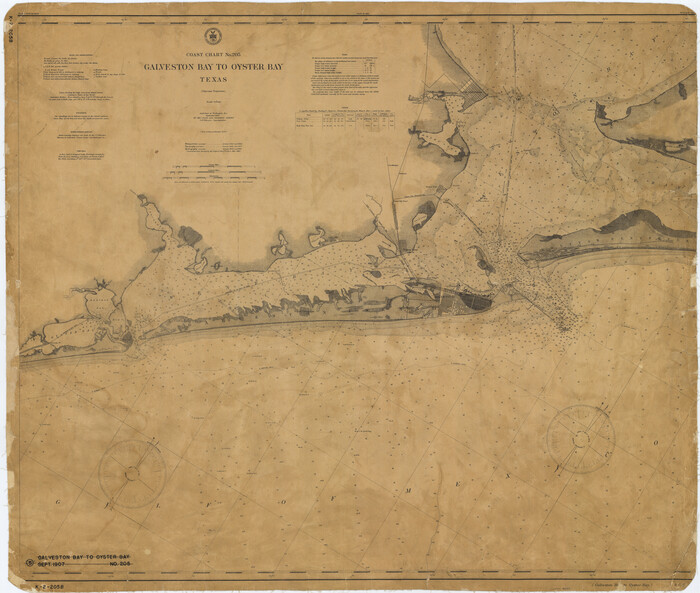
Print $20.00
- Digital $50.00
Coast Chart No. 205 - Galveston Bay to Oyster Bay, Texas
1907
Size 34.3 x 40.5 inches
Map/Doc 69927
Potter County Boundary File 5

Print $24.00
- Digital $50.00
Potter County Boundary File 5
Size 15.0 x 9.4 inches
Map/Doc 58013
Aransas County Rolled Sketch 35

Print $40.00
- Digital $50.00
Aransas County Rolled Sketch 35
2006
Size 37.5 x 50.0 inches
Map/Doc 83555
Duval County Working Sketch 55

Print $20.00
- Digital $50.00
Duval County Working Sketch 55
1936
Size 25.7 x 21.6 inches
Map/Doc 68779
Dickens County Sketch File 1

Print $20.00
- Digital $50.00
Dickens County Sketch File 1
1879
Size 18.2 x 15.5 inches
Map/Doc 11315
Hays County Sketch File 28

Print $20.00
- Digital $50.00
Hays County Sketch File 28
1912
Size 26.0 x 20.0 inches
Map/Doc 11750
Flight Mission No. BRA-8M, Frame 118, Jefferson County

Print $20.00
- Digital $50.00
Flight Mission No. BRA-8M, Frame 118, Jefferson County
1953
Size 18.6 x 22.3 inches
Map/Doc 85614