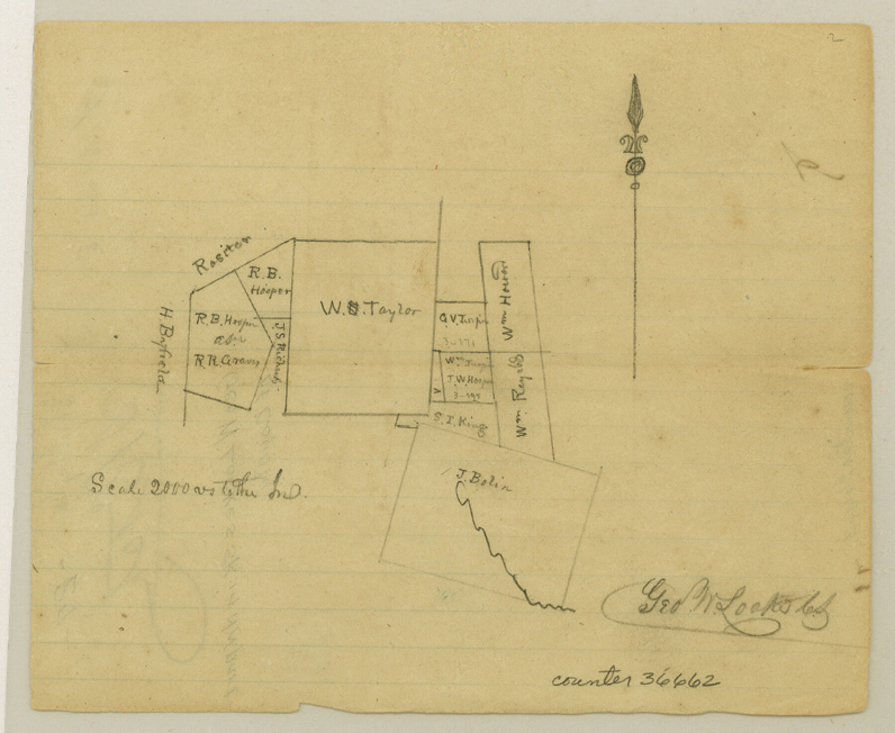
Shelby County Sketch File 27
[Office sketch of surveys in the northwest corner of county near the boundary with Panola County]
-
Map/Doc
36662
-
Collection
General Map Collection
-
People and Organizations
G.W. Locke (Surveyor/Engineer)
-
Counties
Shelby
-
Subjects
Surveying Sketch File
-
Height x Width
6.5 x 8.0 inches
16.5 x 20.3 cm
-
Medium
paper, manuscript
-
Scale
1" = 2000 varas
Part of: General Map Collection
Map of Brown County

Print $20.00
- Digital $50.00
Map of Brown County
1876
Size 25.9 x 23.3 inches
Map/Doc 3341
La Salle County Working Sketch 26

Print $20.00
- Digital $50.00
La Salle County Working Sketch 26
1949
Size 28.2 x 16.3 inches
Map/Doc 70327
Martin County Working Sketch 1

Print $20.00
- Digital $50.00
Martin County Working Sketch 1
1922
Size 21.8 x 16.9 inches
Map/Doc 70819
Chambers County Sketch File 51

Print $35.00
- Digital $50.00
Chambers County Sketch File 51
1935
Size 14.3 x 9.0 inches
Map/Doc 18068
Marion County

Print $20.00
- Digital $50.00
Marion County
1943
Size 24.3 x 41.2 inches
Map/Doc 77365
[Maps of surveys in Reeves & Culberson Cos]
![61130, [Maps of surveys in Reeves & Culberson Cos], General Map Collection](https://historictexasmaps.com/wmedia_w700/maps/61130.tif.jpg)
Print $20.00
- Digital $50.00
[Maps of surveys in Reeves & Culberson Cos]
1937
Size 30.7 x 24.9 inches
Map/Doc 61130
Tom Green County Rolled Sketch 4

Print $20.00
- Digital $50.00
Tom Green County Rolled Sketch 4
Size 28.2 x 23.6 inches
Map/Doc 7994
T. & N. O. R.R. Jefferson Co. North

Print $20.00
- Digital $50.00
T. & N. O. R.R. Jefferson Co. North
1917
Size 13.4 x 33.5 inches
Map/Doc 64058
Map of Encinal County

Print $20.00
- Digital $50.00
Map of Encinal County
1878
Size 32.8 x 22.7 inches
Map/Doc 3514
Starr County Rolled Sketch 46B

Print $20.00
- Digital $50.00
Starr County Rolled Sketch 46B
1986
Size 17.9 x 34.5 inches
Map/Doc 7838
Atascosa County Sketch File 16

Print $4.00
- Digital $50.00
Atascosa County Sketch File 16
1877
Size 12.2 x 7.9 inches
Map/Doc 13779
Terrell County Working Sketch 27

Print $20.00
- Digital $50.00
Terrell County Working Sketch 27
1944
Size 30.1 x 31.7 inches
Map/Doc 62177
You may also like
Right of Way and Track Map, Texas & New Orleans R.R. Co. operated by the T. & N. O. R.R. Co., Dallas-Sabine Branch

Print $40.00
- Digital $50.00
Right of Way and Track Map, Texas & New Orleans R.R. Co. operated by the T. & N. O. R.R. Co., Dallas-Sabine Branch
1918
Size 24.6 x 56.9 inches
Map/Doc 64629
Nueces County Sketch File 25a

Print $6.00
- Digital $50.00
Nueces County Sketch File 25a
1890
Size 14.2 x 8.4 inches
Map/Doc 32578
Sutton County Rolled Sketch 60

Print $20.00
- Digital $50.00
Sutton County Rolled Sketch 60
1964
Size 23.5 x 34.7 inches
Map/Doc 7897
El Paso County Rolled Sketch 60

Print $20.00
- Digital $50.00
El Paso County Rolled Sketch 60
1992
Size 29.0 x 36.5 inches
Map/Doc 5852
Andrews County

Print $40.00
- Digital $50.00
Andrews County
1925
Size 42.6 x 57.1 inches
Map/Doc 66703
Hamilton County Sketch File 10

Print $24.00
- Digital $50.00
Hamilton County Sketch File 10
1874
Size 12.8 x 8.5 inches
Map/Doc 24919
Texas Intracoastal Waterway - Port O'Connor to San Antonio Bay, Including Pass Cavallo

Print $20.00
- Digital $50.00
Texas Intracoastal Waterway - Port O'Connor to San Antonio Bay, Including Pass Cavallo
1961
Size 26.5 x 38.7 inches
Map/Doc 73373
New Map of the City of New York, with Brooklyn & part of Williamsburg

Print $20.00
- Digital $50.00
New Map of the City of New York, with Brooklyn & part of Williamsburg
1839
Size 14.4 x 12.3 inches
Map/Doc 95909
Map of Upshur County Texas

Print $20.00
- Digital $50.00
Map of Upshur County Texas
1873
Size 20.4 x 15.2 inches
Map/Doc 4635
Tom Green County Working Sketch 9

Print $20.00
- Digital $50.00
Tom Green County Working Sketch 9
1951
Size 31.3 x 42.2 inches
Map/Doc 69378
Trinity County Working Sketch 20

Print $20.00
- Digital $50.00
Trinity County Working Sketch 20
Size 25.9 x 29.7 inches
Map/Doc 69469
Aransas County NRC Article 33.136 Sketch 12

Print $44.00
- Digital $50.00
Aransas County NRC Article 33.136 Sketch 12
2012
Size 36.0 x 48.0 inches
Map/Doc 94510