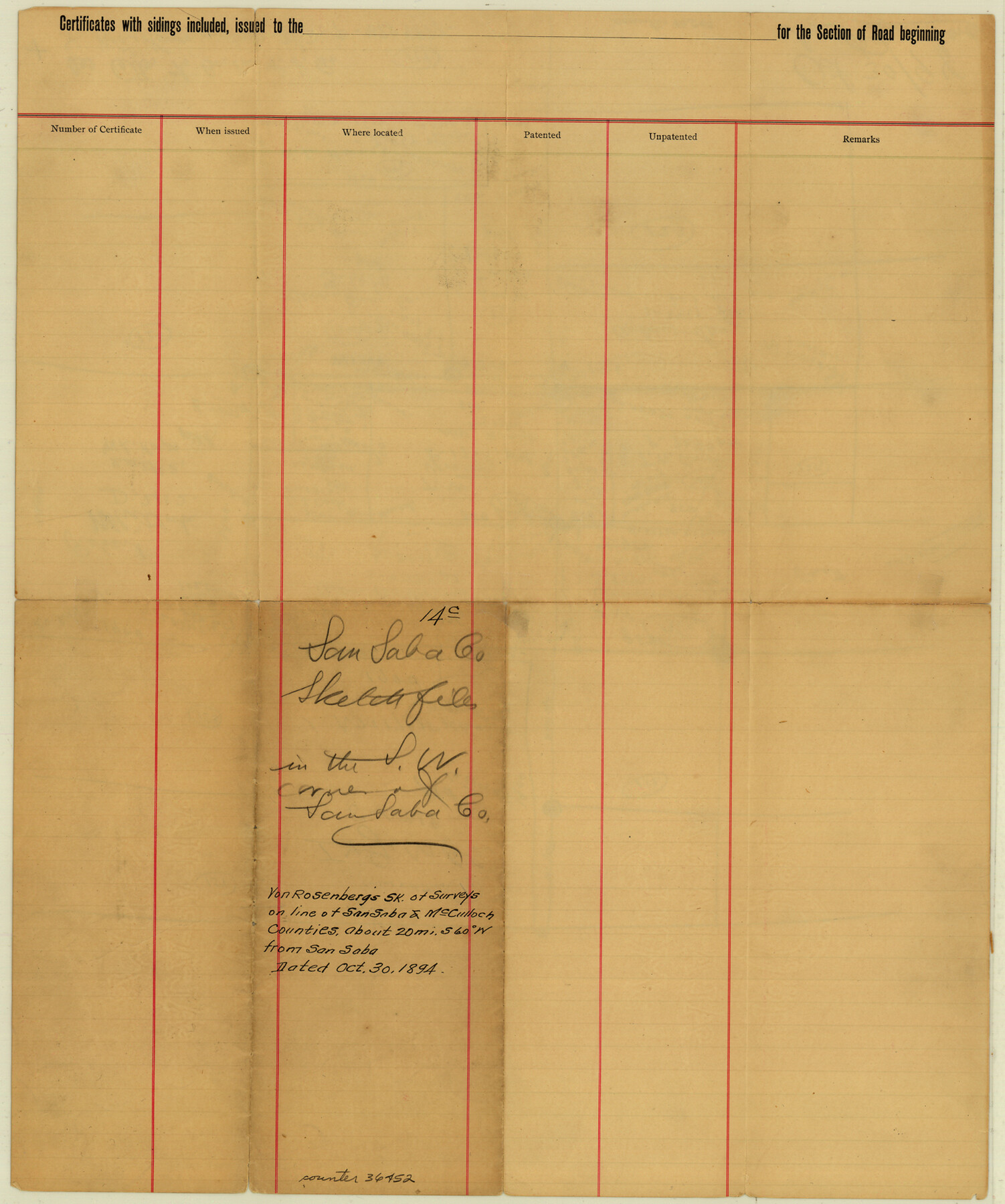
San Saba County Sketch File 14c
[Sketch of surveys near line of San Saba and McCulloch Counties, southwest from San Saba, regarding possible vacancy north of T.W. Barton Survey No. 3004]
-
Map/Doc
36452
-
Collection
General Map Collection
-
Object Dates
10/30/1894 (Creation Date)
-
People and Organizations
von Rosenberg (Surveyor/Engineer)
-
Counties
San Saba
-
Subjects
Surveying Sketch File
-
Height x Width
17.3 x 14.4 inches
43.9 x 36.6 cm
-
Medium
paper, manuscript
-
Comments
See Bexar Scrip 55461
Part of: General Map Collection
Nueces County Rolled Sketch 88

Print $20.00
- Digital $50.00
Nueces County Rolled Sketch 88
1983
Size 18.4 x 24.6 inches
Map/Doc 6990
Victoria County Sketch File A

Print $20.00
- Digital $50.00
Victoria County Sketch File A
1902
Size 23.7 x 22.4 inches
Map/Doc 12597
Hardin County Working Sketch 34

Print $20.00
- Digital $50.00
Hardin County Working Sketch 34
1980
Size 15.7 x 12.1 inches
Map/Doc 63432
Coleman County Sketch File 29

Print $40.00
- Digital $50.00
Coleman County Sketch File 29
1873
Size 16.9 x 12.9 inches
Map/Doc 18718
Jack County Sketch File 7

Print $6.00
- Digital $50.00
Jack County Sketch File 7
1857
Size 6.7 x 12.4 inches
Map/Doc 27516
Carte du Spits-Berg, et partie de la Côte de Galles hams-kes au nouveau Groenland

Print $20.00
- Digital $50.00
Carte du Spits-Berg, et partie de la Côte de Galles hams-kes au nouveau Groenland
1782
Size 13.8 x 19.8 inches
Map/Doc 97123
Crockett County Sketch File 22

Print $12.00
- Digital $50.00
Crockett County Sketch File 22
1881
Size 13.1 x 8.1 inches
Map/Doc 19691
Henderson County Rolled Sketch 8

Print $40.00
- Digital $50.00
Henderson County Rolled Sketch 8
1963
Size 37.3 x 50.9 inches
Map/Doc 9164
Panola County Sketch File 9

Print $8.00
- Digital $50.00
Panola County Sketch File 9
Size 13.9 x 8.5 inches
Map/Doc 33461
Reagan County Working Sketch 14b

Print $20.00
- Digital $50.00
Reagan County Working Sketch 14b
Size 20.3 x 9.0 inches
Map/Doc 71855
[Galveston, Harrisburg & San Antonio through El Paso County]
![64010, [Galveston, Harrisburg & San Antonio through El Paso County], General Map Collection](https://historictexasmaps.com/wmedia_w700/maps/64010.tif.jpg)
Print $20.00
- Digital $50.00
[Galveston, Harrisburg & San Antonio through El Paso County]
1906
Size 13.4 x 33.9 inches
Map/Doc 64010
Brazoria County Rolled Sketch 32

Print $20.00
- Digital $50.00
Brazoria County Rolled Sketch 32
Size 29.1 x 22.6 inches
Map/Doc 5170
You may also like
Leon County Working Sketch 41

Print $40.00
- Digital $50.00
Leon County Working Sketch 41
1980
Size 61.2 x 43.2 inches
Map/Doc 70440
Index Map No. 1 - Rio Bravo del Norte section of boundary between the United States & Mexico; agreed upon by the Joint Commission under the Treaty of Guadalupe Hidalgo

Print $20.00
- Digital $50.00
Index Map No. 1 - Rio Bravo del Norte section of boundary between the United States & Mexico; agreed upon by the Joint Commission under the Treaty of Guadalupe Hidalgo
1852
Size 18.3 x 27.5 inches
Map/Doc 72860
Houston Ship Channel, Alexander Island to Carpenter Bayou

Print $20.00
- Digital $50.00
Houston Ship Channel, Alexander Island to Carpenter Bayou
1960
Size 35.2 x 46.5 inches
Map/Doc 69905
Clay County Sketch File 19

Print $5.00
- Digital $50.00
Clay County Sketch File 19
Size 9.2 x 9.9 inches
Map/Doc 18429
Brewster County Rolled Sketch 82A

Print $40.00
- Digital $50.00
Brewster County Rolled Sketch 82A
1952
Size 74.3 x 34.0 inches
Map/Doc 8498
Travis County Rolled Sketch 19

Print $20.00
- Digital $50.00
Travis County Rolled Sketch 19
1940
Size 34.4 x 37.8 inches
Map/Doc 10012
Frio County Sketch File 2a

Print $6.00
- Digital $50.00
Frio County Sketch File 2a
1861
Size 16.0 x 11.0 inches
Map/Doc 23107
Working Sketch Hemphill County

Print $20.00
- Digital $50.00
Working Sketch Hemphill County
1910
Size 6.9 x 39.1 inches
Map/Doc 90730
Uvalde County Sketch File 33

Print $56.00
- Digital $50.00
Uvalde County Sketch File 33
2017
Size 11.0 x 8.5 inches
Map/Doc 95251
[Hockley, Lubbock, Terry and Lynn Corner]
![92889, [Hockley, Lubbock, Terry and Lynn Corner], Twichell Survey Records](https://historictexasmaps.com/wmedia_w700/maps/92889-1.tif.jpg)
Print $20.00
- Digital $50.00
[Hockley, Lubbock, Terry and Lynn Corner]
Size 17.6 x 15.6 inches
Map/Doc 92889

Upshur County Sketch File 19

Print $40.00
- Digital $50.00
Upshur County Sketch File 19
Size 17.9 x 22.2 inches
Map/Doc 12507