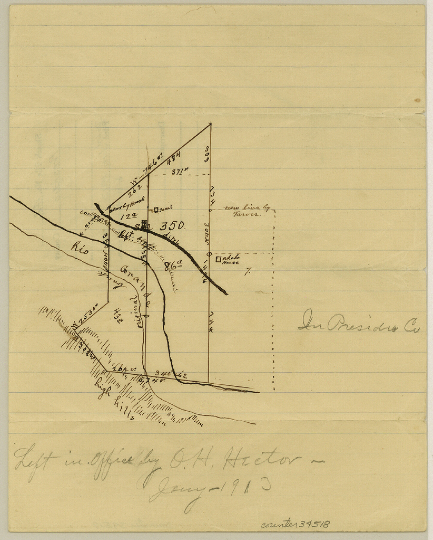
Presidio County Sketch File 42
[Sketch on Rio Grande around survey 350]
-
Map/Doc
34518
-
Collection
General Map Collection
-
Object Dates
1/1913 (Creation Date)
-
People and Organizations
O.H. Hector (Surveyor/Engineer)
-
Counties
Presidio
-
Subjects
Surveying Sketch File
-
Height x Width
10.2 x 8.2 inches
25.9 x 20.8 cm
-
Medium
paper, manuscript
-
Features
Rio Grande
Part of: General Map Collection
General Chart of the Coast No. XVI - Gulf Coast from Galveston to the Rio Grande

Print $20.00
- Digital $50.00
General Chart of the Coast No. XVI - Gulf Coast from Galveston to the Rio Grande
1883
Size 26.7 x 18.2 inches
Map/Doc 72735
Crockett County Rolled Sketch 59

Print $20.00
- Digital $50.00
Crockett County Rolled Sketch 59
1946
Size 30.1 x 20.9 inches
Map/Doc 5602
Duval County Rolled Sketch 44

Digital $50.00
Duval County Rolled Sketch 44
Size 36.5 x 90.5 inches
Map/Doc 8821
Newton County Sketch File 47

Print $20.00
- Digital $50.00
Newton County Sketch File 47
1932
Size 18.9 x 21.9 inches
Map/Doc 42159
Hamilton County Working Sketch 17

Print $20.00
- Digital $50.00
Hamilton County Working Sketch 17
1951
Size 44.4 x 25.0 inches
Map/Doc 63355
Flight Mission No. BRE-1P, Frame 71, Nueces County

Print $20.00
- Digital $50.00
Flight Mission No. BRE-1P, Frame 71, Nueces County
1956
Size 18.6 x 22.2 inches
Map/Doc 86653
Haskell County Sketch File 23

Print $40.00
- Digital $50.00
Haskell County Sketch File 23
1939
Size 23.2 x 13.5 inches
Map/Doc 11745
Motley County Boundary File 2e

Print $40.00
- Digital $50.00
Motley County Boundary File 2e
Size 29.4 x 96.1 inches
Map/Doc 57561
Dickens County Rolled Sketch 14
Digital $50.00
Dickens County Rolled Sketch 14
Size 36.5 x 80.7 inches
Map/Doc 8792
Sutton County Boundary File 5a

Print $20.00
- Digital $50.00
Sutton County Boundary File 5a
Size 14.5 x 8.9 inches
Map/Doc 59060
Nolan County Working Sketch 9

Print $20.00
- Digital $50.00
Nolan County Working Sketch 9
1964
Size 25.0 x 36.8 inches
Map/Doc 71300
San Luis Pass to Matagorda Bay

Print $20.00
- Digital $50.00
San Luis Pass to Matagorda Bay
1933
Size 34.3 x 47.3 inches
Map/Doc 69960
You may also like
Eastland County Sketch File 11

Print $8.00
- Digital $50.00
Eastland County Sketch File 11
Size 6.7 x 7.0 inches
Map/Doc 21585
Lamar County State Real Property Sketch 1

Print $20.00
- Digital $50.00
Lamar County State Real Property Sketch 1
2013
Size 24.0 x 36.0 inches
Map/Doc 93656
Crane County Working Sketch 2

Print $20.00
- Digital $50.00
Crane County Working Sketch 2
1924
Size 31.6 x 34.5 inches
Map/Doc 68279
Official Map of the City of Bryan from Actual Survey [East half]
![3203, Official Map of the City of Bryan from Actual Survey [East half], General Map Collection](https://historictexasmaps.com/wmedia_w700/maps/3203.tif.jpg)
Print $40.00
- Digital $50.00
Official Map of the City of Bryan from Actual Survey [East half]
1898
Size 52.3 x 27.4 inches
Map/Doc 3203
Webb County Sketch File 70

Print $26.00
- Digital $50.00
Webb County Sketch File 70
Size 11.4 x 8.9 inches
Map/Doc 39875
Galveston County Rolled Sketch 18

Print $20.00
- Digital $50.00
Galveston County Rolled Sketch 18
1958
Size 24.1 x 32.0 inches
Map/Doc 5956
Morris County Rolled Sketch 2A

Print $20.00
- Digital $50.00
Morris County Rolled Sketch 2A
Size 24.0 x 18.7 inches
Map/Doc 10260
Mitchell County Rolled Sketch 2A

Print $20.00
- Digital $50.00
Mitchell County Rolled Sketch 2A
Size 24.2 x 18.5 inches
Map/Doc 88857

Wilbarger County Working Sketch 5

Print $20.00
- Digital $50.00
Wilbarger County Working Sketch 5
1940
Size 21.3 x 25.6 inches
Map/Doc 72543
Map of Fannin County

Print $20.00
- Digital $50.00
Map of Fannin County
1866
Size 21.9 x 18.1 inches
Map/Doc 3534
Brown County Sketch File 12

Print $4.00
- Digital $50.00
Brown County Sketch File 12
1870
Size 12.4 x 8.0 inches
Map/Doc 16602