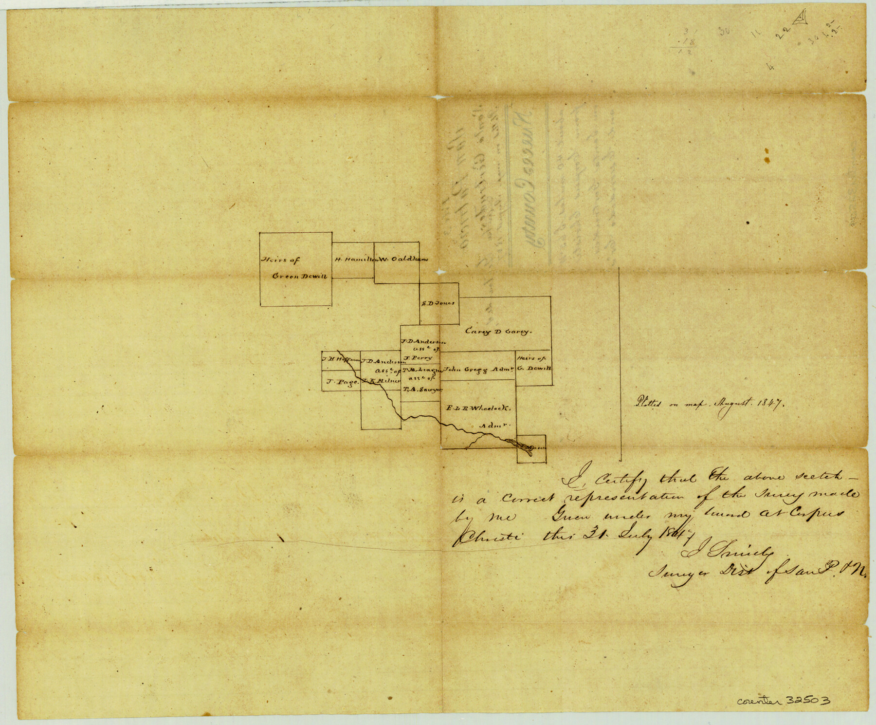
Nueces County Sketch File 3
[Sketch southwest from Corpus Christi on Santa Gertrudis and Escondido Creeks]
-
Map/Doc
32503
-
Collection
General Map Collection
-
Object Dates
8/1847 (File Date)
7/31/1847 (Creation Date)
8/1847 (Creation Date)
7/31/1847 (Survey Date)
-
People and Organizations
J. Snively (Surveyor/Engineer)
-
Counties
Nueces
-
Subjects
Surveying Sketch File
-
Height x Width
12.5 x 15.1 inches
31.8 x 38.4 cm
-
Medium
paper, manuscript
-
Features
Santa Gertrudis Creek
Escondido Creek
Part of: General Map Collection
Aransas County Working Sketch 3

Print $20.00
- Digital $50.00
Aransas County Working Sketch 3
1928
Size 20.6 x 32.9 inches
Map/Doc 67170
Taylor County Sketch File A1

Print $40.00
- Digital $50.00
Taylor County Sketch File A1
Size 12.8 x 14.3 inches
Map/Doc 37774
South Part Presidio County

Print $20.00
- Digital $50.00
South Part Presidio County
1975
Size 35.0 x 40.3 inches
Map/Doc 95617
Johnson County Working Sketch 14

Print $20.00
- Digital $50.00
Johnson County Working Sketch 14
1974
Size 37.3 x 31.7 inches
Map/Doc 66627
Fayette County

Print $40.00
- Digital $50.00
Fayette County
1978
Size 42.5 x 54.7 inches
Map/Doc 73146
Flight Mission No. DQO-7K, Frame 99, Galveston County

Print $20.00
- Digital $50.00
Flight Mission No. DQO-7K, Frame 99, Galveston County
1952
Size 18.7 x 22.5 inches
Map/Doc 85114
San Patricio County Working Sketch 14

Print $20.00
- Digital $50.00
San Patricio County Working Sketch 14
1949
Size 34.9 x 28.2 inches
Map/Doc 63776
Gray County Rolled Sketch 3

Print $105.00
- Digital $50.00
Gray County Rolled Sketch 3
Size 10.6 x 15.5 inches
Map/Doc 45287
Chambers County Working Sketch 23

Print $20.00
- Digital $50.00
Chambers County Working Sketch 23
1979
Size 14.9 x 23.5 inches
Map/Doc 68006
Flight Mission No. BRA-6M, Frame 80, Jefferson County

Print $20.00
- Digital $50.00
Flight Mission No. BRA-6M, Frame 80, Jefferson County
1953
Size 18.6 x 22.3 inches
Map/Doc 85424
Mississippi River to Galveston

Print $40.00
- Digital $50.00
Mississippi River to Galveston
1986
Size 36.8 x 49.9 inches
Map/Doc 69948
Flight Mission No. DQO-8K, Frame 72, Galveston County

Print $20.00
- Digital $50.00
Flight Mission No. DQO-8K, Frame 72, Galveston County
1952
Size 18.7 x 22.4 inches
Map/Doc 85176
You may also like
Presidio County Working Sketch 90

Print $20.00
- Digital $50.00
Presidio County Working Sketch 90
1973
Size 25.5 x 28.1 inches
Map/Doc 71767
[Map of the Hearne and Brazos Valley Railroad from Mumford to Moseley's Ferry]
![64401, [Map of the Hearne and Brazos Valley Railroad from Mumford to Moseley's Ferry], General Map Collection](https://historictexasmaps.com/wmedia_w700/maps/64401.tif.jpg)
Print $40.00
- Digital $50.00
[Map of the Hearne and Brazos Valley Railroad from Mumford to Moseley's Ferry]
1892
Size 20.0 x 71.5 inches
Map/Doc 64401
Whitharral Located on West Half of Labor 11, Capitol League 716 Hockley County, Texas

Print $20.00
- Digital $50.00
Whitharral Located on West Half of Labor 11, Capitol League 716 Hockley County, Texas
Size 17.5 x 20.9 inches
Map/Doc 92261
Stonewall County Working Sketch 8

Print $20.00
- Digital $50.00
Stonewall County Working Sketch 8
1950
Size 23.5 x 23.2 inches
Map/Doc 62315

Floyd County Boundary File 1

Print $30.00
- Digital $50.00
Floyd County Boundary File 1
Size 8.9 x 4.2 inches
Map/Doc 53445
Mills County Working Sketch 27

Print $20.00
- Digital $50.00
Mills County Working Sketch 27
2000
Size 37.3 x 47.3 inches
Map/Doc 71057
Lynn County Boundary File 7b

Print $8.00
- Digital $50.00
Lynn County Boundary File 7b
Size 11.3 x 8.6 inches
Map/Doc 56651
Williamson County Rolled Sketch 3

Print $20.00
- Digital $50.00
Williamson County Rolled Sketch 3
1915
Size 40.1 x 30.9 inches
Map/Doc 8261
Flight Mission No. CUG-3P, Frame 134, Kleberg County

Print $20.00
- Digital $50.00
Flight Mission No. CUG-3P, Frame 134, Kleberg County
1956
Size 18.5 x 22.3 inches
Map/Doc 86269
Map of Edwards County, Texas

Print $20.00
- Digital $50.00
Map of Edwards County, Texas
Size 21.5 x 18.2 inches
Map/Doc 92635
The Inca, An Empire and its Ancestors

The Inca, An Empire and its Ancestors
Size 31.2 x 20.4 inches
Map/Doc 95936