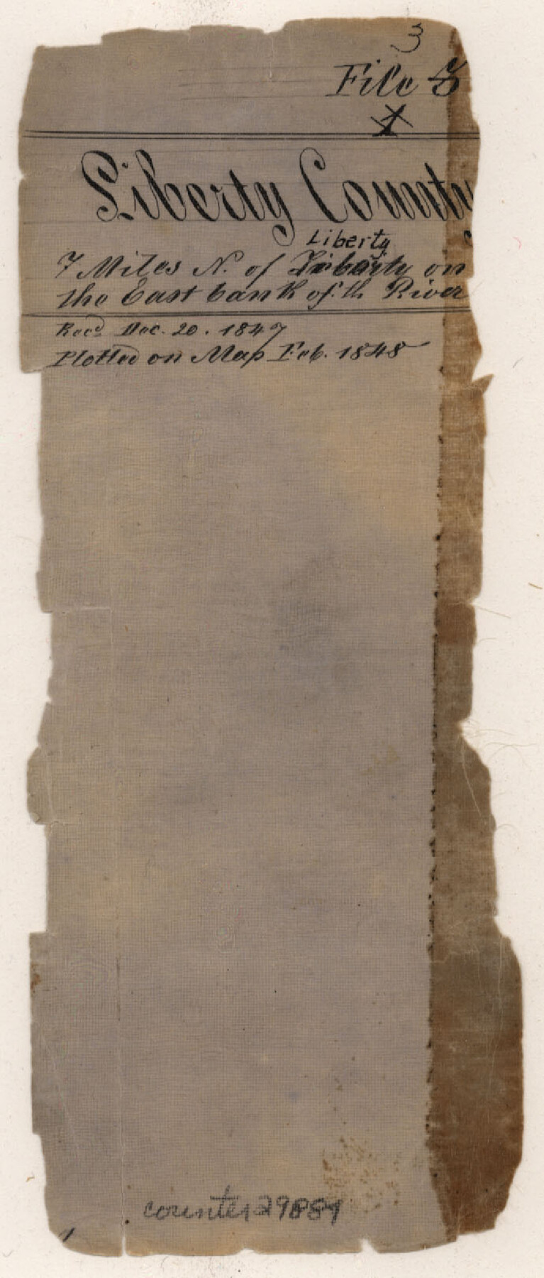
Liberty County Sketch File 3
[Sketch north of Liberty on the east bank of the river]
-
Map/Doc
29884
-
Collection
General Map Collection
-
Object Dates
12/7/1847 (Creation Date)
12/20/1847 (File Date)
-
People and Organizations
H. Jackson (Surveyor/Engineer)
-
Counties
Liberty
-
Subjects
Surveying Sketch File
-
Height x Width
13.7 x 8.3 inches
34.8 x 21.1 cm
-
Medium
paper, manuscript
Part of: General Map Collection
Nueces County Working Sketch 1

Print $20.00
- Digital $50.00
Nueces County Working Sketch 1
1937
Size 27.9 x 28.5 inches
Map/Doc 71303
Archer County Sketch File 16

Print $6.00
- Digital $50.00
Archer County Sketch File 16
1889
Size 12.8 x 8.3 inches
Map/Doc 13650
Hardin County Rolled Sketch 16

Print $39.00
- Digital $50.00
Hardin County Rolled Sketch 16
1940
Size 9.9 x 15.9 inches
Map/Doc 45750
Tyler County Working Sketch 3

Print $20.00
- Digital $50.00
Tyler County Working Sketch 3
1922
Size 28.0 x 32.6 inches
Map/Doc 69473
Cameron County Rolled Sketch 31

Print $20.00
- Digital $50.00
Cameron County Rolled Sketch 31
1993
Size 18.4 x 24.3 inches
Map/Doc 5395
Throckmorton Co.

Print $20.00
- Digital $50.00
Throckmorton Co.
1898
Size 41.7 x 36.7 inches
Map/Doc 63064
Nueces County Rolled Sketch 49

Print $20.00
- Digital $50.00
Nueces County Rolled Sketch 49
1979
Size 21.1 x 20.7 inches
Map/Doc 6888
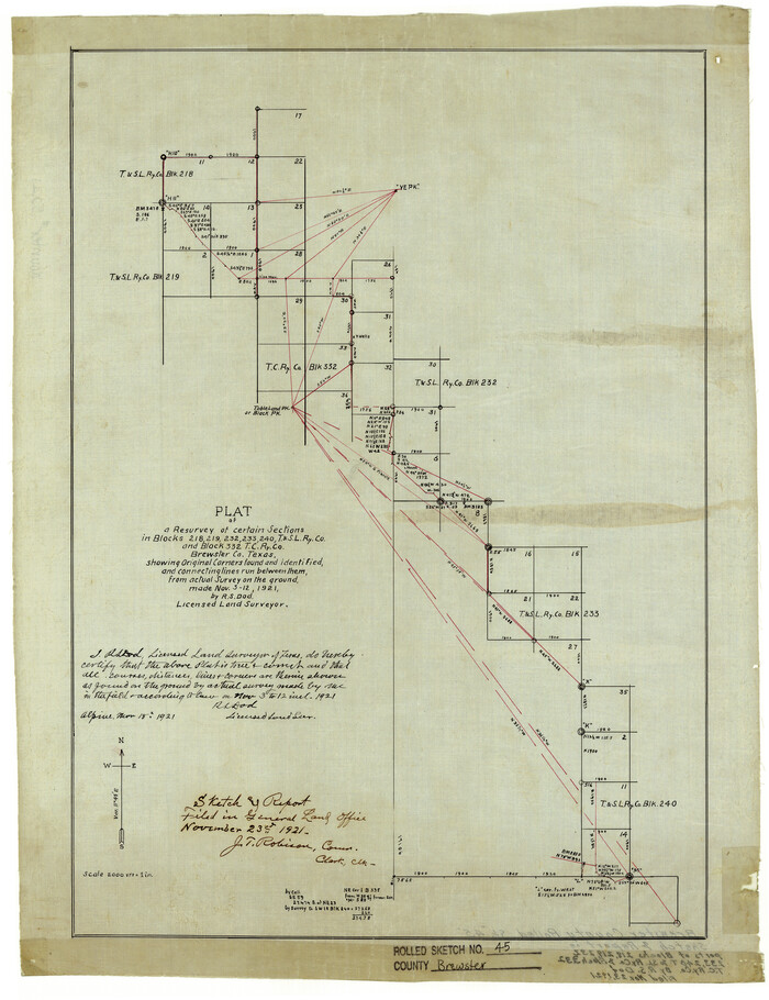
Brewster County Rolled Sketch 45
Print $20.00
- Digital $50.00
Brewster County Rolled Sketch 45
1921
Size 20.3 x 15.6 inches
Map/Doc 5221
Sherman County Boundary File 1

Print $20.00
- Digital $50.00
Sherman County Boundary File 1
Size 11.4 x 8.9 inches
Map/Doc 58751
Refugio County Rolled Sketch 4

Print $40.00
- Digital $50.00
Refugio County Rolled Sketch 4
1941
Size 55.7 x 46.4 inches
Map/Doc 9958
Newton County Sketch File 4

Print $22.00
- Digital $50.00
Newton County Sketch File 4
1876
Size 8.0 x 12.8 inches
Map/Doc 32360
The Texas and Pacific Ry. Co., Station Map, Roscoe, Texas

Print $20.00
- Digital $50.00
The Texas and Pacific Ry. Co., Station Map, Roscoe, Texas
Size 11.0 x 19.0 inches
Map/Doc 64690
You may also like
Water Plant for E. C. Stovall, South Bend, Texas

Print $20.00
- Digital $50.00
Water Plant for E. C. Stovall, South Bend, Texas
1914
Size 37.1 x 24.6 inches
Map/Doc 92142
Wise County Sketch File 9

Print $5.00
- Digital $50.00
Wise County Sketch File 9
1854
Size 11.9 x 14.8 inches
Map/Doc 40539
[Sketch for Mineral Application 13440]
![65674, [Sketch for Mineral Application 13440], General Map Collection](https://historictexasmaps.com/wmedia_w700/maps/65674-1.tif.jpg)
Print $40.00
- Digital $50.00
[Sketch for Mineral Application 13440]
Size 65.8 x 42.9 inches
Map/Doc 65674
Galveston County NRC Article 33.136 Sketch 64

Print $26.00
- Digital $50.00
Galveston County NRC Article 33.136 Sketch 64
2010
Size 24.0 x 36.0 inches
Map/Doc 89990
Victoria County Working Sketch 9

Print $40.00
- Digital $50.00
Victoria County Working Sketch 9
1963
Size 49.9 x 35.8 inches
Map/Doc 72279
Right of Way & Track Map San Antonio & Aransas Pass Railway Co.

Print $40.00
- Digital $50.00
Right of Way & Track Map San Antonio & Aransas Pass Railway Co.
1919
Size 25.6 x 57.0 inches
Map/Doc 64025
Dawson County Working Sketch 11

Print $20.00
- Digital $50.00
Dawson County Working Sketch 11
1946
Size 25.3 x 21.9 inches
Map/Doc 68555
Angelina County

Print $40.00
- Digital $50.00
Angelina County
1945
Size 38.7 x 49.3 inches
Map/Doc 1770
The Republic County of Washington. Boundaries Defined, December 14, 1837

Print $20.00
The Republic County of Washington. Boundaries Defined, December 14, 1837
2020
Size 20.3 x 21.7 inches
Map/Doc 96302
[Surveying sketch of S. Hayford, E. T. R.R. Co., T. C. R. R. Co., et al in Travis County, Texas]
![10753, [Surveying sketch of S. Hayford, E. T. R.R. Co., T. C. R. R. Co., et al in Travis County, Texas], Maddox Collection](https://historictexasmaps.com/wmedia_w700/maps/10753.tif.jpg)
Print $20.00
- Digital $50.00
[Surveying sketch of S. Hayford, E. T. R.R. Co., T. C. R. R. Co., et al in Travis County, Texas]
Size 18.0 x 17.3 inches
Map/Doc 10753
Victoria County Sketch File 6

Print $2.00
- Digital $50.00
Victoria County Sketch File 6
Size 5.3 x 12.5 inches
Map/Doc 39523
Map of Hamilton County

Print $20.00
- Digital $50.00
Map of Hamilton County
1872
Size 15.1 x 22.1 inches
Map/Doc 4555