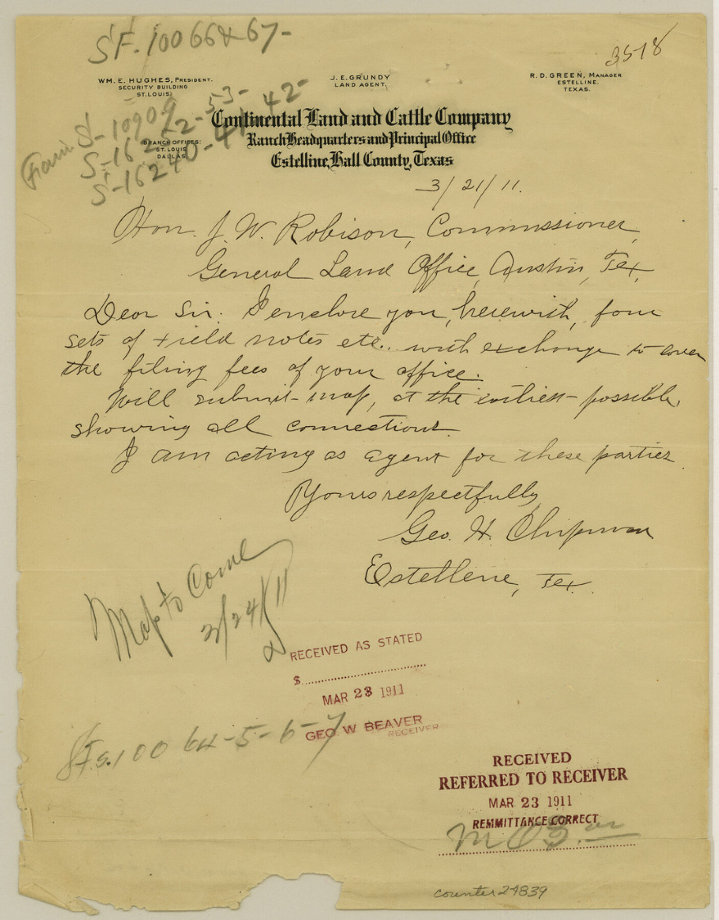
Hall County Sketch File 32
[Report on D. P. RR. Co. Block S5]
-
Map/Doc
24839
-
Collection
General Map Collection
-
Object Dates
1911/8/31 (Creation Date)
1911/9/2 (File Date)
-
People and Organizations
George H. Chipman (Surveyor/Engineer)
B.F. Moore (Surveyor/Engineer)
-
Counties
Hall Cottle Motley
-
Subjects
Surveying Sketch File
-
Height x Width
11.2 x 8.8 inches
28.4 x 22.4 cm
-
Medium
multi-page, multi-format
Part of: General Map Collection
Terrell County Sketch File 40
![38005, Terrell County Sketch File 40, General Map Collection](https://historictexasmaps.com/wmedia_w700/pdf_converted_jpg/qi_pdf_thumbnail_14488.jpg)
Print $6.00
- Digital $50.00
Terrell County Sketch File 40
1995
Size 14.2 x 8.9 inches
Map/Doc 38005
Bee County Working Sketch 30
![67281, Bee County Working Sketch 30, General Map Collection](https://historictexasmaps.com/wmedia_w700/maps/67281.tif.jpg)
Print $20.00
- Digital $50.00
Bee County Working Sketch 30
1950
Size 12.7 x 15.7 inches
Map/Doc 67281
Fayette County
![77278, Fayette County, General Map Collection](https://historictexasmaps.com/wmedia_w700/maps/77278.tif.jpg)
Print $40.00
- Digital $50.00
Fayette County
1978
Size 42.8 x 54.5 inches
Map/Doc 77278
Reeves County Rolled Sketch 10A
![7481, Reeves County Rolled Sketch 10A, General Map Collection](https://historictexasmaps.com/wmedia_w700/maps/7481.tif.jpg)
Print $20.00
- Digital $50.00
Reeves County Rolled Sketch 10A
Size 22.7 x 42.0 inches
Map/Doc 7481
Flight Mission No. CLL-1N, Frame 87, Willacy County
![87033, Flight Mission No. CLL-1N, Frame 87, Willacy County, General Map Collection](https://historictexasmaps.com/wmedia_w700/pdf_converted_jpg/qi_pdf_thumbnail_34167.jpg)
Print $20.00
- Digital $50.00
Flight Mission No. CLL-1N, Frame 87, Willacy County
1954
Size 18.3 x 22.0 inches
Map/Doc 87033
Hudspeth County Working Sketch 8
![66289, Hudspeth County Working Sketch 8, General Map Collection](https://historictexasmaps.com/wmedia_w700/maps/66289-1.tif.jpg)
Print $20.00
- Digital $50.00
Hudspeth County Working Sketch 8
Size 27.3 x 33.1 inches
Map/Doc 66289
Nueces County Sketch File 26a
![32581, Nueces County Sketch File 26a, General Map Collection](https://historictexasmaps.com/wmedia_w700/pdf_converted_jpg/qi_pdf_thumbnail_13351.jpg)
Print $14.00
- Digital $50.00
Nueces County Sketch File 26a
1894
Size 12.6 x 7.9 inches
Map/Doc 32581
Maps of Gulf Intracoastal Waterway, Texas - Sabine River to the Rio Grande and connecting waterways including ship channels
![61969, Maps of Gulf Intracoastal Waterway, Texas - Sabine River to the Rio Grande and connecting waterways including ship channels, General Map Collection](https://historictexasmaps.com/wmedia_w700/maps/61969.tif.jpg)
Print $20.00
- Digital $50.00
Maps of Gulf Intracoastal Waterway, Texas - Sabine River to the Rio Grande and connecting waterways including ship channels
1966
Size 14.5 x 22.2 inches
Map/Doc 61969
Real County Rolled Sketch 18
![7468, Real County Rolled Sketch 18, General Map Collection](https://historictexasmaps.com/wmedia_w700/maps/7468.tif.jpg)
Print $20.00
- Digital $50.00
Real County Rolled Sketch 18
1986
Size 24.9 x 31.9 inches
Map/Doc 7468
Freestone County State of Texas
![3562, Freestone County State of Texas, General Map Collection](https://historictexasmaps.com/wmedia_w700/maps/3562-1.tif.jpg)
Print $20.00
- Digital $50.00
Freestone County State of Texas
1888
Size 27.2 x 21.6 inches
Map/Doc 3562
Midland County Rolled Sketch 8
![6765, Midland County Rolled Sketch 8, General Map Collection](https://historictexasmaps.com/wmedia_w700/pdf_converted_jpg/qi_pdf_thumbnail_4085.jpg)
Print $80.00
- Digital $50.00
Midland County Rolled Sketch 8
1952
Size 39.8 x 17.8 inches
Map/Doc 6765
Copy of Surveyor's Field Book, Morris Browning - In Blocks 7, 5 & 4, I&GNRRCo., Hutchinson and Carson Counties, Texas
![62268, Copy of Surveyor's Field Book, Morris Browning - In Blocks 7, 5 & 4, I&GNRRCo., Hutchinson and Carson Counties, Texas, General Map Collection](https://historictexasmaps.com/wmedia_w700/maps/62268.tif.jpg)
Print $2.00
- Digital $50.00
Copy of Surveyor's Field Book, Morris Browning - In Blocks 7, 5 & 4, I&GNRRCo., Hutchinson and Carson Counties, Texas
1888
Size 7.0 x 8.9 inches
Map/Doc 62268
You may also like
[Sketch centered around Thos. B. Bell survey 98 showing adjacent and nearby surveys]
![90229, [Sketch centered around Thos. B. Bell survey 98 showing adjacent and nearby surveys], Twichell Survey Records](https://historictexasmaps.com/wmedia_w700/maps/90229-1.tif.jpg)
Print $20.00
- Digital $50.00
[Sketch centered around Thos. B. Bell survey 98 showing adjacent and nearby surveys]
Size 33.0 x 24.1 inches
Map/Doc 90229
Mills County Boundary File Index
![57258, Mills County Boundary File Index, General Map Collection](https://historictexasmaps.com/wmedia_w700/pdf_converted_jpg/qi_pdf_thumbnail_16562.jpg)
Print $2.00
- Digital $50.00
Mills County Boundary File Index
Size 8.8 x 8.9 inches
Map/Doc 57258
Stonewall County Rolled Sketch 36A
![76403, Stonewall County Rolled Sketch 36A, General Map Collection](https://historictexasmaps.com/wmedia_w700/maps/76403.tif.jpg)
Print $20.00
- Digital $50.00
Stonewall County Rolled Sketch 36A
Size 17.6 x 22.4 inches
Map/Doc 76403
Map of Bexar County
![87234, Map of Bexar County, General Map Collection](https://historictexasmaps.com/wmedia_w700/maps/87234.tif.jpg)
Print $20.00
- Digital $50.00
Map of Bexar County
1845
Size 47.4 x 44.9 inches
Map/Doc 87234
Flight Mission No. CRC-3R, Frame 166, Chambers County
![84848, Flight Mission No. CRC-3R, Frame 166, Chambers County, General Map Collection](https://historictexasmaps.com/wmedia_w700/pdf_converted_jpg/qi_pdf_thumbnail_32063.jpg)
Print $20.00
- Digital $50.00
Flight Mission No. CRC-3R, Frame 166, Chambers County
1956
Size 18.8 x 22.4 inches
Map/Doc 84848
Harris County Working Sketch 65
![65957, Harris County Working Sketch 65, General Map Collection](https://historictexasmaps.com/wmedia_w700/maps/65957.tif.jpg)
Print $20.00
- Digital $50.00
Harris County Working Sketch 65
Size 29.5 x 28.6 inches
Map/Doc 65957
Gillespie County Sketch File 6
![24139, Gillespie County Sketch File 6, General Map Collection](https://historictexasmaps.com/wmedia_w700/pdf_converted_jpg/qi_pdf_thumbnail_11371.jpg)
Print $4.00
- Digital $50.00
Gillespie County Sketch File 6
Size 6.4 x 11.0 inches
Map/Doc 24139
Donley County Rolled Sketch 2
![8800, Donley County Rolled Sketch 2, General Map Collection](https://historictexasmaps.com/wmedia_w700/maps/8800.tif.jpg)
Print $20.00
- Digital $50.00
Donley County Rolled Sketch 2
Size 41.8 x 34.3 inches
Map/Doc 8800
Bowie County Sketch File 7b
![14859, Bowie County Sketch File 7b, General Map Collection](https://historictexasmaps.com/wmedia_w700/pdf_converted_jpg/qi_pdf_thumbnail_9518.jpg)
Print $10.00
- Digital $50.00
Bowie County Sketch File 7b
1927
Size 10.7 x 8.6 inches
Map/Doc 14859
El Paso County Rolled Sketch 49
![8875, El Paso County Rolled Sketch 49, General Map Collection](https://historictexasmaps.com/wmedia_w700/maps/8875.tif.jpg)
Print $40.00
- Digital $50.00
El Paso County Rolled Sketch 49
Size 10.5 x 99.9 inches
Map/Doc 8875
Angelina County Working Sketch 13
![67094, Angelina County Working Sketch 13, General Map Collection](https://historictexasmaps.com/wmedia_w700/maps/67094.tif.jpg)
Print $20.00
- Digital $50.00
Angelina County Working Sketch 13
1935
Size 30.8 x 35.4 inches
Map/Doc 67094
Matagorda County Aerial Photograph Index Sheet 4
![83725, Matagorda County Aerial Photograph Index Sheet 4, General Map Collection](https://historictexasmaps.com/wmedia_w700/pdf_converted_jpg/qi_pdf_thumbnail_30946.jpg)
Print $20.00
- Digital $50.00
Matagorda County Aerial Photograph Index Sheet 4
1953
Size 23.6 x 19.5 inches
Map/Doc 83725