Cherokee County Sketch File 29
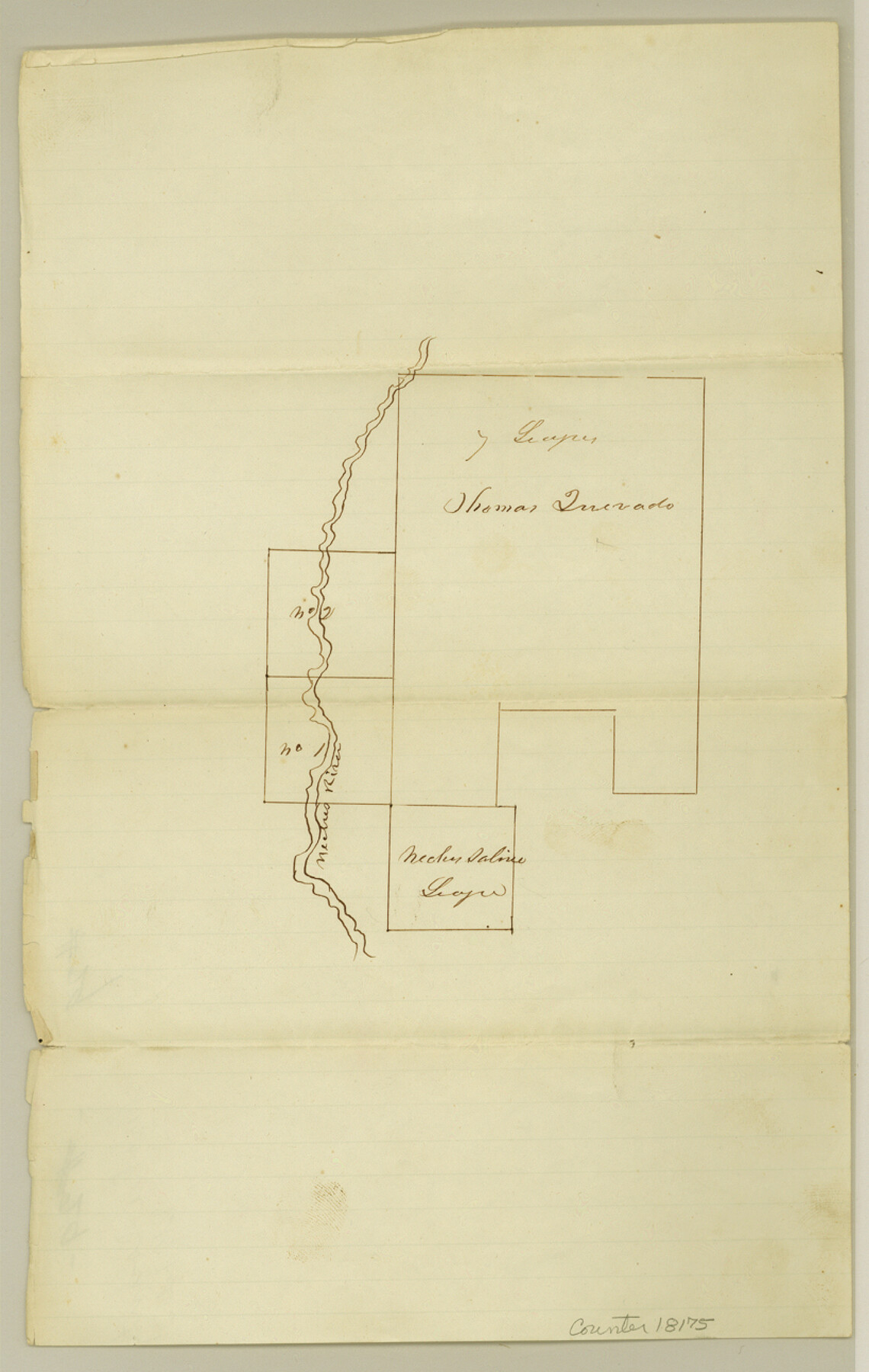
[Sketch along Neches River near Thomas Quevado 7 league grant in Smith County]
-
Map/Doc
18175
-
Collection
General Map Collection
-
Counties
Smith
-
Subjects
Surveying Sketch File
-
Height x Width
12.9 x 8.2 inches
32.8 x 20.8 cm
-
Medium
paper, manuscript
-
Features
Neches River
Part of: General Map Collection
Liberty County Working Sketch 91

Print $40.00
- Digital $50.00
Liberty County Working Sketch 91
1919
Size 48.4 x 43.0 inches
Map/Doc 65459
Hudspeth County Sketch File 23

Print $20.00
- Digital $50.00
Hudspeth County Sketch File 23
1935
Size 15.1 x 26.9 inches
Map/Doc 11801

Jackson County Boundary File 3

Print $10.00
- Digital $50.00
Jackson County Boundary File 3
Size 10.9 x 8.7 inches
Map/Doc 55455
Kent County Sketch File 9

Print $8.00
- Digital $50.00
Kent County Sketch File 9
Size 10.3 x 8.1 inches
Map/Doc 28832
Kerr County Rolled Sketch 22

Print $20.00
- Digital $50.00
Kerr County Rolled Sketch 22
1959
Size 35.7 x 30.2 inches
Map/Doc 9349
Orange County Sketch File 26

Print $20.00
- Digital $50.00
Orange County Sketch File 26
Size 38.5 x 29.3 inches
Map/Doc 10564
Lubbock County Boundary File 4

Print $4.00
- Digital $50.00
Lubbock County Boundary File 4
Size 11.2 x 8.8 inches
Map/Doc 56491
Houston & Texas Central Railway Through Bastrop County

Print $40.00
- Digital $50.00
Houston & Texas Central Railway Through Bastrop County
1916
Size 21.3 x 116.5 inches
Map/Doc 64418

Chambers County Sketch File 15

Print $4.00
- Digital $50.00
Chambers County Sketch File 15
Size 8.3 x 12.4 inches
Map/Doc 17563
Ochiltree County Working Sketch 5

Print $40.00
- Digital $50.00
Ochiltree County Working Sketch 5
1961
Size 110.0 x 37.3 inches
Map/Doc 71318
You may also like
Carson County Rolled Sketch 1

Print $20.00
- Digital $50.00
Carson County Rolled Sketch 1
Size 31.2 x 33.4 inches
Map/Doc 8580
Land for Sale or Lease in Garza and Crosby County, 13 miles S 10° W from center of Crosby County

Print $2.00
- Digital $50.00
Land for Sale or Lease in Garza and Crosby County, 13 miles S 10° W from center of Crosby County
Size 9.0 x 14.3 inches
Map/Doc 90367
Montgomery County Working Sketch 1

Print $20.00
- Digital $50.00
Montgomery County Working Sketch 1
1912
Size 20.8 x 17.1 inches
Map/Doc 71107
Eastland County Rolled Sketch 19

Print $20.00
- Digital $50.00
Eastland County Rolled Sketch 19
1980
Size 28.9 x 30.9 inches
Map/Doc 8825
Williamson County

Print $20.00
- Digital $50.00
Williamson County
1919
Size 22.5 x 29.8 inches
Map/Doc 4643
Freestone County Rolled Sketch 3

Print $67.00
- Digital $50.00
Freestone County Rolled Sketch 3
Size 10.4 x 15.5 inches
Map/Doc 44784
Roberts County Working Sketch 41

Print $20.00
- Digital $50.00
Roberts County Working Sketch 41
1978
Size 26.6 x 22.6 inches
Map/Doc 63567
Travels to the source of the Missouri River and across the American Continent to the Pacific Ocean - Vol. 3

Travels to the source of the Missouri River and across the American Continent to the Pacific Ocean - Vol. 3
1815
Map/Doc 97414
[Surveys in the Travis District along the Colorado River]
![120, [Surveys in the Travis District along the Colorado River], General Map Collection](https://historictexasmaps.com/wmedia_w700/maps/120-2.tif.jpg)
Print $3.00
- Digital $50.00
[Surveys in the Travis District along the Colorado River]
1841
Size 7.0 x 16.5 inches
Map/Doc 120
Texas State Boundary Line 9

Print $174.00
Texas State Boundary Line 9
2000
Size 11.3 x 8.8 inches
Map/Doc 75076
Brooks County

Print $20.00
- Digital $50.00
Brooks County
1955
Size 42.0 x 34.2 inches
Map/Doc 73091
Brewster County Rolled Sketch 146A

Print $40.00
- Digital $50.00
Brewster County Rolled Sketch 146A
Size 62.4 x 45.1 inches
Map/Doc 8527