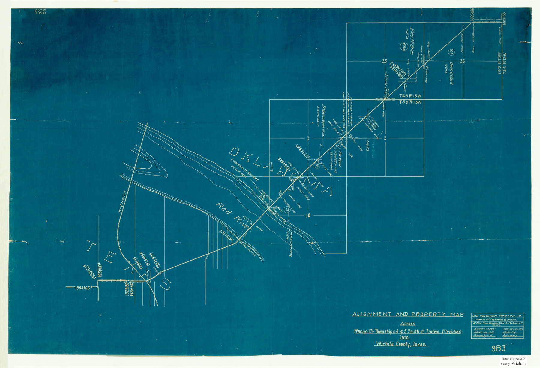
Wichita County Sketch File 26
Alignment and property map across Range 13, Townships 4 & 5 south of Indian Meridian into Wichita County, Texas.
-
Map/Doc
12686
-
Collection
General Map Collection
-
Object Dates
12/30/1919 (Creation Date)
-
Counties
Wichita
-
Subjects
Surveying Sketch File
-
Height x Width
24.9 x 36.6 inches
63.3 x 93.0 cm
-
Medium
blueprint/diazo
-
Scale
1" = 1000 feet
-
Features
Red River
WF&NW
Part of: General Map Collection
Hudspeth County Rolled Sketch 41

Print $40.00
- Digital $50.00
Hudspeth County Rolled Sketch 41
1947
Size 11.3 x 96.3 inches
Map/Doc 9214
Sutton County Working Sketch 15

Print $40.00
- Digital $50.00
Sutton County Working Sketch 15
1972
Size 37.0 x 81.1 inches
Map/Doc 62358
Map of the upper surveys in Robertson's Colony Sold by the State of Coahuila and Texas

Print $20.00
- Digital $50.00
Map of the upper surveys in Robertson's Colony Sold by the State of Coahuila and Texas
Size 26.8 x 22.0 inches
Map/Doc 82
Willacy County Sketch File 1

Print $30.00
- Digital $50.00
Willacy County Sketch File 1
1981
Size 11.2 x 8.6 inches
Map/Doc 40234
Montague County Boundary File 1

Print $32.00
- Digital $50.00
Montague County Boundary File 1
Size 12.8 x 8.1 inches
Map/Doc 57399
Map of the City of Washington showing location of fatal cases of Diphtheria and Scarlet Fever; also number of cases thereof reported to the Health Department during the year ending June 30, 1896

Print $20.00
- Digital $50.00
Map of the City of Washington showing location of fatal cases of Diphtheria and Scarlet Fever; also number of cases thereof reported to the Health Department during the year ending June 30, 1896
1896
Size 30.0 x 29.4 inches
Map/Doc 97103
Flight Mission No. DQN-2K, Frame 122, Calhoun County

Print $4.00
- Digital $50.00
Flight Mission No. DQN-2K, Frame 122, Calhoun County
1953
Size 18.5 x 22.2 inches
Map/Doc 84298
Taylor County Boundary File 1

Print $44.00
- Digital $50.00
Taylor County Boundary File 1
Size 8.4 x 8.2 inches
Map/Doc 59184
Kent County Boundary File 8

Print $20.00
- Digital $50.00
Kent County Boundary File 8
Size 14.2 x 8.6 inches
Map/Doc 55873
Donley County Sketch File 7

Print $20.00
- Digital $50.00
Donley County Sketch File 7
Size 38.3 x 38.2 inches
Map/Doc 10367
Floyd County Rolled Sketch 10

Print $20.00
- Digital $50.00
Floyd County Rolled Sketch 10
1953
Size 37.8 x 25.0 inches
Map/Doc 5883
Brazoria County Working Sketch 14

Print $20.00
- Digital $50.00
Brazoria County Working Sketch 14
1940
Size 33.6 x 43.9 inches
Map/Doc 67499
You may also like
Flight Mission No. BRE-5P, Frame 191, Nueces County

Print $20.00
- Digital $50.00
Flight Mission No. BRE-5P, Frame 191, Nueces County
1956
Size 18.7 x 22.5 inches
Map/Doc 86837
Working Sketch in Gaines and Dawson Counties

Print $20.00
- Digital $50.00
Working Sketch in Gaines and Dawson Counties
1939
Size 43.4 x 45.3 inches
Map/Doc 93254
Right of Way and Track Map, Houston & Texas Central R.R. operated by the T. and N. O. R.R., Fort Worth Branch

Print $40.00
- Digital $50.00
Right of Way and Track Map, Houston & Texas Central R.R. operated by the T. and N. O. R.R., Fort Worth Branch
1918
Size 30.9 x 56.9 inches
Map/Doc 64783
Coast Chart No. 210 - Aransas Pass and Corpus Christi Bay with the coast to latitude 27° 12', Texas

Print $20.00
- Digital $50.00
Coast Chart No. 210 - Aransas Pass and Corpus Christi Bay with the coast to latitude 27° 12', Texas
1907
Size 15.4 x 23.5 inches
Map/Doc 73451

Flight Mission No. DQO-1K, Frame 39, Galveston County

Print $20.00
- Digital $50.00
Flight Mission No. DQO-1K, Frame 39, Galveston County
1952
Size 18.8 x 22.6 inches
Map/Doc 84982
Flight Mission No. DQN-4K, Frame 3, Calhoun County

Print $20.00
- Digital $50.00
Flight Mission No. DQN-4K, Frame 3, Calhoun County
1953
Size 18.9 x 22.4 inches
Map/Doc 84368
Crosby County Working Sketch 12

Print $20.00
- Digital $50.00
Crosby County Working Sketch 12
1953
Size 26.0 x 29.8 inches
Map/Doc 68446
![94196, New Mexico [Recto], General Map Collection](https://historictexasmaps.com/wmedia_w700/maps/94196.tif.jpg)
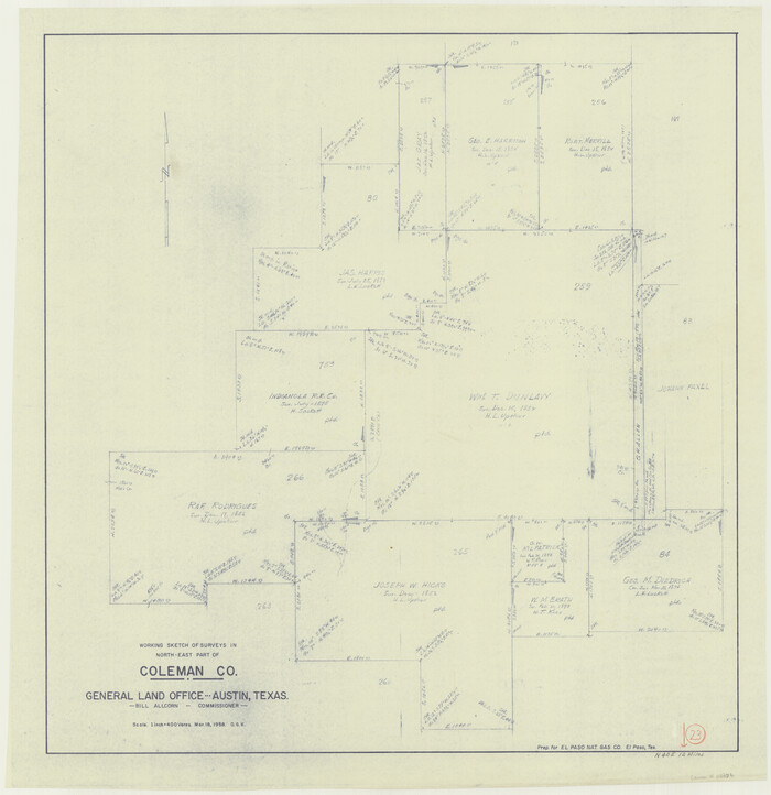
Coleman County Working Sketch 23
Print $20.00
- Digital $50.00
Coleman County Working Sketch 23
1958
Size 30.4 x 29.5 inches
Map/Doc 68276

[Leagues 212- 217, 241- 244, and Vicinity]
![91430, [Leagues 212- 217, 241- 244, and Vicinity], Twichell Survey Records](https://historictexasmaps.com/wmedia_w700/maps/91430-1.tif.jpg)
Print $20.00
- Digital $50.00
[Leagues 212- 217, 241- 244, and Vicinity]
1902
Size 20.6 x 6.4 inches
Map/Doc 91430