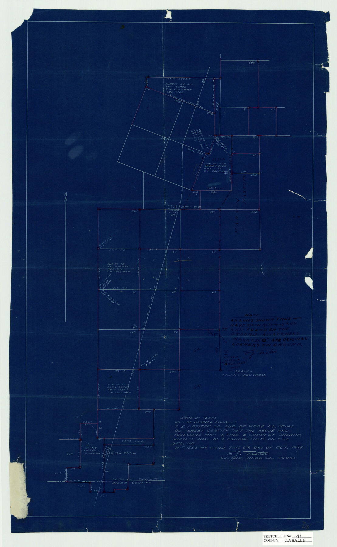
La Salle County Sketch File 41
Sketch of Surveys Around Atlee Sta., La Salle County, Texas
-
Map/Doc
11986
-
Collection
General Map Collection
-
Object Dates
1918/10/8 (Creation Date)
1919/2/6 (File Date)
-
People and Organizations
E.J. Foster (Surveyor/Engineer)
-
Counties
La Salle Webb
-
Subjects
Surveying Sketch File
-
Height x Width
25.8 x 15.9 inches
65.5 x 40.4 cm
-
Medium
blueprint/diazo
-
Scale
1" = 1000 varas
-
Features
Atlee
I&GN
Encinal
Part of: General Map Collection
Stephens County Sketch File 15

Print $4.00
- Digital $50.00
Stephens County Sketch File 15
1890
Size 9.1 x 6.7 inches
Map/Doc 37068
Sterling County Sketch File 20

Print $12.00
- Digital $50.00
Sterling County Sketch File 20
1952
Size 11.2 x 8.7 inches
Map/Doc 37173
Lay's Map of the United States

Print $40.00
- Digital $50.00
Lay's Map of the United States
Size 55.0 x 61.7 inches
Map/Doc 95693
[Beaumont, Sour Lake and Western Ry. Right of Way and Alignment - Frisco]
![64110, [Beaumont, Sour Lake and Western Ry. Right of Way and Alignment - Frisco], General Map Collection](https://historictexasmaps.com/wmedia_w700/maps/64110.tif.jpg)
Print $20.00
- Digital $50.00
[Beaumont, Sour Lake and Western Ry. Right of Way and Alignment - Frisco]
1910
Size 20.2 x 46.3 inches
Map/Doc 64110
Lipscomb County Rolled Sketch 7

Print $20.00
- Digital $50.00
Lipscomb County Rolled Sketch 7
1968
Size 23.6 x 23.4 inches
Map/Doc 6630
Leon County Working Sketch 36

Print $20.00
- Digital $50.00
Leon County Working Sketch 36
1978
Size 36.1 x 32.5 inches
Map/Doc 70435
Pecos County Rolled Sketch 190

Print $20.00
- Digital $50.00
Pecos County Rolled Sketch 190
2005
Size 20.3 x 26.1 inches
Map/Doc 83284
Right of Way & Track Map, San Antonio & Aransas Pass Railway Co.

Print $40.00
- Digital $50.00
Right of Way & Track Map, San Antonio & Aransas Pass Railway Co.
1919
Size 25.0 x 56.7 inches
Map/Doc 64215
Wichita County Working Sketch 12b

Print $20.00
- Digital $50.00
Wichita County Working Sketch 12b
1920
Size 21.2 x 14.9 inches
Map/Doc 72522
Crockett County Rolled Sketch 88C

Print $20.00
- Digital $50.00
Crockett County Rolled Sketch 88C
1973
Size 36.3 x 38.1 inches
Map/Doc 8728
Fractional Township No. 9 South Range No. 11 East of the Indian Meridian, Indian Territory

Print $20.00
- Digital $50.00
Fractional Township No. 9 South Range No. 11 East of the Indian Meridian, Indian Territory
1898
Size 19.3 x 24.4 inches
Map/Doc 75220
Val Verde County Sketch File 18

Print $8.00
- Digital $50.00
Val Verde County Sketch File 18
1883
Size 13.1 x 8.4 inches
Map/Doc 39225
You may also like
Walker County Working Sketch 5

Print $20.00
- Digital $50.00
Walker County Working Sketch 5
1934
Size 24.5 x 30.8 inches
Map/Doc 72285
Galveston County Sketch File 73

Print $78.00
- Digital $50.00
Galveston County Sketch File 73
1998
Size 11.3 x 8.8 inches
Map/Doc 23980
[Surveying Sketch of T. & N. O. R. R. Co., S. P. R. R. Co., E. T. R. R. Co., et al in Dallam, Hartley, Sherman & Moore Counties, Texas]
![75824, [Surveying Sketch of T. & N. O. R. R. Co., S. P. R. R. Co., E. T. R. R. Co., et al in Dallam, Hartley, Sherman & Moore Counties, Texas], Maddox Collection](https://historictexasmaps.com/wmedia_w700/maps/75824.tif.jpg)
Print $20.00
- Digital $50.00
[Surveying Sketch of T. & N. O. R. R. Co., S. P. R. R. Co., E. T. R. R. Co., et al in Dallam, Hartley, Sherman & Moore Counties, Texas]
Size 17.5 x 22.1 inches
Map/Doc 75824
Harris County Sketch File 32

Print $14.00
- Digital $50.00
Harris County Sketch File 32
1900
Size 6.7 x 8.8 inches
Map/Doc 25429
Liberty County Working Sketch 67

Print $20.00
- Digital $50.00
Liberty County Working Sketch 67
1971
Size 35.3 x 44.5 inches
Map/Doc 70527
Dickens County Sketch File 29

Print $6.00
- Digital $50.00
Dickens County Sketch File 29
1921
Size 5.9 x 8.8 inches
Map/Doc 21016
Brewster County Sketch File 53

Print $94.00
- Digital $50.00
Brewster County Sketch File 53
1910
Size 13.3 x 8.9 inches
Map/Doc 16361
Hutchinson County Sketch File 53

Print $2.00
- Digital $50.00
Hutchinson County Sketch File 53
2000
Size 11.2 x 8.8 inches
Map/Doc 27455
Kendall County Sketch File 22B

Print $20.00
- Digital $50.00
Kendall County Sketch File 22B
1937
Size 19.3 x 24.6 inches
Map/Doc 11911
Galveston County NRC Article 33.136 Sketch 13

Print $20.00
- Digital $50.00
Galveston County NRC Article 33.136 Sketch 13
2002
Size 17.9 x 22.4 inches
Map/Doc 77044
El Paso County Rolled Sketch 65

Print $20.00
- Digital $50.00
El Paso County Rolled Sketch 65
2012
Size 24.5 x 36.8 inches
Map/Doc 93327
Milam County Working Sketch 10

Print $20.00
- Digital $50.00
Milam County Working Sketch 10
1986
Size 25.5 x 34.6 inches
Map/Doc 71025