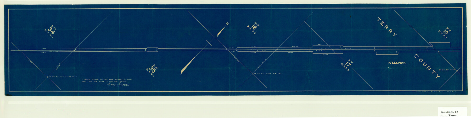
Terry County Sketch File 12
[Sketch of South Plains and Santa Fe Railroad ROW in the north part of Block DD in the south part of the county]
-
Map/Doc
10396
-
Collection
General Map Collection
-
Object Dates
9/2/1931 (File Date)
-
People and Organizations
Sylvan Sanders (Surveyor/Engineer)
-
Counties
Terry
-
Subjects
Surveying Sketch File
-
Height x Width
10.9 x 43.2 inches
27.7 x 109.7 cm
-
Medium
blueprint/diazo
Part of: General Map Collection
Flight Mission No. BRA-7M, Frame 9, Jefferson County

Print $20.00
- Digital $50.00
Flight Mission No. BRA-7M, Frame 9, Jefferson County
1953
Size 18.7 x 22.3 inches
Map/Doc 85460
San Patricio County Rolled Sketch 37

Print $127.00
- Digital $50.00
San Patricio County Rolled Sketch 37
Size 10.3 x 15.2 inches
Map/Doc 48888
Hudspeth County Working Sketch 31

Print $40.00
- Digital $50.00
Hudspeth County Working Sketch 31
1972
Size 56.2 x 41.2 inches
Map/Doc 66314
Crosby County

Print $20.00
- Digital $50.00
Crosby County
1927
Size 41.2 x 36.4 inches
Map/Doc 95472
Oso Creek, Cabaniss Field (P-2) Sheet

Print $6.00
- Digital $50.00
Oso Creek, Cabaniss Field (P-2) Sheet
1942
Size 36.1 x 25.8 inches
Map/Doc 65097
Red River County Sketch File 14

Print $8.00
- Digital $50.00
Red River County Sketch File 14
Size 13.7 x 9.0 inches
Map/Doc 35133
Northeast Part of Crockett County

Print $20.00
- Digital $50.00
Northeast Part of Crockett County
1976
Size 35.6 x 47.0 inches
Map/Doc 95469
Flight Mission No. CRC-2R, Frame 54, Chambers County

Print $20.00
- Digital $50.00
Flight Mission No. CRC-2R, Frame 54, Chambers County
1956
Size 18.5 x 22.3 inches
Map/Doc 84727
Map of San Jacinto County

Print $20.00
- Digital $50.00
Map of San Jacinto County
1872
Size 22.0 x 18.6 inches
Map/Doc 1346
[Surveys in Polk County]
![69751, [Surveys in Polk County], General Map Collection](https://historictexasmaps.com/wmedia_w700/maps/69751.tif.jpg)
Print $2.00
- Digital $50.00
[Surveys in Polk County]
1847
Size 4.6 x 6.6 inches
Map/Doc 69751
Red River County Sketch File 1a

Print $4.00
- Digital $50.00
Red River County Sketch File 1a
1854
Size 12.7 x 8.0 inches
Map/Doc 35093
Hutchinson County Sketch File 31

Print $20.00
- Digital $50.00
Hutchinson County Sketch File 31
Size 19.9 x 15.2 inches
Map/Doc 11819
You may also like
[Floyd County School Land Lgs. 180-183, Fisher County School Land Lgs. 105-108, and part of Blk. V]
![90191, [Floyd County Schoo Land Lgs. 180-183, Fisher County School Land Lgs. 105-108, and part of Blk. V], Twichell Survey Records](https://historictexasmaps.com/wmedia_w700/maps/90191-1.tif.jpg)
Print $2.00
- Digital $50.00
[Floyd County School Land Lgs. 180-183, Fisher County School Land Lgs. 105-108, and part of Blk. V]
Size 8.8 x 10.3 inches
Map/Doc 90191
Aransas County Boundary File 1

Print $14.00
- Digital $50.00
Aransas County Boundary File 1
Size 14.2 x 8.6 inches
Map/Doc 49774
Capitol Lands survey by J. T. Munson

Print $20.00
- Digital $50.00
Capitol Lands survey by J. T. Munson
Size 24.8 x 20.4 inches
Map/Doc 90585
Presidio County Sketch File 58a

Print $14.00
- Digital $50.00
Presidio County Sketch File 58a
1980
Size 11.2 x 8.8 inches
Map/Doc 34628
Sketch E No. 3 Shewing the progress of the Survey at North & South Edisto Rivers and St. Helena Sound, South Carolina

Print $20.00
- Digital $50.00
Sketch E No. 3 Shewing the progress of the Survey at North & South Edisto Rivers and St. Helena Sound, South Carolina
1852
Size 10.9 x 19.5 inches
Map/Doc 97215
Amistad International Reservoir on Rio Grande 100

Print $20.00
- Digital $50.00
Amistad International Reservoir on Rio Grande 100
1950
Size 28.5 x 40.8 inches
Map/Doc 75531
Karnes County Working Sketch 7

Print $20.00
- Digital $50.00
Karnes County Working Sketch 7
1961
Size 20.8 x 24.2 inches
Map/Doc 66655
Brewster County Sketch File FN-35

Print $8.00
- Digital $50.00
Brewster County Sketch File FN-35
1979
Size 14.2 x 8.9 inches
Map/Doc 15861
San Jacinto County Sketch File 24

Print $18.00
San Jacinto County Sketch File 24
2001
Size 14.5 x 8.9 inches
Map/Doc 35816
[Worksheets related to the Wilson Strickland survey and vicinity]
![91281, [Worksheets related to the Wilson Strickland survey and vicinity], Twichell Survey Records](https://historictexasmaps.com/wmedia_w700/maps/91281-1.tif.jpg)
Print $20.00
- Digital $50.00
[Worksheets related to the Wilson Strickland survey and vicinity]
Size 22.6 x 10.2 inches
Map/Doc 91281
General Highway Map, Hidalgo County, Texas

Print $20.00
General Highway Map, Hidalgo County, Texas
1940
Size 18.4 x 25.0 inches
Map/Doc 79128
C. A. Pierce's Subdivision of Dick Slaughter Land

Print $20.00
- Digital $50.00
C. A. Pierce's Subdivision of Dick Slaughter Land
Size 37.7 x 17.1 inches
Map/Doc 90301