Navarro County Rolled Sketch 6

Print $40.00
- Digital $50.00
Navarro County Rolled Sketch 6
Size: 43.1 x 50.8 inches
10307
Navarro County Rolled Sketch 7

Print $20.00
- Digital $50.00
Navarro County Rolled Sketch 7
Size: 45.0 x 34.6 inches
10308
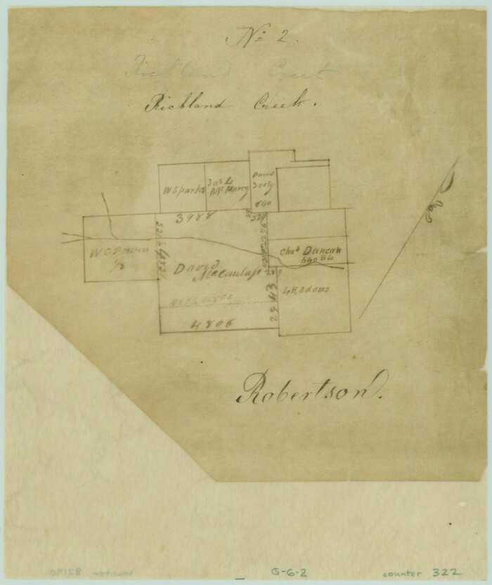
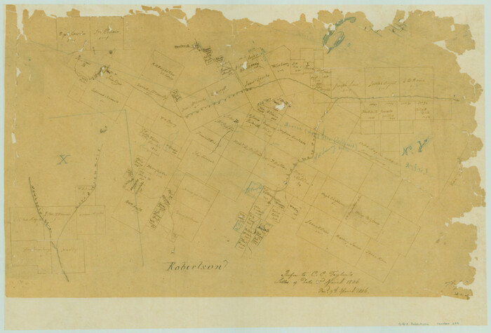
Sketch Richland Creek, Robertson Co.

Print $2.00
- Digital $50.00
Sketch Richland Creek, Robertson Co.
Size: 10.4 x 7.9 inches
266
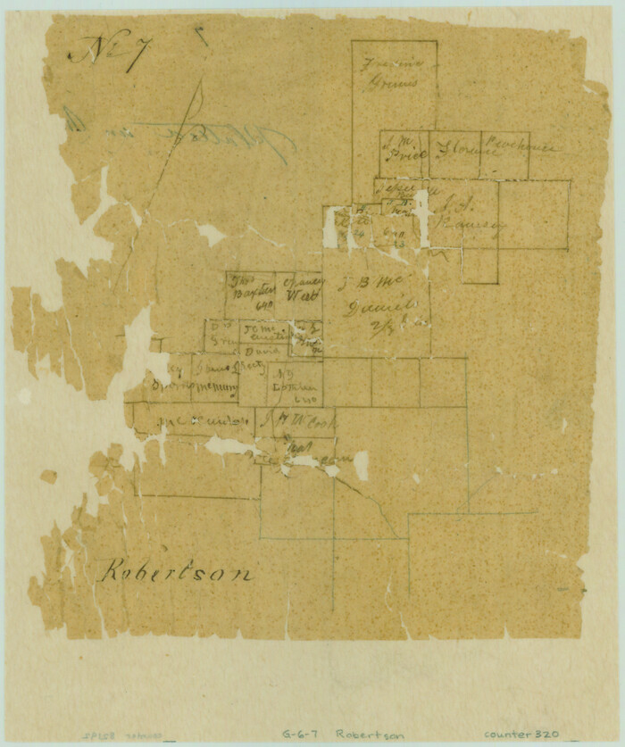
[Surveys along Richland Creek]
Print $2.00
- Digital $50.00
[Surveys along Richland Creek]
Size: 7.2 x 6.0 inches
320
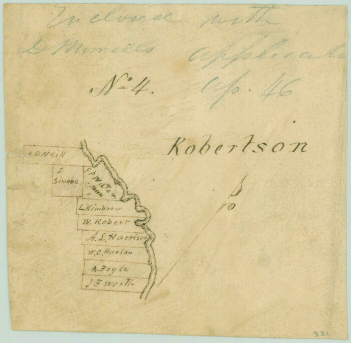
[Surveys along the Trinity River]
Print $2.00
- Digital $50.00
[Surveys along the Trinity River]
Size: 3.6 x 3.7 inches
321
[Surveys along Richland Creek]
Print $2.00
- Digital $50.00
[Surveys along Richland Creek]
Size: 6.0 x 5.0 inches
322
Navarro County Sketch File 1

Print $4.00
- Digital $50.00
Navarro County Sketch File 1
Size: 9.9 x 8.0 inches
32296
Navarro County Sketch File 9

Print $2.00
- Digital $50.00
Navarro County Sketch File 9
Size: 8.3 x 9.1 inches
32317
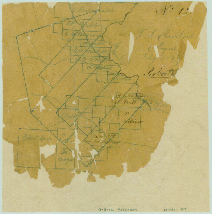
Navarro County Sketch File 12

Print $4.00
- Digital $50.00
Navarro County Sketch File 12
Size: 7.0 x 7.0 inches
32322
Navarro County Sketch File 13

Print $22.00
- Digital $50.00
Navarro County Sketch File 13
Size: 12.0 x 8.6 inches
32324
Navarro County Boundary File 1

Print $66.00
- Digital $50.00
Navarro County Boundary File 1
Size: 10.3 x 8.2 inches
57582
Navarro County Boundary File 1a

Print $42.00
- Digital $50.00
Navarro County Boundary File 1a
Size: 9.5 x 6.1 inches
57605
Navarro County Boundary File 2

Print $12.00
- Digital $50.00
Navarro County Boundary File 2
Size: 8.8 x 3.9 inches
57608
Map of the Houston & Texas Centr. R.R. from Corsicana, Navarro County, to Dallas, Dallas County

Print $40.00
- Digital $50.00
Map of the Houston & Texas Centr. R.R. from Corsicana, Navarro County, to Dallas, Dallas County
Size: 27.6 x 88.3 inches
64041
Map of the Line of the H. & Texas Cen. Railway from the Navasota River, 72 1/2 Miles from Houston, to Corsicana in Navarro Co., 211 mls from Houston

Print $40.00
- Digital $50.00
Map of the Line of the H. & Texas Cen. Railway from the Navasota River, 72 1/2 Miles from Houston, to Corsicana in Navarro Co., 211 mls from Houston
Size: 39.2 x 61.4 inches
64086
[Map of the Line of the H. & Texas Cen. Railway from the Navasota River, 72 1/2 Miles from Houston, to Corsicana in Navarro Co., 211 mls from Houston]
Print $40.00
- Digital $50.00
[Map of the Line of the H. & Texas Cen. Railway from the Navasota River, 72 1/2 Miles from Houston, to Corsicana in Navarro Co., 211 mls from Houston]
Size: 75.6 x 39.6 inches
64087
Navarro County Working Sketch 1b

Print $20.00
- Digital $50.00
Navarro County Working Sketch 1b
Size: 32.5 x 44.6 inches
71230
Navarro County Working Sketch 1c

Print $2.00
- Digital $50.00
Navarro County Working Sketch 1c
Size: 7.1 x 10.6 inches
71231
English Field Notes of the Spanish Archives - Books SAS, DB4, GWS, JWB, and JWB3

English Field Notes of the Spanish Archives - Books SAS, DB4, GWS, JWB, and JWB3
1835
96551
English Field Notes of the Spanish Archives - Books TJG, DB, A, A2, B, B2, WB, and WR

English Field Notes of the Spanish Archives - Books TJG, DB, A, A2, B, B2, WB, and WR
1835
96553
[Surveys along the Nacogdoches River, Richland Creek, and the Trinity River]
Print $20.00
- Digital $50.00
[Surveys along the Nacogdoches River, Richland Creek, and the Trinity River]
1840
Size: 24.2 x 17.9 inches
85
[Surveys in the Robertson District along the Trinity River and Richland Creek]
Print $20.00
- Digital $50.00
[Surveys in the Robertson District along the Trinity River and Richland Creek]
1841
Size: 15.3 x 12.2 inches
104
[Surveys along Tehuacano and Grindstone Creek, drawings X and Y]
Print $20.00
- Digital $50.00
[Surveys along Tehuacano and Grindstone Creek, drawings X and Y]
1846
Size: 12.4 x 18.3 inches
299
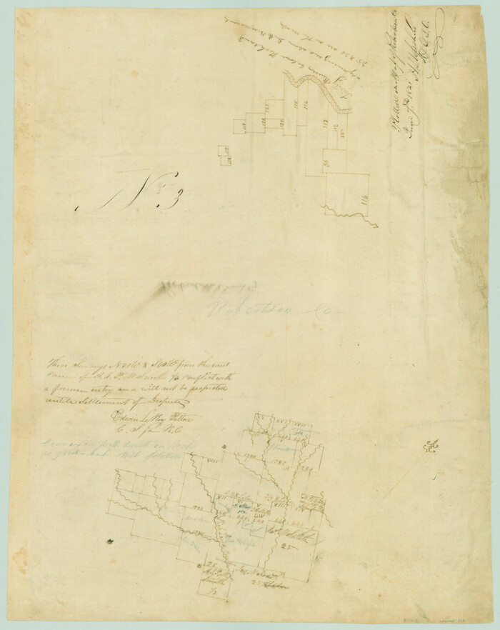
Navarro County Sketch File 3

Print $8.00
- Digital $50.00
Navarro County Sketch File 3
1847
Size: 10.2 x 8.1 inches
32300
[T. J. Chambers' grant]
Print $2.00
- Digital $50.00
[T. J. Chambers' grant]
1847
Size: 7.1 x 7.1 inches
319
Navarro County Sketch File 8

Print $4.00
- Digital $50.00
Navarro County Sketch File 8
1849
Size: 13.2 x 8.5 inches
32315
Navarro County Sketch File 6

Print $6.00
- Digital $50.00
Navarro County Sketch File 6
1849
Size: 6.2 x 8.4 inches
32310
Navarro County Sketch File 5

Print $6.00
- Digital $50.00
Navarro County Sketch File 5
1852
Size: 5.5 x 8.1 inches
32307
Navarro County Sketch File 4

Print $6.00
- Digital $50.00
Navarro County Sketch File 4
1852
Size: 7.5 x 7.2 inches
32304
Navarro County Sketch File 7

Print $4.00
- Digital $50.00
Navarro County Sketch File 7
1854
Size: 12.2 x 8.0 inches
32313
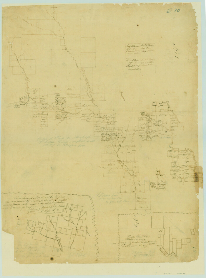
Navarro County Rolled Sketch 6
Print $40.00
- Digital $50.00
Navarro County Rolled Sketch 6
-
Size
43.1 x 50.8 inches
-
Map/Doc
10307
Navarro County Rolled Sketch 7
Print $20.00
- Digital $50.00
Navarro County Rolled Sketch 7
-
Size
45.0 x 34.6 inches
-
Map/Doc
10308
Sketch Richland Creek, Robertson Co.
Print $2.00
- Digital $50.00
Sketch Richland Creek, Robertson Co.
-
Size
10.4 x 7.9 inches
-
Map/Doc
266
[Surveys along Richland Creek]
Print $2.00
- Digital $50.00
[Surveys along Richland Creek]
-
Size
7.2 x 6.0 inches
-
Map/Doc
320
[Surveys along the Trinity River]
Print $2.00
- Digital $50.00
[Surveys along the Trinity River]
-
Size
3.6 x 3.7 inches
-
Map/Doc
321
[Surveys along Richland Creek]
Print $2.00
- Digital $50.00
[Surveys along Richland Creek]
-
Size
6.0 x 5.0 inches
-
Map/Doc
322
Navarro County Sketch File 1
Print $4.00
- Digital $50.00
Navarro County Sketch File 1
-
Size
9.9 x 8.0 inches
-
Map/Doc
32296
Navarro County Sketch File 9
Print $2.00
- Digital $50.00
Navarro County Sketch File 9
-
Size
8.3 x 9.1 inches
-
Map/Doc
32317
Navarro County Sketch File 12
Print $4.00
- Digital $50.00
Navarro County Sketch File 12
-
Size
7.0 x 7.0 inches
-
Map/Doc
32322
Navarro County Sketch File 13
Print $22.00
- Digital $50.00
Navarro County Sketch File 13
-
Size
12.0 x 8.6 inches
-
Map/Doc
32324
Navarro County Boundary File 1
Print $66.00
- Digital $50.00
Navarro County Boundary File 1
-
Size
10.3 x 8.2 inches
-
Map/Doc
57582
Navarro County Boundary File 1a
Print $42.00
- Digital $50.00
Navarro County Boundary File 1a
-
Size
9.5 x 6.1 inches
-
Map/Doc
57605
Navarro County Boundary File 2
Print $12.00
- Digital $50.00
Navarro County Boundary File 2
-
Size
8.8 x 3.9 inches
-
Map/Doc
57608
Map of the Houston & Texas Centr. R.R. from Corsicana, Navarro County, to Dallas, Dallas County
Print $40.00
- Digital $50.00
Map of the Houston & Texas Centr. R.R. from Corsicana, Navarro County, to Dallas, Dallas County
-
Size
27.6 x 88.3 inches
-
Map/Doc
64041
Map of the Line of the H. & Texas Cen. Railway from the Navasota River, 72 1/2 Miles from Houston, to Corsicana in Navarro Co., 211 mls from Houston
Print $40.00
- Digital $50.00
Map of the Line of the H. & Texas Cen. Railway from the Navasota River, 72 1/2 Miles from Houston, to Corsicana in Navarro Co., 211 mls from Houston
-
Size
39.2 x 61.4 inches
-
Map/Doc
64086
[Map of the Line of the H. & Texas Cen. Railway from the Navasota River, 72 1/2 Miles from Houston, to Corsicana in Navarro Co., 211 mls from Houston]
Print $40.00
- Digital $50.00
[Map of the Line of the H. & Texas Cen. Railway from the Navasota River, 72 1/2 Miles from Houston, to Corsicana in Navarro Co., 211 mls from Houston]
-
Size
75.6 x 39.6 inches
-
Map/Doc
64087
Navarro County Working Sketch 1b
Print $20.00
- Digital $50.00
Navarro County Working Sketch 1b
-
Size
32.5 x 44.6 inches
-
Map/Doc
71230
Navarro County Working Sketch 1c
Print $2.00
- Digital $50.00
Navarro County Working Sketch 1c
-
Size
7.1 x 10.6 inches
-
Map/Doc
71231
English Field Notes of the Spanish Archives - Books SAS, DB4, GWS, JWB, and JWB3
English Field Notes of the Spanish Archives - Books SAS, DB4, GWS, JWB, and JWB3
1835
-
Map/Doc
96551
-
Creation Date
1835
English Field Notes of the Spanish Archives - Books TJG, DB, A, A2, B, B2, WB, and WR
English Field Notes of the Spanish Archives - Books TJG, DB, A, A2, B, B2, WB, and WR
1835
-
Map/Doc
96553
-
Creation Date
1835
[Surveys along the Nacogdoches River, Richland Creek, and the Trinity River]
Print $20.00
- Digital $50.00
[Surveys along the Nacogdoches River, Richland Creek, and the Trinity River]
1840
-
Size
24.2 x 17.9 inches
-
Map/Doc
85
-
Creation Date
1840
[Surveys in the Robertson District along the Trinity River and Richland Creek]
Print $20.00
- Digital $50.00
[Surveys in the Robertson District along the Trinity River and Richland Creek]
1841
-
Size
15.3 x 12.2 inches
-
Map/Doc
104
-
Creation Date
1841
[Surveys along Tehuacano and Grindstone Creek, drawings X and Y]
Print $20.00
- Digital $50.00
[Surveys along Tehuacano and Grindstone Creek, drawings X and Y]
1846
-
Size
12.4 x 18.3 inches
-
Map/Doc
299
-
Creation Date
1846
Navarro County Sketch File 3
Print $8.00
- Digital $50.00
Navarro County Sketch File 3
1847
-
Size
10.2 x 8.1 inches
-
Map/Doc
32300
-
Creation Date
1847
[T. J. Chambers' grant]
Print $2.00
- Digital $50.00
[T. J. Chambers' grant]
1847
-
Size
7.1 x 7.1 inches
-
Map/Doc
319
-
Creation Date
1847
Navarro County Sketch File 8
Print $4.00
- Digital $50.00
Navarro County Sketch File 8
1849
-
Size
13.2 x 8.5 inches
-
Map/Doc
32315
-
Creation Date
1849
Navarro County Sketch File 6
Print $6.00
- Digital $50.00
Navarro County Sketch File 6
1849
-
Size
6.2 x 8.4 inches
-
Map/Doc
32310
-
Creation Date
1849
Navarro County Sketch File 5
Print $6.00
- Digital $50.00
Navarro County Sketch File 5
1852
-
Size
5.5 x 8.1 inches
-
Map/Doc
32307
-
Creation Date
1852
Navarro County Sketch File 4
Print $6.00
- Digital $50.00
Navarro County Sketch File 4
1852
-
Size
7.5 x 7.2 inches
-
Map/Doc
32304
-
Creation Date
1852
Navarro County Sketch File 7
Print $4.00
- Digital $50.00
Navarro County Sketch File 7
1854
-
Size
12.2 x 8.0 inches
-
Map/Doc
32313
-
Creation Date
1854