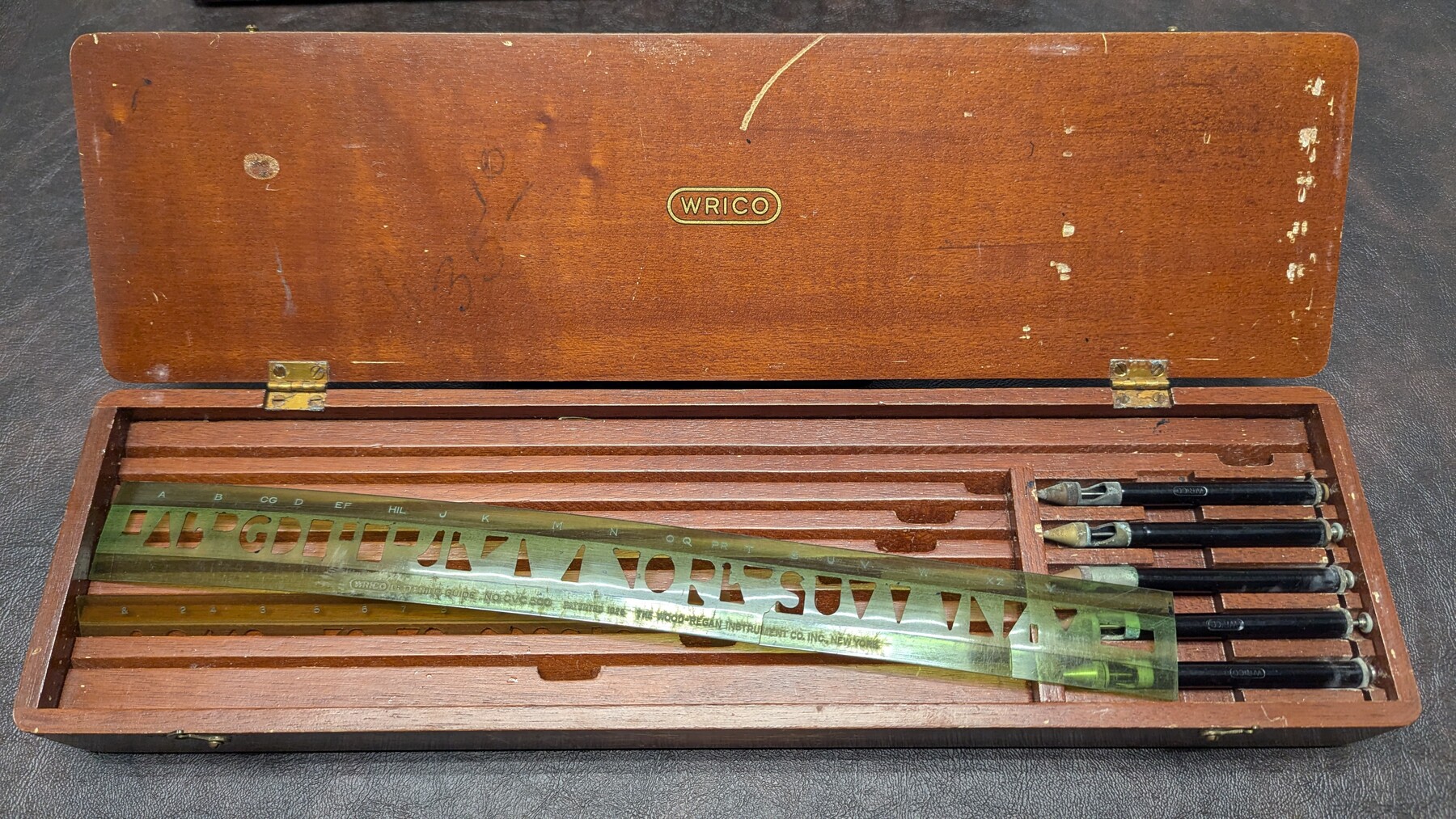
Lettering Set
Manufacturer: Wrico Case: Wooden Box Manufacture Location: New York
-
Map/Doc
97315
-
Collection
Equipment and Tools
-
Height x Width
1.8 x 16.3 inches
4.4 x 41.3 cm
Part of: Equipment and Tools


Half-circle Protractor with Arm and Vernier

Half-circle Protractor with Arm and Vernier
Size 0.8 x 15.0 inches
Map/Doc 97309
K&E Leroy Lettering Set - 3240

K&E Leroy Lettering Set - 3240
1944
Size 1.8 x 15.5 inches
Map/Doc 97314


K&E Compensating Polar Planimeter

K&E Compensating Polar Planimeter
1972
Size 2.1 x 11.6 inches
Map/Doc 97302


You may also like
Map of Swisher County

Print $40.00
- Digital $50.00
Map of Swisher County
1900
Size 48.5 x 41.1 inches
Map/Doc 16890
Wichita County

Print $20.00
- Digital $50.00
Wichita County
1881
Size 18.5 x 19.8 inches
Map/Doc 4143
Edwards County Working Sketch 107

Print $40.00
- Digital $50.00
Edwards County Working Sketch 107
1972
Size 54.5 x 38.8 inches
Map/Doc 68983
Presidio County Working Sketch 95

Print $40.00
- Digital $50.00
Presidio County Working Sketch 95
1976
Size 62.8 x 32.0 inches
Map/Doc 71772
Burnet County Rolled Sketch D1

Print $20.00
- Digital $50.00
Burnet County Rolled Sketch D1
1924
Size 22.2 x 18.5 inches
Map/Doc 5358
Flight Mission No. DCL-6C, Frame 115, Kenedy County

Print $20.00
- Digital $50.00
Flight Mission No. DCL-6C, Frame 115, Kenedy County
1943
Size 18.5 x 22.4 inches
Map/Doc 85945
Calhoun County Rolled Sketch 12

Print $40.00
- Digital $50.00
Calhoun County Rolled Sketch 12
1940
Size 30.2 x 54.8 inches
Map/Doc 43619
Sutton County Sketch File JT

Print $12.00
- Digital $50.00
Sutton County Sketch File JT
Size 14.4 x 8.6 inches
Map/Doc 37453
Llano County Sketch File 13

Print $4.00
- Digital $50.00
Llano County Sketch File 13
1891
Size 9.2 x 15.3 inches
Map/Doc 30387
Blanco County Sketch File 29

Print $40.00
- Digital $50.00
Blanco County Sketch File 29
1888
Size 14.2 x 13.2 inches
Map/Doc 14625
Fannin County Sketch File 13

Print $4.00
- Digital $50.00
Fannin County Sketch File 13
Size 8.1 x 7.9 inches
Map/Doc 22462
Orange County Sketch File A

Print $40.00
- Digital $50.00
Orange County Sketch File A
1890
Size 14.2 x 8.8 inches
Map/Doc 33278