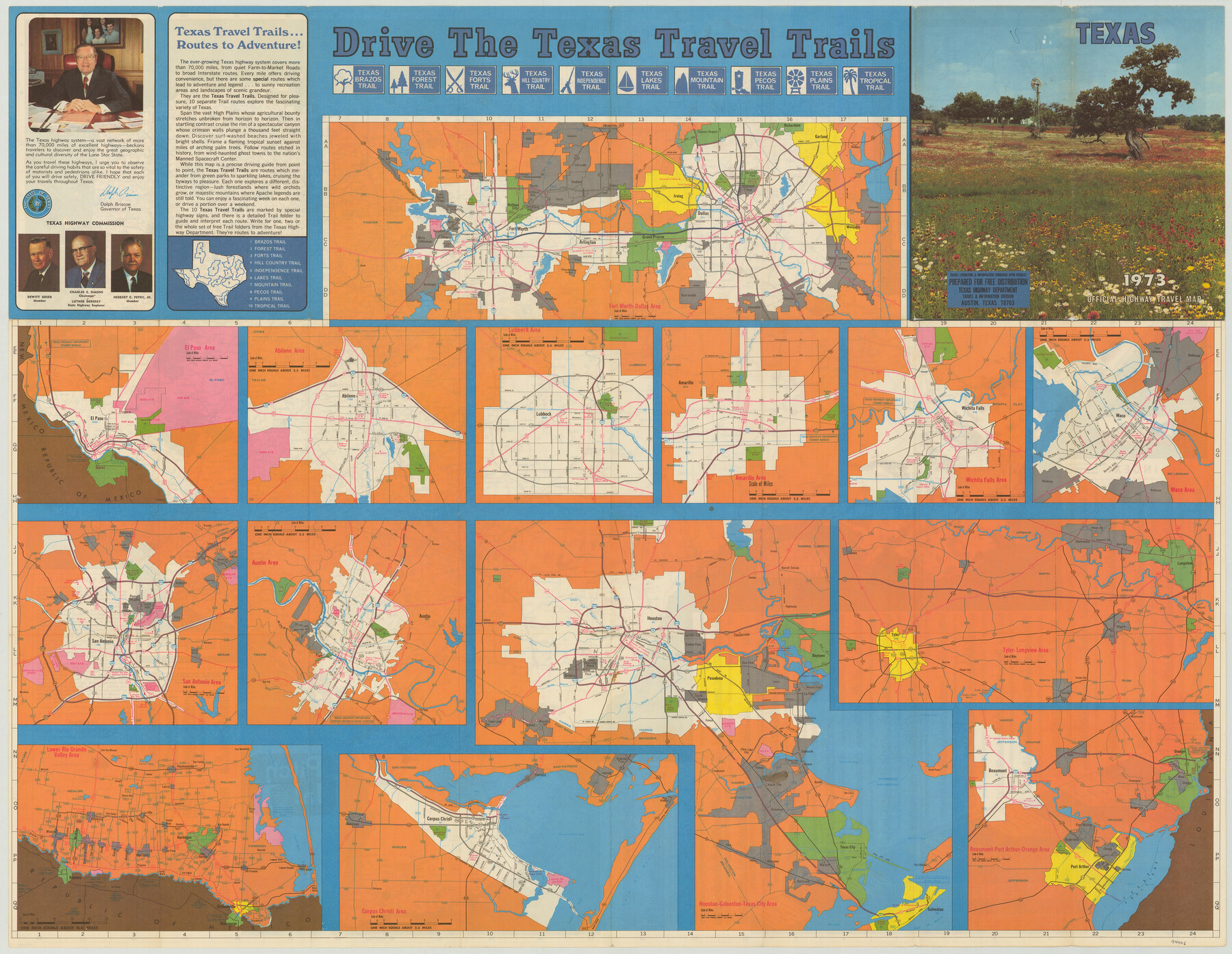
Texas 1973 Official Highway Travel Map
[Verso - various Texas cities]
-
Map/Doc
94406
-
Collection
General Map Collection
-
Object Dates
1973 (Edition Date)
-
People and Organizations
Texas Highway Department (Publisher)
-
Subjects
City
-
Height x Width
28.1 x 36.3 inches
71.4 x 92.2 cm
-
Medium
paper, etching/engraving/lithograph
-
Comments
For map of Texas on recto, see 94405. For research only.
Related maps
Texas 1973 Official Highway Travel Map

Texas 1973 Official Highway Travel Map
Size 28.2 x 36.3 inches
Map/Doc 94405
Part of: General Map Collection
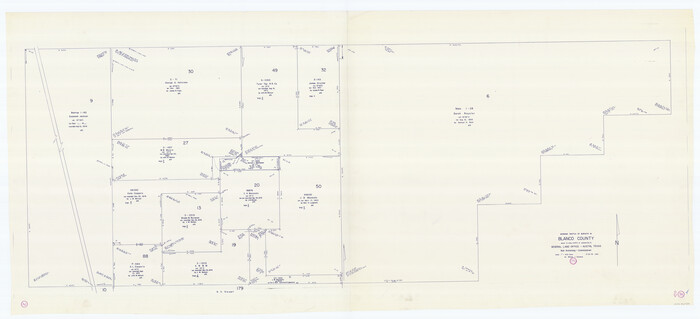
El Paso County Working Sketch 56

Print $40.00
- Digital $50.00
El Paso County Working Sketch 56
1971
Size 65.7 x 43.4 inches
Map/Doc 69078
[Right of Way & Track Map, The Texas & Pacific Ry. Co. Main Line]
![64681, [Right of Way & Track Map, The Texas & Pacific Ry. Co. Main Line], General Map Collection](https://historictexasmaps.com/wmedia_w700/maps/64681.tif.jpg)
Print $20.00
- Digital $50.00
[Right of Way & Track Map, The Texas & Pacific Ry. Co. Main Line]
Size 11.0 x 19.0 inches
Map/Doc 64681
Texas, Copano Bay, Port Bay

Print $40.00
- Digital $50.00
Texas, Copano Bay, Port Bay
1934
Size 32.9 x 48.8 inches
Map/Doc 73432
Knox County Rolled Sketch 19

Print $20.00
- Digital $50.00
Knox County Rolled Sketch 19
1952
Size 27.3 x 24.9 inches
Map/Doc 6559
Menard County Working Sketch 28

Print $20.00
- Digital $50.00
Menard County Working Sketch 28
1963
Size 24.3 x 37.7 inches
Map/Doc 70975
Haskell County Sketch File 1A

Print $40.00
- Digital $50.00
Haskell County Sketch File 1A
Size 12.3 x 14.5 inches
Map/Doc 26119
Clay County Boundary File 5

Print $6.00
- Digital $50.00
Clay County Boundary File 5
Size 11.1 x 8.5 inches
Map/Doc 51373
Starr County Working Sketch 28

Print $20.00
- Digital $50.00
Starr County Working Sketch 28
2004
Size 28.0 x 39.6 inches
Map/Doc 83010
Burleson County Working Sketch 44

Print $20.00
- Digital $50.00
Burleson County Working Sketch 44
1991
Size 22.4 x 25.0 inches
Map/Doc 67763
Brown County Working Sketch 9

Print $40.00
- Digital $50.00
Brown County Working Sketch 9
1977
Size 63.7 x 36.4 inches
Map/Doc 67774
Kendall County Sketch File 1

Print $4.00
- Digital $50.00
Kendall County Sketch File 1
Size 9.6 x 8.3 inches
Map/Doc 28671
Menard County Working Sketch 17

Print $40.00
- Digital $50.00
Menard County Working Sketch 17
1946
Size 59.0 x 42.9 inches
Map/Doc 70964
You may also like
Jasper County Sketch File 20

Print $4.00
- Digital $50.00
Jasper County Sketch File 20
Size 8.7 x 12.2 inches
Map/Doc 27818

Blanco County Working Sketch 34
Print $40.00
- Digital $50.00
Blanco County Working Sketch 34
1978
Size 36.3 x 79.6 inches
Map/Doc 67394
Brewster County Working Sketch 23

Print $20.00
- Digital $50.00
Brewster County Working Sketch 23
1939
Size 26.7 x 43.6 inches
Map/Doc 67557
Kinney County Sketch File 25

Print $20.00
- Digital $50.00
Kinney County Sketch File 25
1927
Size 19.1 x 18.9 inches
Map/Doc 11944
Duval County Working Sketch 57

Print $20.00
- Digital $50.00
Duval County Working Sketch 57
1990
Size 30.3 x 25.4 inches
Map/Doc 68781
Leon County Rolled Sketch 33

Print $20.00
- Digital $50.00
Leon County Rolled Sketch 33
1997
Size 26.3 x 36.7 inches
Map/Doc 6617
Roberts County Rolled Sketch 7

Print $20.00
- Digital $50.00
Roberts County Rolled Sketch 7
2018
Size 20.1 x 24.1 inches
Map/Doc 97418
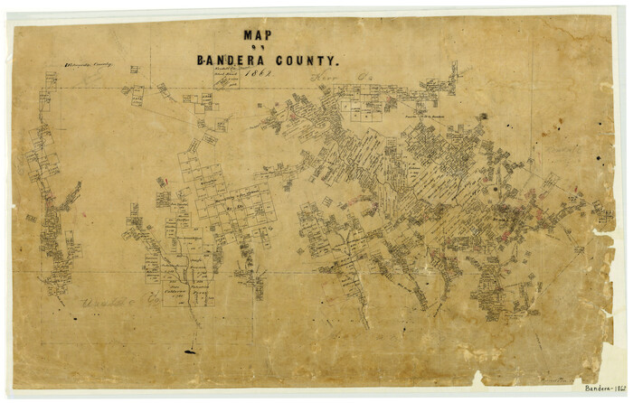
Map of Bandera County
Print $20.00
- Digital $50.00
Map of Bandera County
1862
Size 19.0 x 30.1 inches
Map/Doc 3271
Clay County Sketch File 46

Print $20.00
- Digital $50.00
Clay County Sketch File 46
1890
Size 18.9 x 19.3 inches
Map/Doc 11098

Blanco County Boundary File 7

Print $58.00
- Digital $50.00
Blanco County Boundary File 7
Size 14.3 x 8.5 inches
Map/Doc 50565