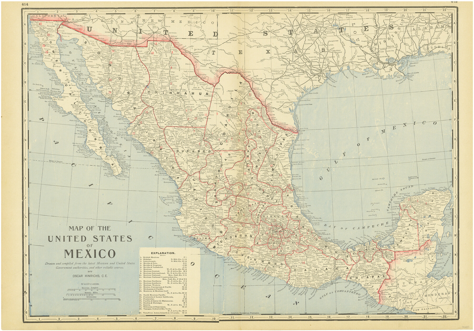
Map of the United States of Mexico drawn and compiled from the latest Mexican and United States Government authorities, and other reliable sources
-
Map/Doc
94083
-
Collection
General Map Collection
-
Object Dates
1895 (Creation Date)
-
People and Organizations
Oscar Hinrichs (Author)
-
Subjects
Mexico
-
Height x Width
17.3 x 24.8 inches
43.9 x 63.0 cm
-
Medium
paper, etching/engraving/lithograph
-
Scale
1:5,385,600
-
Comments
To view/download the "Index of Mexico" on verso, please click the "Download PDF" link above.
Part of: General Map Collection
Wichita County Sketch File 32

Print $12.00
- Digital $50.00
Wichita County Sketch File 32
1939
Size 14.2 x 8.8 inches
Map/Doc 40146
Moore County Working Sketch 10

Print $20.00
- Digital $50.00
Moore County Working Sketch 10
1951
Size 34.9 x 31.5 inches
Map/Doc 71192
Deaf Smith County

Print $40.00
- Digital $50.00
Deaf Smith County
1926
Size 39.0 x 50.5 inches
Map/Doc 73128
McLennan County Boundary File 4a

Print $8.00
- Digital $50.00
McLennan County Boundary File 4a
Size 14.1 x 8.6 inches
Map/Doc 56979
Map of Comal County

Print $20.00
- Digital $50.00
Map of Comal County
1897
Size 40.0 x 45.8 inches
Map/Doc 66780
Limestone County Sketch File 6

Print $4.00
- Digital $50.00
Limestone County Sketch File 6
1859
Size 9.2 x 8.0 inches
Map/Doc 30167
Sabine Pass and mouth of the River Sabine in the sea

Print $20.00
- Digital $50.00
Sabine Pass and mouth of the River Sabine in the sea
1840
Size 23.8 x 19.0 inches
Map/Doc 94268
Map of Lee County Texas

Print $20.00
- Digital $50.00
Map of Lee County Texas
1879
Size 26.2 x 18.0 inches
Map/Doc 4578
Presidio County Rolled Sketch 2

Print $20.00
- Digital $50.00
Presidio County Rolled Sketch 2
Size 30.2 x 18.6 inches
Map/Doc 7326
Concho County Sketch File 22

Print $20.00
- Digital $50.00
Concho County Sketch File 22
Size 24.9 x 18.1 inches
Map/Doc 11155

Caldwell County Working Sketch 1

Print $20.00
- Digital $50.00
Caldwell County Working Sketch 1
Size 20.7 x 26.2 inches
Map/Doc 67831
You may also like
Potter County Working Sketch 2

Print $40.00
- Digital $50.00
Potter County Working Sketch 2
1919
Size 43.3 x 54.4 inches
Map/Doc 71662
Fannin County Sketch File 22

Print $6.00
- Digital $50.00
Fannin County Sketch File 22
1883
Size 10.9 x 9.5 inches
Map/Doc 22489
Central America Past and Present

Central America Past and Present
1986
Size 20.6 x 31.6 inches
Map/Doc 96839
Travis County Working Sketch 17

Print $20.00
- Digital $50.00
Travis County Working Sketch 17
1944
Size 27.8 x 23.3 inches
Map/Doc 69401
Panola County Rolled Sketch 2

Print $20.00
- Digital $50.00
Panola County Rolled Sketch 2
1944
Size 20.7 x 27.0 inches
Map/Doc 7197
Sylvan Dell Heights, North Half of Northeast Quarter of Section 9, Block E2 (J. C. Davis, Owner)

Print $20.00
- Digital $50.00
Sylvan Dell Heights, North Half of Northeast Quarter of Section 9, Block E2 (J. C. Davis, Owner)
1952
Size 38.0 x 23.5 inches
Map/Doc 92774
Map of Retrieve Plantation, Brazoria County, Texas

Print $20.00
- Digital $50.00
Map of Retrieve Plantation, Brazoria County, Texas
Size 26.6 x 28.5 inches
Map/Doc 62999
Bowie County Sketch File 7

Print $40.00
- Digital $50.00
Bowie County Sketch File 7
1927
Size 18.0 x 35.5 inches
Map/Doc 10943
[Sketch Showing Connections Between Blocks X, RG, and A]
![91375, [Sketch Showing Connections Between Blocks X, RG, and A], Twichell Survey Records](https://historictexasmaps.com/wmedia_w700/maps/91375-1.tif.jpg)
Print $20.00
- Digital $50.00
[Sketch Showing Connections Between Blocks X, RG, and A]
Size 17.5 x 26.0 inches
Map/Doc 91375
[Surveys along Cow and Deer Creeks]
![306, [Surveys along Cow and Deer Creeks], General Map Collection](https://historictexasmaps.com/wmedia_w700/maps/306.tif.jpg)
Print $2.00
- Digital $50.00
[Surveys along Cow and Deer Creeks]
1845
Size 15.8 x 8.6 inches
Map/Doc 306
Flight Mission No. DQO-7K, Frame 102, Galveston County

Print $20.00
- Digital $50.00
Flight Mission No. DQO-7K, Frame 102, Galveston County
1952
Size 18.6 x 22.5 inches
Map/Doc 85117
El Paso County Working Sketch 59

Print $20.00
- Digital $50.00
El Paso County Working Sketch 59
2000
Size 28.1 x 35.7 inches
Map/Doc 69081