[Plat of Survey 1, Block B]
180-49
-
Map/Doc
91448
-
Collection
Twichell Survey Records
-
Object Dates
12/12/1907 (Creation Date)
-
Counties
Oldham
-
Height x Width
11.7 x 12.6 inches
29.7 x 32.0 cm
Part of: Twichell Survey Records
[Meridian thru 19th St. Muni. Standpipe]
![92864, [Meridian thru 19th St. Muni. Standpipe], Twichell Survey Records](https://historictexasmaps.com/wmedia_w700/maps/92864-1.tif.jpg)
![92864, [Meridian thru 19th St. Muni. Standpipe], Twichell Survey Records](https://historictexasmaps.com/wmedia_w700/maps/92864-1.tif.jpg)
Print $20.00
- Digital $50.00
[Meridian thru 19th St. Muni. Standpipe]
Size 23.8 x 19.5 inches
Map/Doc 92864
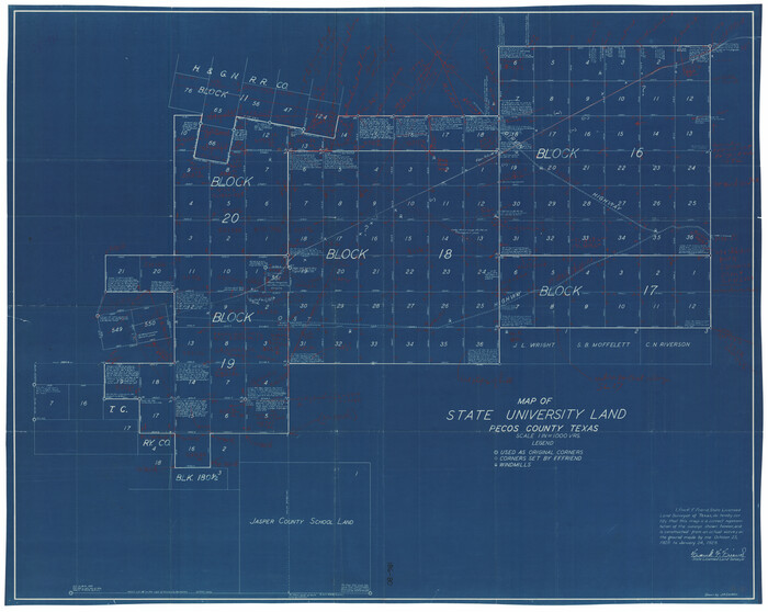
Map of State University Land, Pecos County, Texas

Print $20.00
- Digital $50.00
Map of State University Land, Pecos County, Texas
1929
Size 28.4 x 22.7 inches
Map/Doc 91631
Map Showing Lands Surveyed by Sylvan Sanders, Block D


Print $20.00
- Digital $50.00
Map Showing Lands Surveyed by Sylvan Sanders, Block D
Size 28.2 x 23.5 inches
Map/Doc 92440
'O Bar O' Ranch


Print $40.00
- Digital $50.00
'O Bar O' Ranch
1946
Size 47.8 x 82.6 inches
Map/Doc 93202
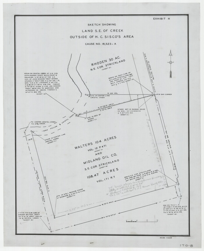
Sketch Showing Lands Southeast of Creek Outside of H. C. Sisco's Area, Exhibit H

Print $20.00
- Digital $50.00
Sketch Showing Lands Southeast of Creek Outside of H. C. Sisco's Area, Exhibit H
Size 20.0 x 24.5 inches
Map/Doc 91373
[Sketch from Paul McCombs Map of 1884, showing T. & P. Township 5, Block 60, Township 6, Block 59, and Township 7, Blocks 59 and 60]
![91774, [Sketch from Paul McCombs Map of 1884, showing T. & P. Township 5, Block 60, Township 6, Block 59, and Township 7, Blocks 59 and 60], Twichell Survey Records](https://historictexasmaps.com/wmedia_w700/maps/91774-1.tif.jpg)
![91774, [Sketch from Paul McCombs Map of 1884, showing T. & P. Township 5, Block 60, Township 6, Block 59, and Township 7, Blocks 59 and 60], Twichell Survey Records](https://historictexasmaps.com/wmedia_w700/maps/91774-1.tif.jpg)
Print $2.00
- Digital $50.00
[Sketch from Paul McCombs Map of 1884, showing T. & P. Township 5, Block 60, Township 6, Block 59, and Township 7, Blocks 59 and 60]
Size 9.2 x 15.0 inches
Map/Doc 91774
[Sketch showing correct location of the North and East lines of the Nave McCord pasture fence]
![90896, [Sketch showing correct location of the North and East lines of the Nave McCord pasture fence], Twichell Survey Records](https://historictexasmaps.com/wmedia_w700/maps/90896-1.tif.jpg)
![90896, [Sketch showing correct location of the North and East lines of the Nave McCord pasture fence], Twichell Survey Records](https://historictexasmaps.com/wmedia_w700/maps/90896-1.tif.jpg)
Print $20.00
- Digital $50.00
[Sketch showing correct location of the North and East lines of the Nave McCord pasture fence]
1900
Size 20.3 x 11.8 inches
Map/Doc 90896
[John H. Gibson Section 892 and Surrounding Surveys]
![92841, [John H. Gibson Section 892 and Surrounding Surveys], Twichell Survey Records](https://historictexasmaps.com/wmedia_w700/maps/92841-1.tif.jpg)
![92841, [John H. Gibson Section 892 and Surrounding Surveys], Twichell Survey Records](https://historictexasmaps.com/wmedia_w700/maps/92841-1.tif.jpg)
Print $3.00
- Digital $50.00
[John H. Gibson Section 892 and Surrounding Surveys]
Size 15.7 x 11.7 inches
Map/Doc 92841
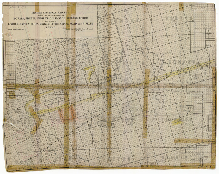
Revised Sectional Map Number 2, Showing Land Surveys in Counties of Howard, Martin, Andrews, Glasscock, Midland, Ector, and Portions of Borden, Dawson, Irion, Reagan, Upton, Crane, Ward, and Winkler, Texas

Print $20.00
- Digital $50.00
Revised Sectional Map Number 2, Showing Land Surveys in Counties of Howard, Martin, Andrews, Glasscock, Midland, Ector, and Portions of Borden, Dawson, Irion, Reagan, Upton, Crane, Ward, and Winkler, Texas
Size 24.8 x 19.7 inches
Map/Doc 91357
[W. S. Mabry's maps in south part of Oldham County]
![93065, [W. S. Mabry's maps in south part of Oldham County], Twichell Survey Records](https://historictexasmaps.com/wmedia_w700/maps/93065-1.tif.jpg)
![93065, [W. S. Mabry's maps in south part of Oldham County], Twichell Survey Records](https://historictexasmaps.com/wmedia_w700/maps/93065-1.tif.jpg)
Print $20.00
- Digital $50.00
[W. S. Mabry's maps in south part of Oldham County]
Size 40.4 x 15.8 inches
Map/Doc 93065
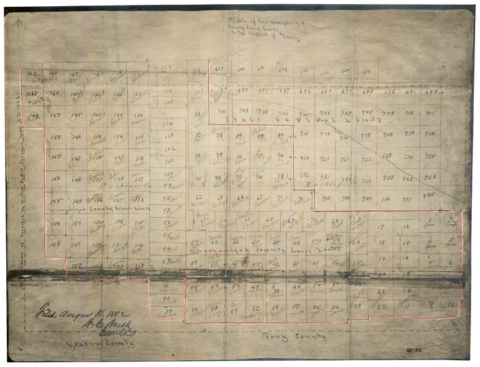
Platte (sic) of the unorganized County School Lands in the District of Young

Print $20.00
- Digital $50.00
Platte (sic) of the unorganized County School Lands in the District of Young
Size 16.0 x 12.3 inches
Map/Doc 90453
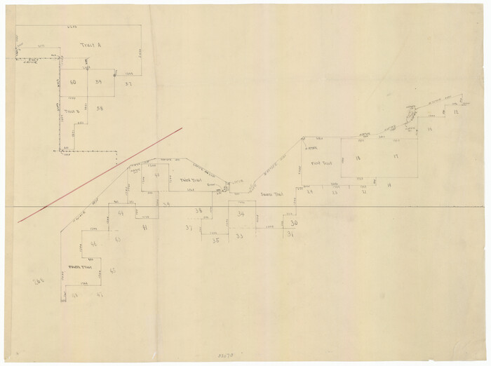
Bravo Deed, Instrument 24, Tract A and Tract B

Digital $50.00
Bravo Deed, Instrument 24, Tract A and Tract B
Map/Doc 91480
You may also like
Matagorda County Sketch File 39


Print $20.00
- Digital $50.00
Matagorda County Sketch File 39
Size 31.1 x 24.3 inches
Map/Doc 12047
Flight Mission No. CGI-3N, Frame 180, Cameron County


Print $20.00
- Digital $50.00
Flight Mission No. CGI-3N, Frame 180, Cameron County
1954
Size 18.6 x 22.2 inches
Map/Doc 84644
Newton County Working Sketch 43


Print $20.00
- Digital $50.00
Newton County Working Sketch 43
1982
Size 20.7 x 28.6 inches
Map/Doc 71289
[Washington County RR. Co. Block 1 and Cherokee Iron Furnace Co. Block 1]
![92065, [Washington County RR. Co. Block 1 and Cherokee Iron Furnace Co. Block 1], Twichell Survey Records](https://historictexasmaps.com/wmedia_w700/maps/92065-1.tif.jpg)
![92065, [Washington County RR. Co. Block 1 and Cherokee Iron Furnace Co. Block 1], Twichell Survey Records](https://historictexasmaps.com/wmedia_w700/maps/92065-1.tif.jpg)
Print $20.00
- Digital $50.00
[Washington County RR. Co. Block 1 and Cherokee Iron Furnace Co. Block 1]
1911
Size 22.4 x 25.4 inches
Map/Doc 92065
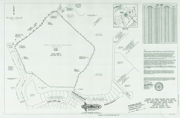
Galveston County NRC Article 33.136 Sketch 40

Print $22.00
- Digital $50.00
Galveston County NRC Article 33.136 Sketch 40
2005
Size 23.9 x 36.5 inches
Map/Doc 83061
Flight Mission No. CLL-1N, Frame 188, Willacy County


Print $20.00
- Digital $50.00
Flight Mission No. CLL-1N, Frame 188, Willacy County
1954
Size 18.4 x 22.0 inches
Map/Doc 87058
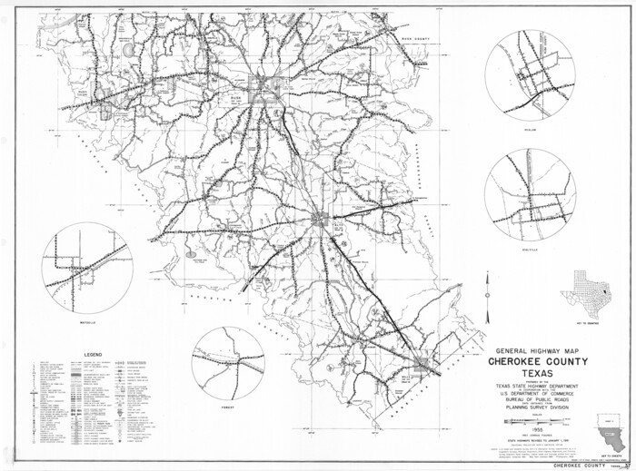
General Highway Map, Cherokee County, Texas

Print $20.00
General Highway Map, Cherokee County, Texas
1961
Size 18.2 x 24.6 inches
Map/Doc 79405
Baylor County Sketch File 27


Print $4.00
- Digital $50.00
Baylor County Sketch File 27
1895
Size 11.1 x 8.9 inches
Map/Doc 14226
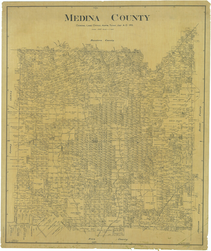
Medina County

Print $40.00
- Digital $50.00
Medina County
1915
Size 50.1 x 42.1 inches
Map/Doc 66924
Stonewall County Sketch File 10
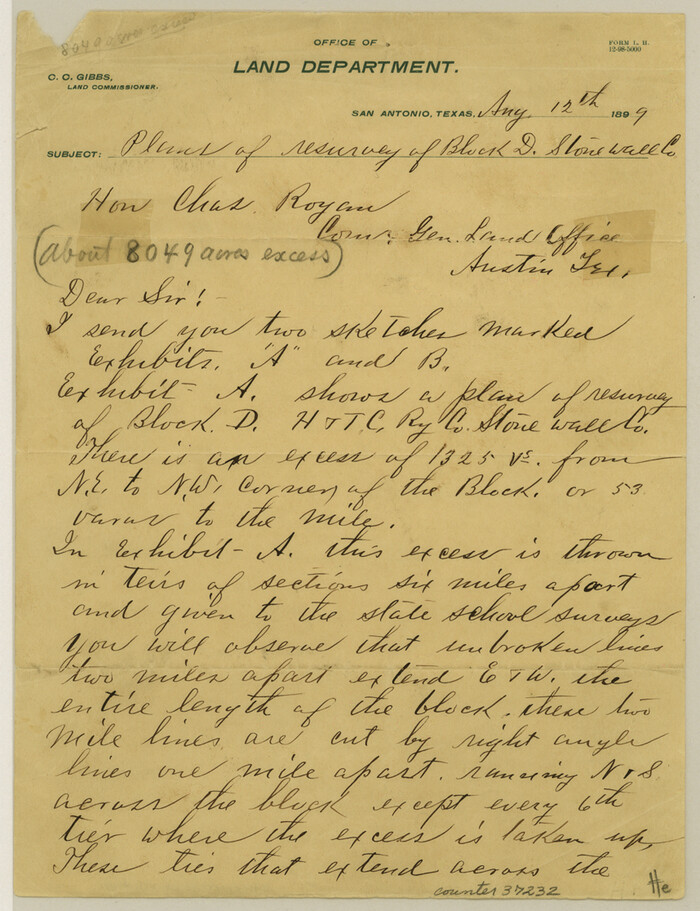

Print $10.00
- Digital $50.00
Stonewall County Sketch File 10
1899
Size 11.2 x 8.6 inches
Map/Doc 37232
Zapata County Rolled Sketch 7
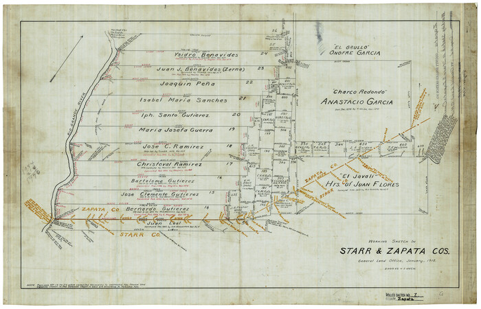

Print $20.00
- Digital $50.00
Zapata County Rolled Sketch 7
1912
Size 18.1 x 27.9 inches
Map/Doc 8308
Parker County Working Sketch 2


Print $20.00
- Digital $50.00
Parker County Working Sketch 2
1920
Map/Doc 71452
![91448, [Plat of Survey 1, Block B], Twichell Survey Records](https://historictexasmaps.com/wmedia_w1800h1800/maps/91448-1.tif.jpg)