[Area along North line of McLennan County School Land]
67-15
-
Map/Doc
90928
-
Collection
Twichell Survey Records
-
Object Dates
5/21/1920 (Creation Date)
-
People and Organizations
J.A. Russell (Surveyor/Engineer)
-
Counties
Eastland
-
Height x Width
5.5 x 14.9 inches
14.0 x 37.9 cm
Part of: Twichell Survey Records
[Sections 61-65, I. & G. N. Block 1 and part of Block 194]
![91678, [Sections 61-65, I. & G. N. Block 1 and part of Block 194], Twichell Survey Records](https://historictexasmaps.com/wmedia_w700/maps/91678-1.tif.jpg)
![91678, [Sections 61-65, I. & G. N. Block 1 and part of Block 194], Twichell Survey Records](https://historictexasmaps.com/wmedia_w700/maps/91678-1.tif.jpg)
Print $20.00
- Digital $50.00
[Sections 61-65, I. & G. N. Block 1 and part of Block 194]
Size 24.9 x 17.3 inches
Map/Doc 91678
[Block M-19, and G. & M. Blocks 4 and 5]
![91784, [Block M-19, and G. & M. Blocks 4 and 5], Twichell Survey Records](https://historictexasmaps.com/wmedia_w700/maps/91784-1.tif.jpg)
![91784, [Block M-19, and G. & M. Blocks 4 and 5], Twichell Survey Records](https://historictexasmaps.com/wmedia_w700/maps/91784-1.tif.jpg)
Print $20.00
- Digital $50.00
[Block M-19, and G. & M. Blocks 4 and 5]
Size 22.4 x 17.7 inches
Map/Doc 91784
[Portions of Hansford and Hutchinson Counties]
![91136, [Portions of Hansford and Hutchinson Counties], Twichell Survey Records](https://historictexasmaps.com/wmedia_w700/maps/91136-1.tif.jpg)
![91136, [Portions of Hansford and Hutchinson Counties], Twichell Survey Records](https://historictexasmaps.com/wmedia_w700/maps/91136-1.tif.jpg)
Print $3.00
- Digital $50.00
[Portions of Hansford and Hutchinson Counties]
Size 11.5 x 13.5 inches
Map/Doc 91136
Chapman and McFarlin Production Co. Cogdell Ranch Kent County, Texas
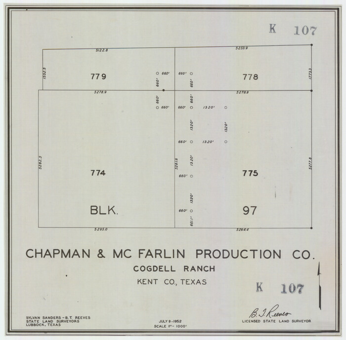

Print $2.00
- Digital $50.00
Chapman and McFarlin Production Co. Cogdell Ranch Kent County, Texas
1952
Size 9.0 x 8.9 inches
Map/Doc 92190
Wonderland, Randolph Place, and Deer Wood
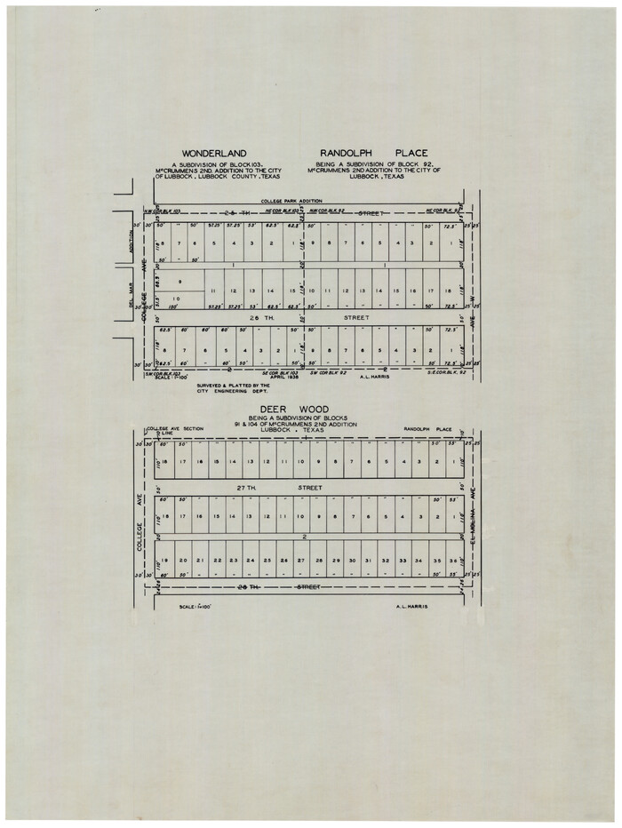

Print $20.00
- Digital $50.00
Wonderland, Randolph Place, and Deer Wood
Size 18.9 x 24.8 inches
Map/Doc 92742
Deaf Smith County, Texas / [Sec. 144, Blk. K-5]
![92037, Deaf Smith County, Texas / [Sec. 144, Blk. K-5], Twichell Survey Records](https://historictexasmaps.com/wmedia_w700/maps/92037-1.tif.jpg)
![92037, Deaf Smith County, Texas / [Sec. 144, Blk. K-5], Twichell Survey Records](https://historictexasmaps.com/wmedia_w700/maps/92037-1.tif.jpg)
Print $20.00
- Digital $50.00
Deaf Smith County, Texas / [Sec. 144, Blk. K-5]
Size 25.6 x 19.6 inches
Map/Doc 92037
[C.C.S.D. & R.G.N.G. RR. Co. Blk. G east thru T.&P. Blk 33]
![89777, [C.C.S.D. & R.G.N.G. RR. Co. Blk. G east thru T.&P. Blk 33], Twichell Survey Records](https://historictexasmaps.com/wmedia_w700/maps/89777-1.tif.jpg)
![89777, [C.C.S.D. & R.G.N.G. RR. Co. Blk. G east thru T.&P. Blk 33], Twichell Survey Records](https://historictexasmaps.com/wmedia_w700/maps/89777-1.tif.jpg)
Print $40.00
- Digital $50.00
[C.C.S.D. & R.G.N.G. RR. Co. Blk. G east thru T.&P. Blk 33]
1901
Size 69.8 x 24.3 inches
Map/Doc 89777
[SE/4 of NW/4 of King Co.]
![89925, [SE/4 of NW/4 of King Co.], Twichell Survey Records](https://historictexasmaps.com/wmedia_w700/maps/89925-1.tif.jpg)
![89925, [SE/4 of NW/4 of King Co.], Twichell Survey Records](https://historictexasmaps.com/wmedia_w700/maps/89925-1.tif.jpg)
Print $40.00
- Digital $50.00
[SE/4 of NW/4 of King Co.]
Size 43.7 x 55.5 inches
Map/Doc 89925
Sketch showing Block R situated in Counties of Castro, Deaf Smith, Randall & Swisher
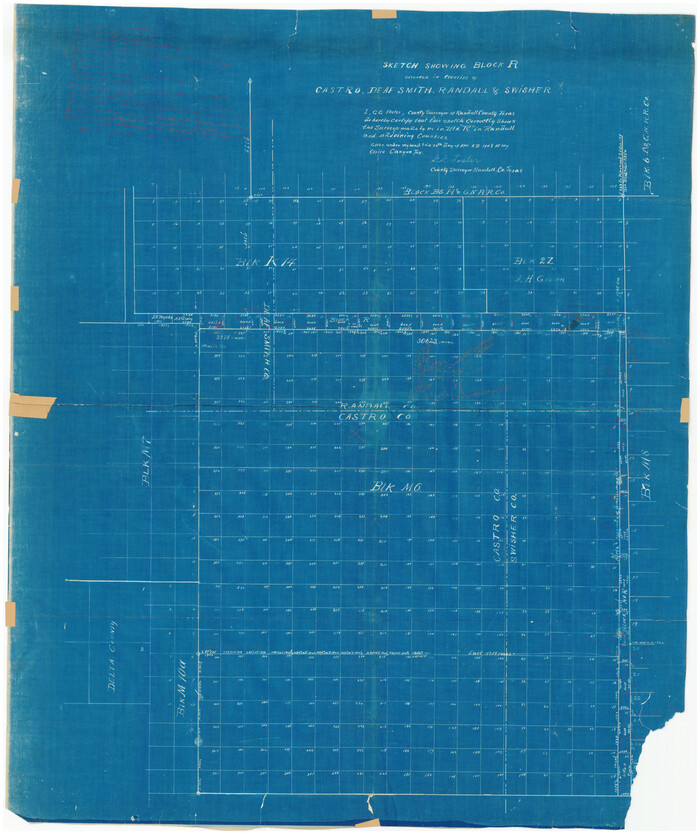

Print $20.00
- Digital $50.00
Sketch showing Block R situated in Counties of Castro, Deaf Smith, Randall & Swisher
1908
Size 29.0 x 34.4 inches
Map/Doc 90408
Gaines County, Texas


Print $40.00
- Digital $50.00
Gaines County, Texas
1915
Size 54.1 x 33.0 inches
Map/Doc 89843
Plat in Pecos County, Texas
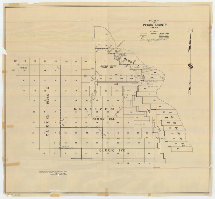

Print $20.00
- Digital $50.00
Plat in Pecos County, Texas
Size 39.1 x 36.2 inches
Map/Doc 89830
[Fisher County School Land Lgs. 106-108]
![90198, [Fisher County School Land Lgs. 106-108], Twichell Survey Records](https://historictexasmaps.com/wmedia_w700/maps/90198-1.tif.jpg)
![90198, [Fisher County School Land Lgs. 106-108], Twichell Survey Records](https://historictexasmaps.com/wmedia_w700/maps/90198-1.tif.jpg)
Print $20.00
- Digital $50.00
[Fisher County School Land Lgs. 106-108]
Size 11.7 x 18.4 inches
Map/Doc 90198
You may also like
Carte Reduite des Costes de la Louisiane et de la Floride


Print $20.00
Carte Reduite des Costes de la Louisiane et de la Floride
1764
Size 23.3 x 35.1 inches
Map/Doc 79295
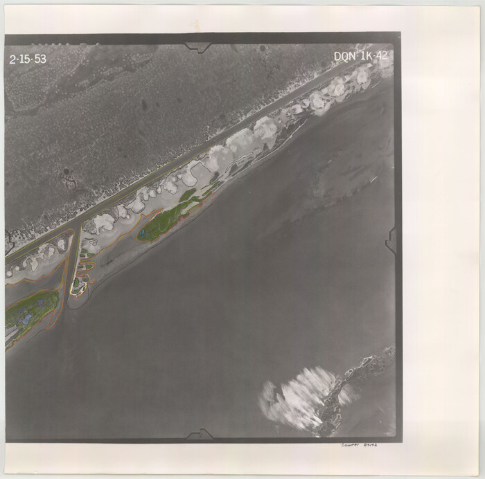
Flight Mission No. DQN-1K, Frame 42, Calhoun County

Print $20.00
- Digital $50.00
Flight Mission No. DQN-1K, Frame 42, Calhoun County
1953
Size 18.5 x 18.7 inches
Map/Doc 84142
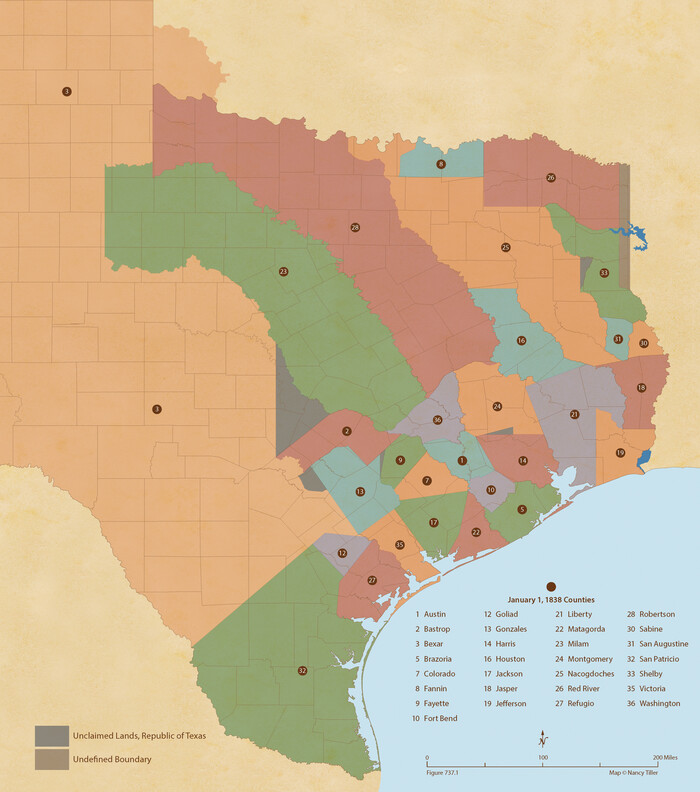
Republic Counties. January 1, 1838

Print $20.00
Republic Counties. January 1, 1838
2020
Size 24.5 x 21.7 inches
Map/Doc 96311
[Strickland Survey Sketch Showing Abercrombie Corner, Exhibit C]
![91369, [Strickland Survey Sketch Showing Abercrombie Corner, Exhibit C], Twichell Survey Records](https://historictexasmaps.com/wmedia_w700/maps/91369-1.tif.jpg)
![91369, [Strickland Survey Sketch Showing Abercrombie Corner, Exhibit C], Twichell Survey Records](https://historictexasmaps.com/wmedia_w700/maps/91369-1.tif.jpg)
Print $20.00
- Digital $50.00
[Strickland Survey Sketch Showing Abercrombie Corner, Exhibit C]
Size 18.0 x 24.5 inches
Map/Doc 91369
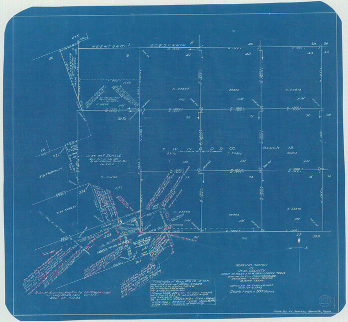
Real County Working Sketch 22

Print $20.00
- Digital $50.00
Real County Working Sketch 22
1945
Size 20.0 x 21.7 inches
Map/Doc 71914
Trinity River, Balltown Sheet/Pilot Grove Creek


Print $20.00
- Digital $50.00
Trinity River, Balltown Sheet/Pilot Grove Creek
1938
Size 40.1 x 33.7 inches
Map/Doc 65196
Dallam County Boundary File 4


Print $80.00
- Digital $50.00
Dallam County Boundary File 4
Size 9.4 x 49.8 inches
Map/Doc 52082
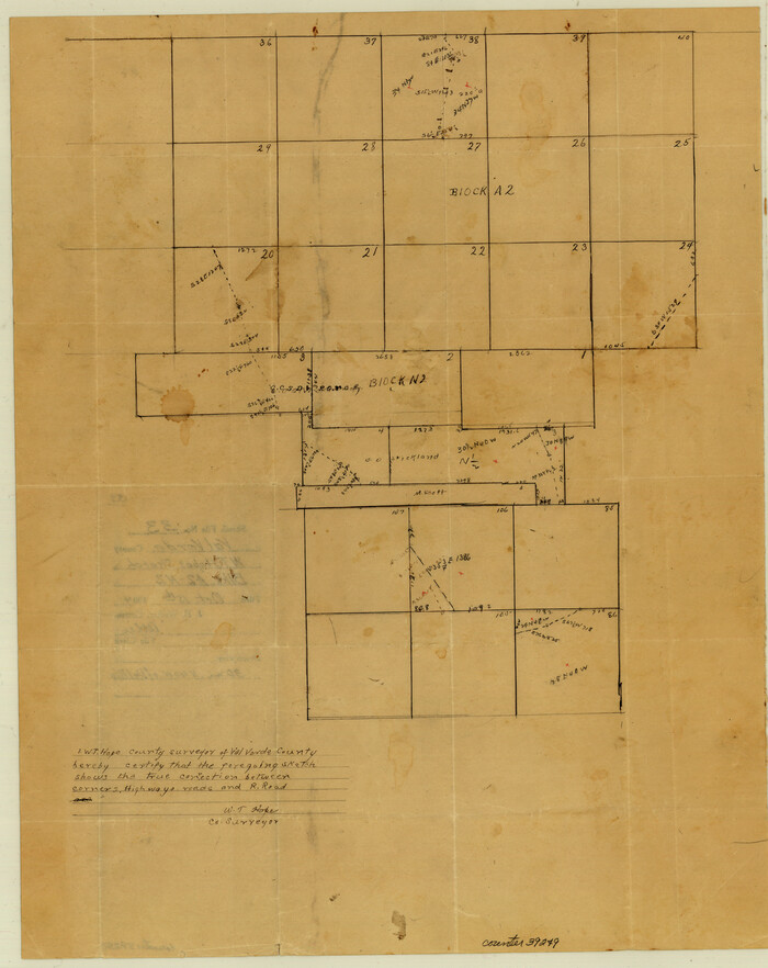
Val Verde County Sketch File 33

Print $40.00
- Digital $50.00
Val Verde County Sketch File 33
Size 17.5 x 13.9 inches
Map/Doc 39249
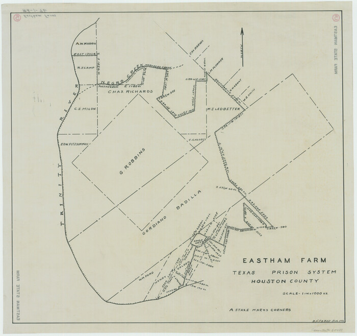
Eastham Farm, Texas Prison System, Houston County

Print $20.00
- Digital $50.00
Eastham Farm, Texas Prison System, Houston County
Size 17.3 x 18.4 inches
Map/Doc 62988
Young County Rolled Sketch 16


Print $20.00
- Digital $50.00
Young County Rolled Sketch 16
1982
Size 19.1 x 31.3 inches
Map/Doc 8304
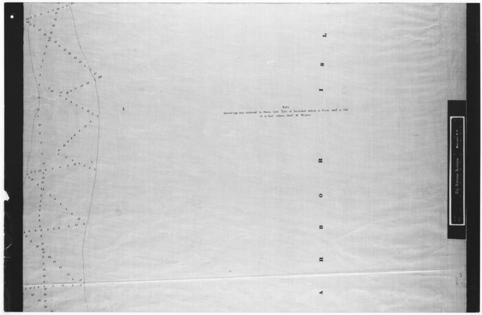
No. 3 Chart of Channel connecting Corpus Christi Bay with Aransas Bay, Texas

Print $20.00
- Digital $50.00
No. 3 Chart of Channel connecting Corpus Christi Bay with Aransas Bay, Texas
1878
Size 18.3 x 28.0 inches
Map/Doc 72773
Hutchinson County Rolled Sketch 19


Print $20.00
- Digital $50.00
Hutchinson County Rolled Sketch 19
Size 21.3 x 25.0 inches
Map/Doc 6285
![90928, [Area along North line of McLennan County School Land], Twichell Survey Records](https://historictexasmaps.com/wmedia_w1800h1800/maps/90928-1.tif.jpg)