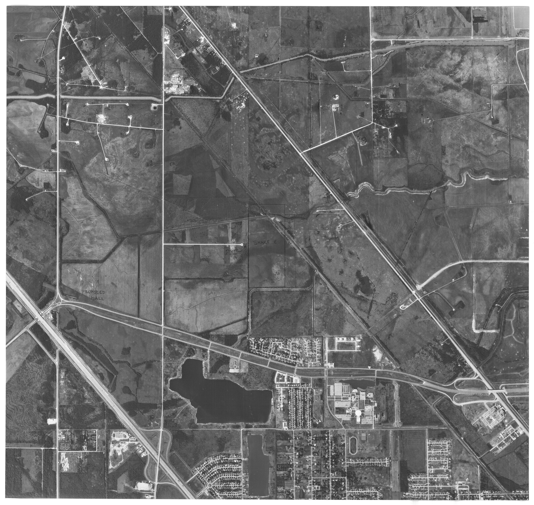
Galveston County Rolled Sketch 42
[Aerial photograph]
-
Map/Doc
9021
-
Collection
General Map Collection
-
Object Dates
1982 (Creation Date)
8/29/1988 (File Date)
-
Counties
Galveston
-
Subjects
Surveying Rolled Sketch
-
Height x Width
42.9 x 40.6 inches
109.0 x 103.1 cm
-
Medium
photograph
Related maps
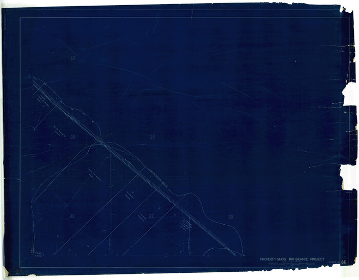
Galveston County Sketch File 60

Print $103.00
- Digital $50.00
Galveston County Sketch File 60
1988
Size 14.3 x 8.8 inches
Map/Doc 23611
Galveston County Rolled Sketch 40A

Print $20.00
- Digital $50.00
Galveston County Rolled Sketch 40A
1988
Size 42.0 x 46.0 inches
Map/Doc 9020
Part of: General Map Collection
Sketch showing surveys on Harbor Island in Nueces County

Print $20.00
- Digital $50.00
Sketch showing surveys on Harbor Island in Nueces County
1978
Size 46.4 x 36.0 inches
Map/Doc 2020
Cass County Sketch File 5 and 5a

Print $6.00
- Digital $50.00
Cass County Sketch File 5 and 5a
1851
Size 2.8 x 5.1 inches
Map/Doc 17401
Hood County Rolled Sketch 7

Print $20.00
- Digital $50.00
Hood County Rolled Sketch 7
2009
Size 19.1 x 24.5 inches
Map/Doc 89062
Harrison County Working Sketch 15

Print $20.00
- Digital $50.00
Harrison County Working Sketch 15
1961
Size 25.7 x 18.0 inches
Map/Doc 66035
Calhoun County Sketch File 20

Print $10.00
Calhoun County Sketch File 20
1839
Size 8.8 x 8.6 inches
Map/Doc 76865
Hill County Working Sketch 5

Print $20.00
- Digital $50.00
Hill County Working Sketch 5
2008
Size 32.2 x 31.6 inches
Map/Doc 89013
Navarro County Sketch File 6

Print $6.00
- Digital $50.00
Navarro County Sketch File 6
1849
Size 6.2 x 8.4 inches
Map/Doc 32310
Flight Mission No. CGI-3N, Frame 185, Cameron County

Print $20.00
- Digital $50.00
Flight Mission No. CGI-3N, Frame 185, Cameron County
1954
Size 18.6 x 22.4 inches
Map/Doc 84649
Tyler County Working Sketch 22

Print $20.00
- Digital $50.00
Tyler County Working Sketch 22
1987
Size 42.0 x 35.5 inches
Map/Doc 69492
Panola County Working Sketch 5

Print $20.00
- Digital $50.00
Panola County Working Sketch 5
1940
Map/Doc 71414
Hudspeth County Working Sketch 19

Print $20.00
- Digital $50.00
Hudspeth County Working Sketch 19
1959
Size 21.5 x 24.3 inches
Map/Doc 66301
Ellis County Sketch File 4

Print $4.00
- Digital $50.00
Ellis County Sketch File 4
1859
Size 13.0 x 8.5 inches
Map/Doc 21832
You may also like
Sterling County Working Sketch 10

Print $20.00
- Digital $50.00
Sterling County Working Sketch 10
1980
Size 39.6 x 26.3 inches
Map/Doc 63992
Harris County Working Sketch 126

Print $20.00
- Digital $50.00
Harris County Working Sketch 126
1995
Size 14.5 x 30.0 inches
Map/Doc 66018
Little River, Faubion Bridge Sheet

Print $20.00
- Digital $50.00
Little River, Faubion Bridge Sheet
1914
Size 18.5 x 27.6 inches
Map/Doc 69682
Flight Mission No. DCL-5C, Frame 73, Kenedy County

Print $20.00
- Digital $50.00
Flight Mission No. DCL-5C, Frame 73, Kenedy County
1943
Size 18.5 x 22.2 inches
Map/Doc 85856
El Paso County Rolled Sketch Z60
Print $20.00
- Digital $50.00
El Paso County Rolled Sketch Z60
1915
Size 37.3 x 47.7 inches
Map/Doc 8873
Blanco County Working Sketch 23

Print $40.00
- Digital $50.00
Blanco County Working Sketch 23
1962
Size 52.4 x 38.5 inches
Map/Doc 67383
Blanco County Working Sketch 19

Print $20.00
- Digital $50.00
Blanco County Working Sketch 19
1960
Size 24.4 x 29.2 inches
Map/Doc 67379
Trinity River, Grapevine Sheet/Denton Creek

Print $6.00
- Digital $50.00
Trinity River, Grapevine Sheet/Denton Creek
1938
Size 22.2 x 34.7 inches
Map/Doc 65243
Galveston County Working Sketch 17

Print $20.00
- Digital $50.00
Galveston County Working Sketch 17
1982
Size 15.5 x 14.3 inches
Map/Doc 69354
Bowie County Sketch File 6

Print $10.00
- Digital $50.00
Bowie County Sketch File 6
1927
Size 8.5 x 4.0 inches
Map/Doc 14839
Gaines County Working Sketch 14

Print $40.00
- Digital $50.00
Gaines County Working Sketch 14
1957
Size 62.3 x 31.7 inches
Map/Doc 69314
Eastland County Working Sketch 21

Print $20.00
- Digital $50.00
Eastland County Working Sketch 21
1920
Size 15.4 x 22.7 inches
Map/Doc 68802