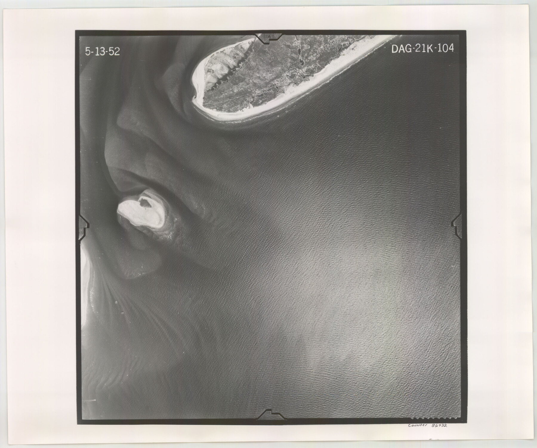
Flight Mission No. DAG-21K, Frame 104, Matagorda County
DAG-21K-104
- 
                          Map/Doc
86432
 - 
                            Collection
General Map Collection
 - 
                            Object Dates
1952/5/13 (Creation Date)
 - 
                            People and Organizations
U. S. Department of Agriculture (Publisher)
 - 
                            Counties
Matagorda
 - 
                            Subjects
Aerial Photograph
 - 
                            Height x Width
18.7 x 22.3 inches
47.5 x 56.6 cm
 - 
                            Comments
Flown by Aero Exploration Company of Tulsa, Oklahoma.
 
Part of: General Map Collection
            Dallas County Working Sketch 12


                                            Print $20.00                    
                                             -                         Digital $50.00                                    
                Dallas County Working Sketch 12
1983
Size 30.5 x 44.1 inches
                                Map/Doc 68578
            
            Upton County Sketch File 4


                                            Print $40.00                    
                                             -                         Digital $50.00                                    
                Upton County Sketch File 4
1886
Size 19.5 x 9.0 inches
                                Map/Doc 12510
            
            Edwards County Sketch File 16b


                                            Print $56.00                    
                                             -                         Digital $50.00                                    
                Edwards County Sketch File 16b
1907
Size 9.4 x 8.7 inches
                                Map/Doc 21722
            
            Harrison County Sketch File 7


                                            Print $6.00                    
                                             -                         Digital $50.00                                    
                Harrison County Sketch File 7
1858
Size 11.7 x 9.7 inches
                                Map/Doc 26046
            
            Leon County Sketch File 36


                                            Print $6.00                    
                                             -                         Digital $50.00                                    
                Leon County Sketch File 36
1994
Size 14.2 x 8.7 inches
                                Map/Doc 29850
            
            Flight Mission No. DIX-8P, Frame 88, Aransas County


                                            Print $20.00                    
                                             -                         Digital $50.00                                    
                Flight Mission No. DIX-8P, Frame 88, Aransas County
1956
Size 18.6 x 22.3 inches
                                Map/Doc 83913
            
            Texas Official Travel Map


                                                                    Digital $50.00                                    
                Texas Official Travel Map
Size 33.5 x 36.2 inches
                                Map/Doc 94303
            
            Reeves County Sketch File 10


                                            Print $20.00                    
                                             -                         Digital $50.00                                    
                Reeves County Sketch File 10
Size 17.0 x 32.0 inches
                                Map/Doc 12244
            
            Jefferson County Rolled Sketch 36


                                            Print $20.00                    
                                             -                         Digital $50.00                                    
                Jefferson County Rolled Sketch 36
1957
Size 41.1 x 29.1 inches
                                Map/Doc 6395
            
            Henderson County Working Sketch 26


                                            Print $20.00                    
                                             -                         Digital $50.00                                    
                Henderson County Working Sketch 26
1954
Size 23.8 x 23.5 inches
                                Map/Doc 66159
            
            Township 12 South Range 14 West and 15 West, South Western District, Louisiana


                                            Print $20.00                    
                                             -                         Digital $50.00                                    
                Township 12 South Range 14 West and 15 West, South Western District, Louisiana
1838
Size 19.5 x 24.5 inches
                                Map/Doc 65856
            
            Carson County Boundary File 5 and 5a


                                            Print $50.00                    
                                             -                         Digital $50.00                                    
                Carson County Boundary File 5 and 5a
Size 8.8 x 4.4 inches
                                Map/Doc 51134
            You may also like
            Goliad County Working Sketch 19


                                            Print $20.00                    
                                             -                         Digital $50.00                                    
                Goliad County Working Sketch 19
1954
Size 31.5 x 31.8 inches
                                Map/Doc 63209
            
            Map of South America engraved to illustrate Mitchell's new intermediate geography


                                            Print $20.00                    
                                             -                         Digital $50.00                                    
                Map of South America engraved to illustrate Mitchell's new intermediate geography
1885
Size 12.2 x 9.0 inches
                                Map/Doc 93525
            
            Deaf Smith Co.


                                            Print $40.00                    
                                             -                         Digital $50.00                                    
                Deaf Smith Co.
1898
Size 37.2 x 48.8 inches
                                Map/Doc 4930
            
            Hudspeth County Rolled Sketch 60


                                            Print $20.00                    
                                             -                         Digital $50.00                                    
                Hudspeth County Rolled Sketch 60
1982
Size 43.4 x 44.4 inches
                                Map/Doc 9225
            
            Terrell County Sketch File 25


                                            Print $4.00                    
                                             -                         Digital $50.00                                    
                Terrell County Sketch File 25
1935
Size 13.5 x 8.1 inches
                                Map/Doc 37959
            
            Montague County Sketch File 13


                                            Print $4.00                    
                                             -                         Digital $50.00                                    
                Montague County Sketch File 13
1879
Size 8.9 x 9.0 inches
                                Map/Doc 31738
            
            Howard County Rolled Sketch 6


                                            Print $20.00                    
                                             -                         Digital $50.00                                    
                Howard County Rolled Sketch 6
Size 17.3 x 18.1 inches
                                Map/Doc 6235
            
            Houston County Working Sketch 23


                                            Print $20.00                    
                                             -                         Digital $50.00                                    
                Houston County Working Sketch 23
1983
Size 19.4 x 25.3 inches
                                Map/Doc 66253
            
            Northeast Part of Webb County


                                            Print $40.00                    
                                             -                         Digital $50.00                                    
                Northeast Part of Webb County
1986
Size 38.0 x 49.2 inches
                                Map/Doc 73318
            
            [Surveys along the Brazos River]


                                            Print $3.00                    
                                             -                         Digital $50.00                                    
                [Surveys along the Brazos River]
1840
Size 9.5 x 10.9 inches
                                Map/Doc 39
            
            Foard County Sketch File 36


                                            Print $20.00                    
                                             -                         Digital $50.00                                    
                Foard County Sketch File 36
Size 15.4 x 28.0 inches
                                Map/Doc 11498