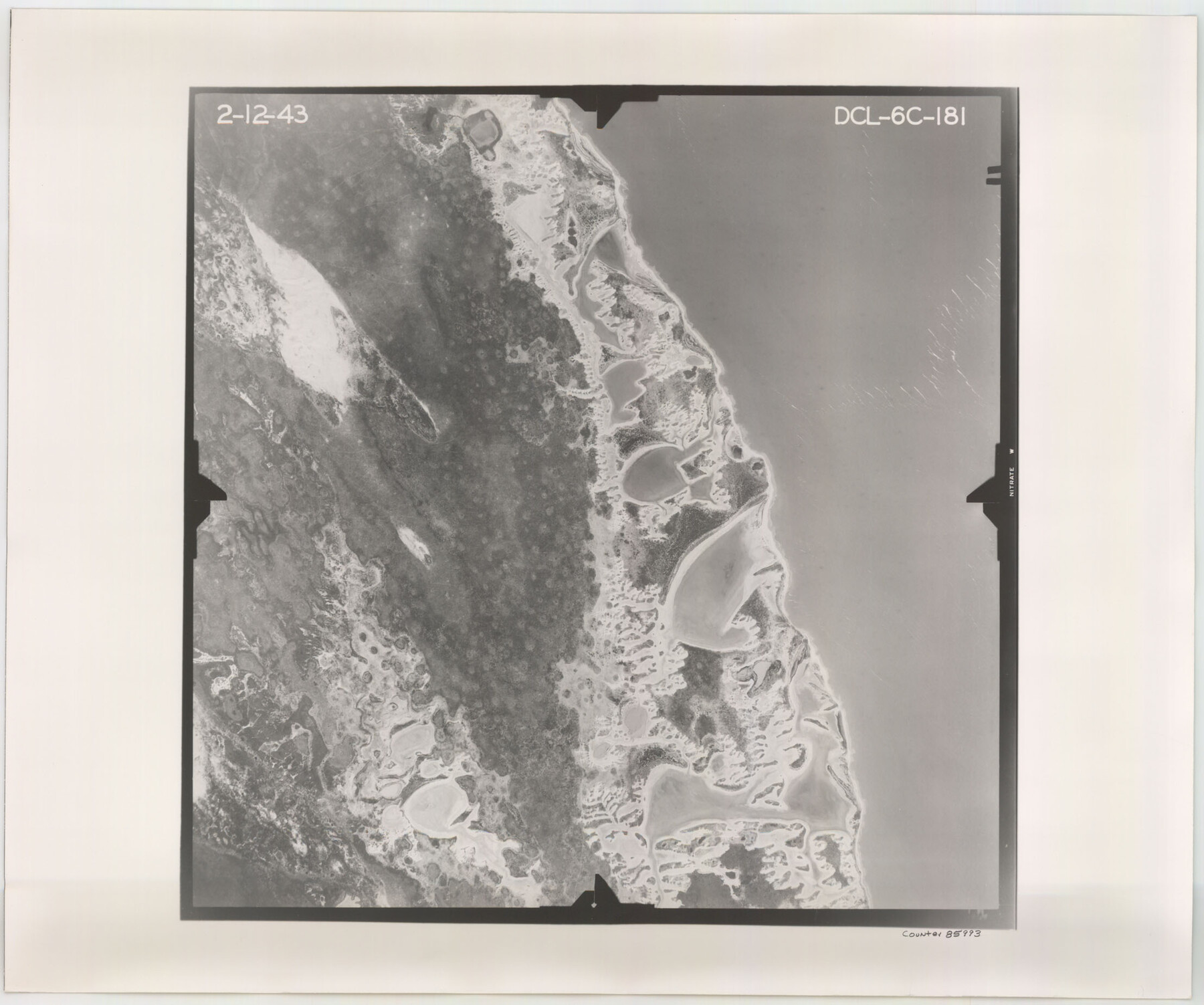
Flight Mission No. DCL-6C, Frame 181, Kenedy County
DCL-6C-181
-
Map/Doc
85993
-
Collection
General Map Collection
-
Object Dates
1943/2/12 (Creation Date)
-
People and Organizations
U. S. Department of Agriculture (Publisher)
-
Counties
Kenedy
-
Subjects
Aerial Photograph
-
Height x Width
18.5 x 22.2 inches
47.0 x 56.4 cm
-
Comments
Flown by Aerial Surveys of Pittsburgh, Inc. of Pittsburgh, Pennsylvania.
Part of: General Map Collection
East Part of Edwards County

Print $40.00
- Digital $50.00
East Part of Edwards County
1975
Size 56.3 x 41.1 inches
Map/Doc 95488
Liberty County Working Sketch 14

Print $20.00
- Digital $50.00
Liberty County Working Sketch 14
1919
Size 17.0 x 25.4 inches
Map/Doc 70473
Denton County Sketch File 4

Print $6.00
- Digital $50.00
Denton County Sketch File 4
1858
Size 12.2 x 7.9 inches
Map/Doc 20690
Hydrographic Survey H-6396 of Outer Coast of Padre Island; Gulf of Mexico

Print $40.00
- Digital $50.00
Hydrographic Survey H-6396 of Outer Coast of Padre Island; Gulf of Mexico
1938
Size 55.4 x 34.0 inches
Map/Doc 2698
Travis County Working Sketch 16

Print $20.00
- Digital $50.00
Travis County Working Sketch 16
1941
Size 17.8 x 20.5 inches
Map/Doc 69400
Presidio County Working Sketch 53

Print $20.00
- Digital $50.00
Presidio County Working Sketch 53
1955
Size 28.6 x 18.9 inches
Map/Doc 71730
La Salle County Rolled Sketch 33

Print $20.00
- Digital $50.00
La Salle County Rolled Sketch 33
2015
Size 17.6 x 27.6 inches
Map/Doc 95306
Kenedy County Rolled Sketch 3

Print $40.00
- Digital $50.00
Kenedy County Rolled Sketch 3
1904
Size 40.1 x 57.4 inches
Map/Doc 9329
Cass County Rolled Sketch OF

Print $20.00
- Digital $50.00
Cass County Rolled Sketch OF
1937
Size 16.2 x 24.3 inches
Map/Doc 5414
Chambers County Sketch File 47

Print $211.00
- Digital $50.00
Chambers County Sketch File 47
1927
Size 14.3 x 9.0 inches
Map/Doc 17899
Coleman County Sketch File 50

Print $4.00
- Digital $50.00
Coleman County Sketch File 50
Size 12.6 x 8.2 inches
Map/Doc 18853
Pecos County Sketch File 49

Print $4.00
- Digital $50.00
Pecos County Sketch File 49
1900
Size 14.2 x 8.6 inches
Map/Doc 33764
You may also like
Topographical Map of the Rio Grande, Sheet No. 22

Print $20.00
- Digital $50.00
Topographical Map of the Rio Grande, Sheet No. 22
1912
Map/Doc 89546
Hunt County Working Sketch 4

Print $20.00
- Digital $50.00
Hunt County Working Sketch 4
1923
Size 21.3 x 30.5 inches
Map/Doc 66351
Dallam County

Print $40.00
- Digital $50.00
Dallam County
1926
Size 40.1 x 48.6 inches
Map/Doc 73125
Val Verde County Working Sketch 37

Print $20.00
- Digital $50.00
Val Verde County Working Sketch 37
1943
Size 27.1 x 31.1 inches
Map/Doc 72172
Flight Mission No. CRC-3R, Frame 42, Chambers County

Print $20.00
- Digital $50.00
Flight Mission No. CRC-3R, Frame 42, Chambers County
1956
Size 18.8 x 22.4 inches
Map/Doc 84815
San Patricio County Sketch File 39

Print $8.00
- Digital $50.00
San Patricio County Sketch File 39
Size 12.9 x 8.4 inches
Map/Doc 36232
Amistad International Reservoir on Rio Grande 67

Print $20.00
- Digital $50.00
Amistad International Reservoir on Rio Grande 67
1949
Size 28.3 x 39.5 inches
Map/Doc 73352
Armstrong County

Print $20.00
- Digital $50.00
Armstrong County
1933
Size 44.0 x 41.3 inches
Map/Doc 1773
Live Oak County Sketch File 18

Print $11.00
- Digital $50.00
Live Oak County Sketch File 18
1895
Size 10.5 x 17.0 inches
Map/Doc 30284
Sutton County Sketch File E2

Print $20.00
- Digital $50.00
Sutton County Sketch File E2
Size 16.8 x 19.0 inches
Map/Doc 12397
Presidio County Sketch File 122

Print $22.00
- Digital $50.00
Presidio County Sketch File 122
2010
Size 11.0 x 8.5 inches
Map/Doc 89604
Brewster County Rolled Sketch 127

Print $20.00
- Digital $50.00
Brewster County Rolled Sketch 127
1969
Size 39.0 x 43.8 inches
Map/Doc 8521