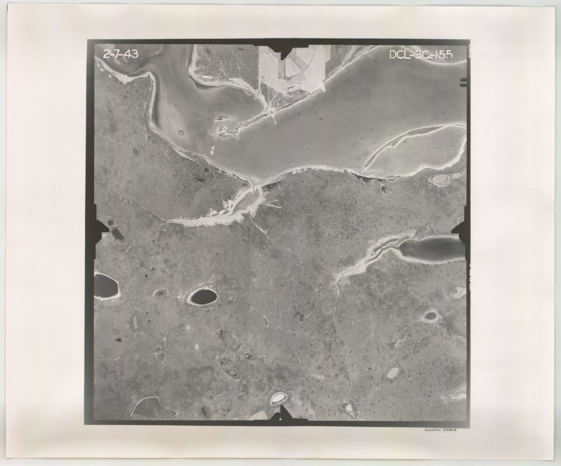
Flight Mission No. DCL-3C, Frame 155, Kenedy County
DCL-3C-155
-
Map/Doc
85803
-
Collection
General Map Collection
-
Object Dates
1943/2/7 (Creation Date)
-
People and Organizations
U. S. Department of Agriculture (Publisher)
-
Counties
Kenedy
-
Subjects
Aerial Photograph
-
Height x Width
18.6 x 22.4 inches
47.2 x 56.9 cm
-
Comments
Flown by Aerial Surveys of Pittsburgh, Inc. of Pittsburgh, Pennsylvania.
Part of: General Map Collection
Glasscock County Rolled Sketch 1

Print $20.00
- Digital $50.00
Glasscock County Rolled Sketch 1
1906
Size 37.3 x 33.6 inches
Map/Doc 9055
Mitchell County Working Sketch 3

Print $20.00
- Digital $50.00
Mitchell County Working Sketch 3
1925
Size 30.4 x 33.9 inches
Map/Doc 71060
Jack County Sketch File 35

Print $20.00
- Digital $50.00
Jack County Sketch File 35
1958
Size 23.9 x 35.6 inches
Map/Doc 11833
Right of Way and Track Map, International & Gt. Northern Ry. operated by the International & Gt. Northern Ry. Co. Gulf Division, Mineola Branch

Print $40.00
- Digital $50.00
Right of Way and Track Map, International & Gt. Northern Ry. operated by the International & Gt. Northern Ry. Co. Gulf Division, Mineola Branch
1917
Size 25.4 x 121.1 inches
Map/Doc 64702
Flight Mission No. DAG-21K, Frame 33, Matagorda County

Print $20.00
- Digital $50.00
Flight Mission No. DAG-21K, Frame 33, Matagorda County
1952
Size 18.5 x 22.3 inches
Map/Doc 86400
Leon County Working Sketch 51

Print $40.00
- Digital $50.00
Leon County Working Sketch 51
1982
Size 31.5 x 54.6 inches
Map/Doc 70450
[Surveys near Brushy Creek]
![361, [Surveys near Brushy Creek], General Map Collection](https://historictexasmaps.com/wmedia_w700/maps/361.tif.jpg)
Print $2.00
- Digital $50.00
[Surveys near Brushy Creek]
1846
Size 9.1 x 7.7 inches
Map/Doc 361
Hutchinson County Working Sketch 11

Print $20.00
- Digital $50.00
Hutchinson County Working Sketch 11
1924
Size 20.4 x 29.4 inches
Map/Doc 66369
Chambers County Working Sketch 2

Print $20.00
- Digital $50.00
Chambers County Working Sketch 2
1904
Size 34.6 x 25.3 inches
Map/Doc 67985
Tyler County Rolled Sketch 10

Print $40.00
- Digital $50.00
Tyler County Rolled Sketch 10
1982
Size 48.7 x 35.4 inches
Map/Doc 10032
Intracoastal Waterway - Galveston Bay to West Bay including Galveston Bay Entrance

Print $20.00
- Digital $50.00
Intracoastal Waterway - Galveston Bay to West Bay including Galveston Bay Entrance
1957
Size 27.2 x 38.6 inches
Map/Doc 69933
Texas Land Commissioner George P. Bush's Energy Map of Texas Showing Significant Events and Well & Pipeline Locations Between 1543 and 2015

Print $20.00
- Digital $50.00
Texas Land Commissioner George P. Bush's Energy Map of Texas Showing Significant Events and Well & Pipeline Locations Between 1543 and 2015
2015
Size 33.3 x 36.3 inches
Map/Doc 93978
You may also like
El Paso County Working Sketch 14

Print $20.00
- Digital $50.00
El Paso County Working Sketch 14
1957
Size 10.0 x 27.0 inches
Map/Doc 69036
[McMullen and Live Oak County]
![10789, [McMullen and Live Oak County], General Map Collection](https://historictexasmaps.com/wmedia_w700/maps/10789.tif.jpg)
Print $20.00
- Digital $50.00
[McMullen and Live Oak County]
1870
Size 34.3 x 36.0 inches
Map/Doc 10789
Gaines County Rolled Sketch 15C

Print $40.00
- Digital $50.00
Gaines County Rolled Sketch 15C
Size 128.4 x 22.8 inches
Map/Doc 75928
Gaines County Working Sketch 26

Print $20.00
- Digital $50.00
Gaines County Working Sketch 26
1983
Size 34.1 x 39.7 inches
Map/Doc 69326
Capitol Land and Investment Company's List of Texas Lands

Capitol Land and Investment Company's List of Texas Lands
1907
Size 7.9 x 5.2 inches
Map/Doc 97052
Current Miscellaneous File 32

Print $12.00
- Digital $50.00
Current Miscellaneous File 32
Size 11.0 x 8.7 inches
Map/Doc 73933
Blanco County Sketch File 28

Print $40.00
- Digital $50.00
Blanco County Sketch File 28
1888
Size 13.8 x 13.2 inches
Map/Doc 14623
Presidio County Working Sketch 43

Print $40.00
- Digital $50.00
Presidio County Working Sketch 43
1949
Size 29.0 x 54.9 inches
Map/Doc 71720
[Galveston, Harrisburg & San Antonio Railroad from Cuero to Stockdale]
![64204, [Galveston, Harrisburg & San Antonio Railroad from Cuero to Stockdale], General Map Collection](https://historictexasmaps.com/wmedia_w700/maps/64204.tif.jpg)
Print $20.00
- Digital $50.00
[Galveston, Harrisburg & San Antonio Railroad from Cuero to Stockdale]
1907
Size 13.3 x 33.1 inches
Map/Doc 64204
El Nuevo Mexico y Tierras Adyacentes Mapa Levantado para la demarcacion de los Limites de los Dominios Españoles y de los Estados Unidos por el P.D. Jose Pichardo quien lo dedica al Exmo. Sor. D. Fracisco Xavier Venegas Virrey de esta N.E. &. Año de 1811

Print $40.00
El Nuevo Mexico y Tierras Adyacentes Mapa Levantado para la demarcacion de los Limites de los Dominios Españoles y de los Estados Unidos por el P.D. Jose Pichardo quien lo dedica al Exmo. Sor. D. Fracisco Xavier Venegas Virrey de esta N.E. &. Año de 1811
1811
Size 35.8 x 49.6 inches
Map/Doc 95360
Nueces County Sketch File 12c

Print $11.00
- Digital $50.00
Nueces County Sketch File 12c
1889
Size 12.6 x 8.2 inches
Map/Doc 32534
[West half of County]
![89961, [West half of County], Twichell Survey Records](https://historictexasmaps.com/wmedia_w700/maps/89961-1.tif.jpg)
Print $40.00
- Digital $50.00
[West half of County]
1914
Size 40.0 x 62.5 inches
Map/Doc 89961