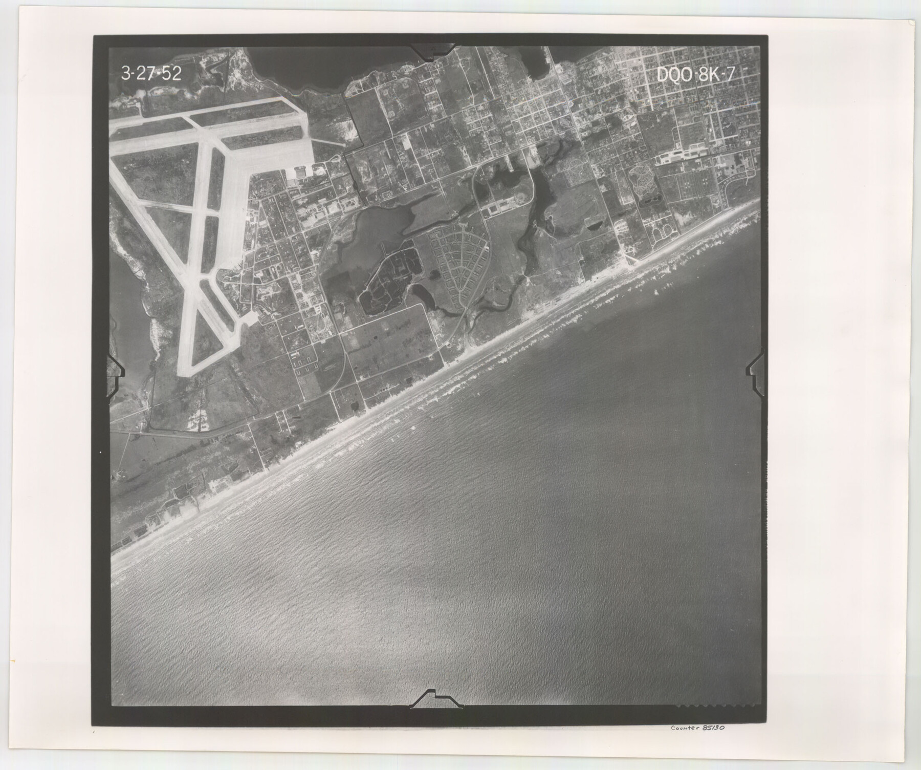
Flight Mission No. DQO-8K, Frame 7, Galveston County
DQO-8K-7
-
Map/Doc
85130
-
Collection
General Map Collection
-
Object Dates
1952/3/27 (Creation Date)
-
People and Organizations
U. S. Department of Agriculture (Publisher)
-
Counties
Galveston
-
Subjects
Aerial Photograph
-
Height x Width
18.7 x 22.4 inches
47.5 x 56.9 cm
-
Comments
Flown by Aero Exploration Company of Tulsa, Oklahoma.
Part of: General Map Collection
Goliad County Sketch File 9

Print $6.00
- Digital $50.00
Goliad County Sketch File 9
1849
Size 8.1 x 10.1 inches
Map/Doc 24223
Terrell County Sketch File 22A

Print $20.00
- Digital $50.00
Terrell County Sketch File 22A
Size 21.7 x 11.4 inches
Map/Doc 12422
Irion County Rolled Sketch 24

Print $40.00
- Digital $50.00
Irion County Rolled Sketch 24
Size 49.4 x 37.4 inches
Map/Doc 9257
Brooks County Working Sketch 7

Print $20.00
- Digital $50.00
Brooks County Working Sketch 7
1928
Size 35.6 x 27.1 inches
Map/Doc 67791
Station Map, the Missouri, Kansas and Texas Ry. Of Texas - Henrietta Division

Print $20.00
- Digital $50.00
Station Map, the Missouri, Kansas and Texas Ry. Of Texas - Henrietta Division
1918
Size 11.7 x 26.8 inches
Map/Doc 64764
Maverick County Sketch File 23

Print $7.00
- Digital $50.00
Maverick County Sketch File 23
Size 9.1 x 8.5 inches
Map/Doc 31142
Hood County Rolled Sketch 7

Print $20.00
- Digital $50.00
Hood County Rolled Sketch 7
2009
Size 19.1 x 24.5 inches
Map/Doc 89062
Flight Mission No. CGI-3N, Frame 111, Cameron County

Print $20.00
- Digital $50.00
Flight Mission No. CGI-3N, Frame 111, Cameron County
1954
Size 18.6 x 22.2 inches
Map/Doc 84591

The Coast & Bays of Western Texas

Print $20.00
- Digital $50.00
The Coast & Bays of Western Texas
1857
Size 18.2 x 23.9 inches
Map/Doc 73424
Flight Mission No. BRE-1P, Frame 53, Nueces County

Print $20.00
- Digital $50.00
Flight Mission No. BRE-1P, Frame 53, Nueces County
1956
Size 18.5 x 22.4 inches
Map/Doc 86642
Nueces County NRC Article 33.136 Location Key Sheet

Print $20.00
- Digital $50.00
Nueces County NRC Article 33.136 Location Key Sheet
1975
Size 27.0 x 23.0 inches
Map/Doc 77031
You may also like
San Patricio County Rolled Sketch 20A

Print $20.00
- Digital $50.00
San Patricio County Rolled Sketch 20A
Size 25.9 x 30.3 inches
Map/Doc 7579
Harris County Rolled Sketch 59

Print $20.00
- Digital $50.00
Harris County Rolled Sketch 59
1937
Size 18.7 x 20.9 inches
Map/Doc 6105
Denton County Sketch File 37

Print $24.00
- Digital $50.00
Denton County Sketch File 37
1932
Size 11.5 x 8.9 inches
Map/Doc 20776
Flight Mission No. CRK-7P, Frame 82, Refugio County

Print $20.00
- Digital $50.00
Flight Mission No. CRK-7P, Frame 82, Refugio County
1956
Size 18.3 x 22.1 inches
Map/Doc 86953
Williamson County Sketch File 5a

Print $4.00
- Digital $50.00
Williamson County Sketch File 5a
1849
Size 12.8 x 8.1 inches
Map/Doc 40312
Brewster County Rolled Sketch 87

Print $40.00
- Digital $50.00
Brewster County Rolled Sketch 87
1947
Size 130.7 x 40.4 inches
Map/Doc 8497

Flight Mission No. BRA-3M, Frame 200, Jefferson County

Print $20.00
- Digital $50.00
Flight Mission No. BRA-3M, Frame 200, Jefferson County
1953
Size 18.5 x 22.4 inches
Map/Doc 85415

Packery Channel

Print $3.00
- Digital $50.00
Packery Channel
1962
Size 10.7 x 13.2 inches
Map/Doc 3005
Schleicher County Sketch File 46

Print $4.00
- Digital $50.00
Schleicher County Sketch File 46
1958
Size 3.7 x 8.8 inches
Map/Doc 36554
Moore County Rolled Sketch 11

Print $20.00
- Digital $50.00
Moore County Rolled Sketch 11
Size 34.1 x 43.0 inches
Map/Doc 9549