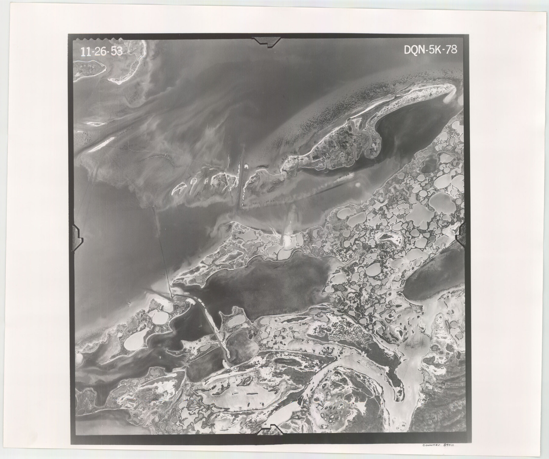
Flight Mission No. DQN-5K, Frame 78, Calhoun County
DQN-5K-78
-
Map/Doc
84411
-
Collection
General Map Collection
-
Object Dates
1953/11/26 (Creation Date)
-
People and Organizations
U. S. Department of Agriculture (Publisher)
-
Counties
Calhoun
-
Subjects
Aerial Photograph
-
Height x Width
18.6 x 22.3 inches
47.2 x 56.6 cm
-
Comments
Flown by Aero Exploration Company of Tulsa, Oklahoma.
Part of: General Map Collection
Pecos County Rolled Sketch 173

Print $20.00
- Digital $50.00
Pecos County Rolled Sketch 173
Size 32.2 x 35.6 inches
Map/Doc 9751
Hall County Sketch File 16

Print $20.00
- Digital $50.00
Hall County Sketch File 16
1892
Size 24.0 x 35.5 inches
Map/Doc 11608
Jefferson County Rolled Sketch 50

Print $20.00
- Digital $50.00
Jefferson County Rolled Sketch 50
Size 34.2 x 41.6 inches
Map/Doc 9306
Wise County Sketch File 41

Print $4.00
- Digital $50.00
Wise County Sketch File 41
1875
Size 12.8 x 8.1 inches
Map/Doc 40599


Calhoun County NRC Article 33.136 Location Key Sheet

Print $20.00
- Digital $50.00
Calhoun County NRC Article 33.136 Location Key Sheet
1973
Size 27.0 x 23.0 inches
Map/Doc 87906
Nueces County Rolled Sketch 98B

Print $20.00
- Digital $50.00
Nueces County Rolled Sketch 98B
Size 33.5 x 32.7 inches
Map/Doc 9632
Hidalgo County Sketch File 17

Print $6.00
- Digital $50.00
Hidalgo County Sketch File 17
1950
Size 14.5 x 8.8 inches
Map/Doc 26443

Fort Bend County Working Sketch 5

Print $20.00
- Digital $50.00
Fort Bend County Working Sketch 5
1915
Size 14.5 x 20.9 inches
Map/Doc 69211
Dallam County Rolled Sketch 7

Print $20.00
- Digital $50.00
Dallam County Rolled Sketch 7
Size 15.4 x 18.6 inches
Map/Doc 5685
You may also like
Kimble County Rolled Sketch 40

Print $20.00
- Digital $50.00
Kimble County Rolled Sketch 40
Size 27.5 x 22.4 inches
Map/Doc 6530
[Galveston, Harrisburg & San Antonio Railroad from Cuero to Stockdale]
![64193, [Galveston, Harrisburg & San Antonio Railroad from Cuero to Stockdale], General Map Collection](https://historictexasmaps.com/wmedia_w700/maps/64193.tif.jpg)
Print $20.00
- Digital $50.00
[Galveston, Harrisburg & San Antonio Railroad from Cuero to Stockdale]
1907
Size 13.7 x 34.0 inches
Map/Doc 64193
Flight Mission No. DQN-1K, Frame 108, Calhoun County

Print $20.00
- Digital $50.00
Flight Mission No. DQN-1K, Frame 108, Calhoun County
1953
Size 18.4 x 22.1 inches
Map/Doc 84175
El Paso County Sketch File 27

Print $20.00
- Digital $50.00
El Paso County Sketch File 27
Size 18.3 x 24.5 inches
Map/Doc 11458
Crane County Rolled Sketch 5A

Print $20.00
- Digital $50.00
Crane County Rolled Sketch 5A
1927
Size 38.0 x 46.4 inches
Map/Doc 8678
Flight Mission No. BRE-2P, Frame 11, Nueces County

Print $20.00
- Digital $50.00
Flight Mission No. BRE-2P, Frame 11, Nueces County
1956
Size 18.6 x 22.7 inches
Map/Doc 86720
Map of Hill County

Print $20.00
- Digital $50.00
Map of Hill County
1862
Size 22.1 x 24.7 inches
Map/Doc 3671
Starr County Working Sketch 21

Print $20.00
- Digital $50.00
Starr County Working Sketch 21
1982
Size 32.6 x 33.7 inches
Map/Doc 63937
Harris County Sketch File 83

Print $20.00
- Digital $50.00
Harris County Sketch File 83
1898
Size 18.5 x 27.3 inches
Map/Doc 11671
Orange County Sketch File 37

Print $8.00
- Digital $50.00
Orange County Sketch File 37
1950
Size 14.2 x 8.8 inches
Map/Doc 33374
Aransas County Sketch File 16

Print $40.00
- Digital $50.00
Aransas County Sketch File 16
1877
Size 16.4 x 12.8 inches
Map/Doc 13147
Colorado River, Matagorda Sheet

Print $6.00
- Digital $50.00
Colorado River, Matagorda Sheet
1937
Size 30.9 x 35.8 inches
Map/Doc 65303